MyTopo
Classic USGS Tony Wisconsin 7.5'x7.5' Topo Map
Couldn't load pickup availability
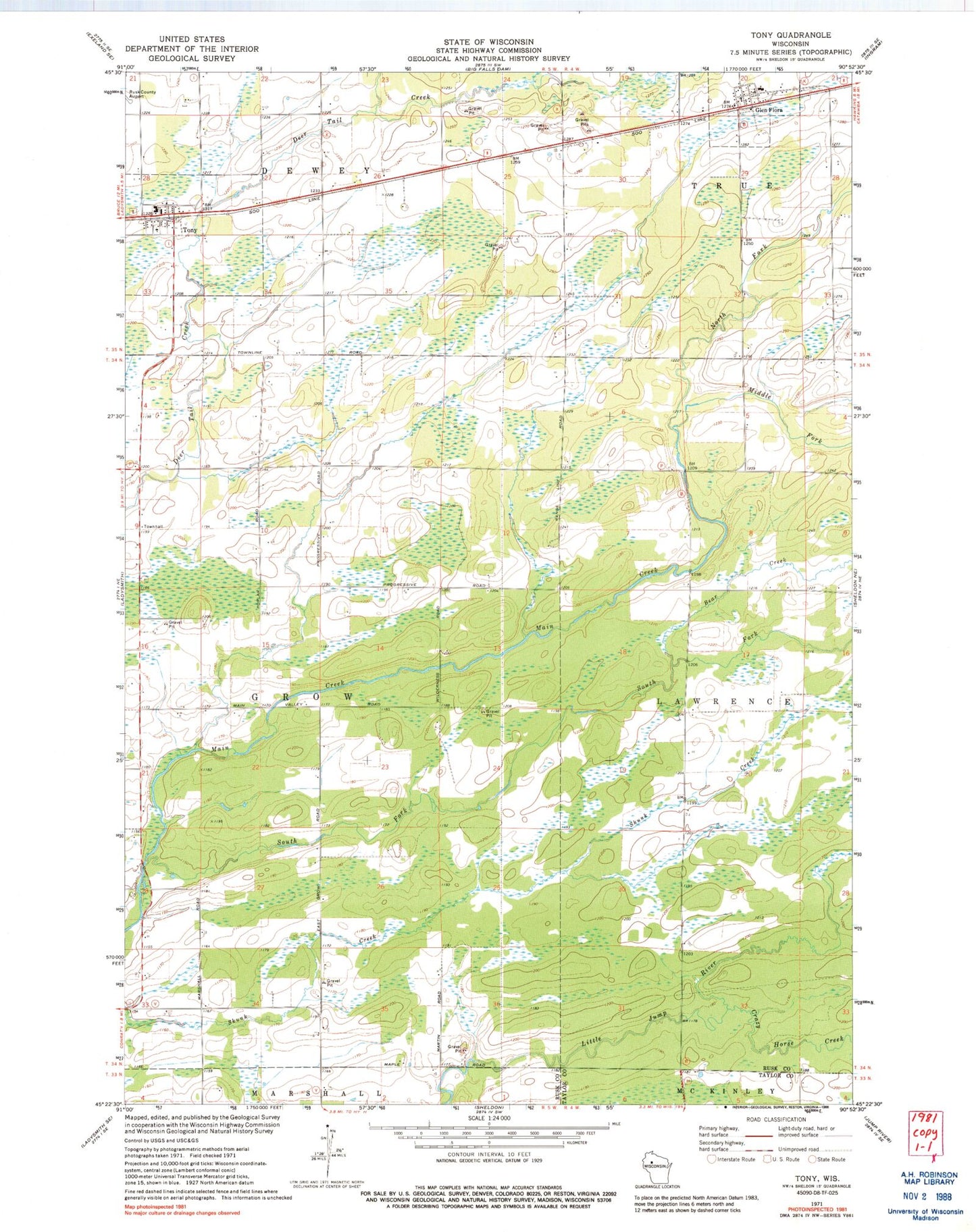
Historical USGS topographic quad map of Tony in the state of Wisconsin. Map scale may vary for some years, but is generally around 1:24,000. Print size is approximately 24" x 27"
This quadrangle is in the following counties: Rusk, Taylor.
The map contains contour lines, roads, rivers, towns, and lakes. Printed on high-quality waterproof paper with UV fade-resistant inks, and shipped rolled.
Contains the following named places: Bear Creek, Crazy Horse Creek, Flambeau Charter School, Flambeau Elementary School, Flambeau High School, Flambeau Junior High School, Glen Flora, Glen Flora Elementary School, Grow Townhall, Middle Fork Main Creek, North Fork Main Creek, Oak Grove School, Progressive School, South Fork Main Creek, Tony, Tony Post Office, Town of Grow, Village of Glen Flora, Village of Tony, Whitetail Academy, ZIP Code: 54563