MyTopo
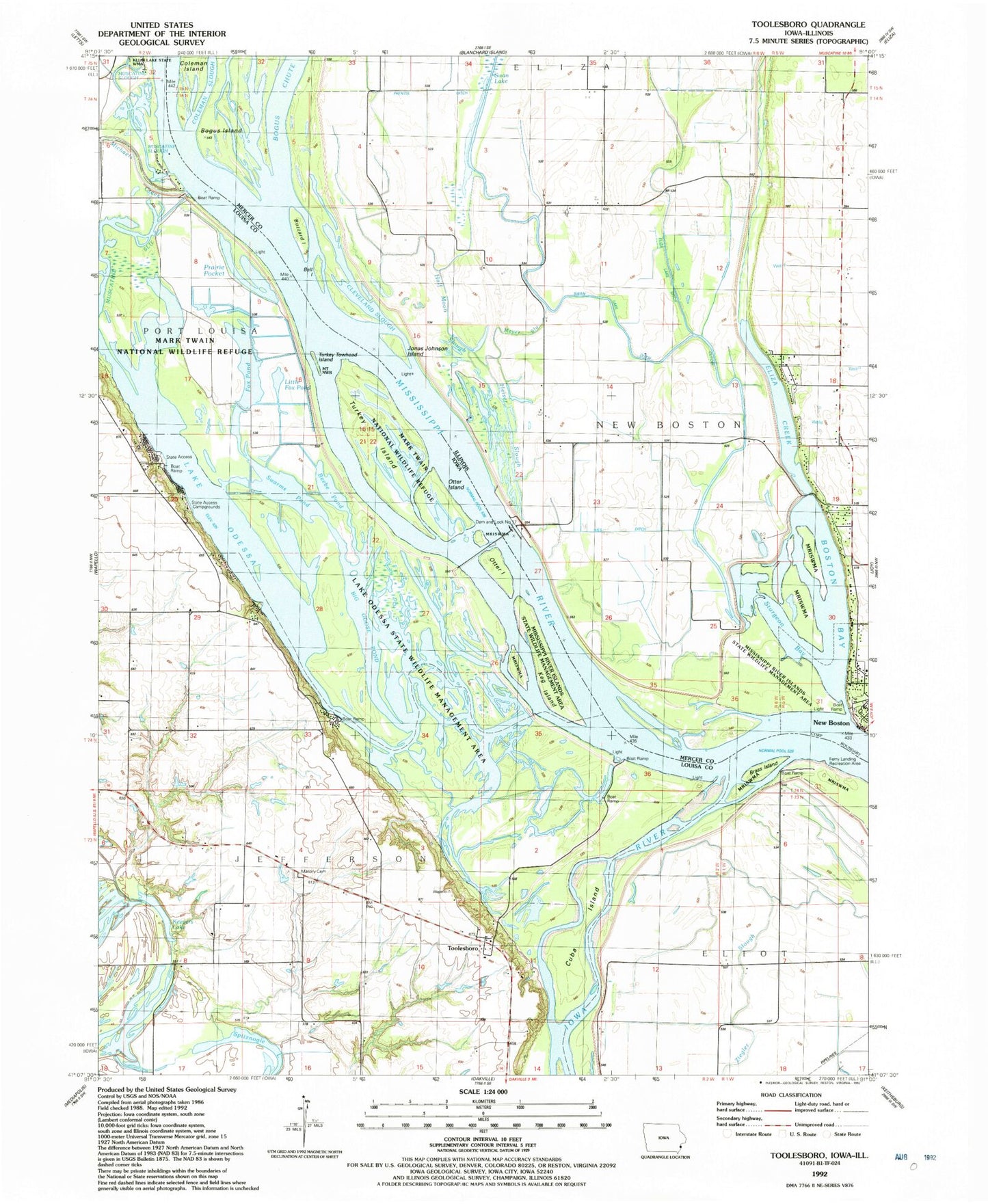
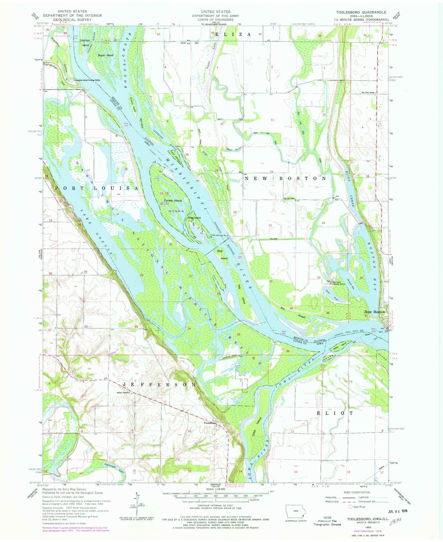
Classic USGS Toolesboro Iowa 7.5'x7.5' Topo Map
Couldn't load pickup availability
Historical USGS topographic quad map of Toolesboro in the states of Iowa, Illinois. Map scale may vary for some years, but is generally around 1:24,000. Print size is approximately 24" x 27"
This quadrangle is in the following counties: Louisa, Mercer.
The map contains contour lines, roads, rivers, towns, and lakes. Printed on high-quality waterproof paper with UV fade-resistant inks, and shipped rolled.
Contains the following named places: Bay Island Pumping Station, Bay View School, Beaver Pond, Beebe Pond, Bell Island, Bell Pocket, Big Goose Pond, Blackhawk Pond, Bogus Chute, Boston Bay, Brass Island, Burris City Post Office, Burris Ditch, Buzzard Island, Camp Slough Island, Cleveland Slough, Coleman Slough, Dam and Lock Number 17, Eliza Creek, Eliza Lake Ditch Cutoff, Ferry Landing Recreation Area, Fox Pond, Goose Pond, Half Moon Slough, Heidelbaugh Pond, Heiser Slough, Iowa River, Ives Ditch, Jonas Johnson Island, Keevers Lake, Keg Island, Keg Slough, Lake Odesa, Lake Odessa, Lake Odessa Campground, Lake Odessa Public Hunting Area, Lake Odessa Wildlife Management Area, Little Fox Pond, Little Goose Pond, Lock and Dam 17, Lower Eliza Lake, Mallard Pond, Mallory Cemetery, Meyer Slough, Michaels Creek, Mill Pond, Mississippi River Lock Dam Number Seventeen, Muscatine Island Pumping Station, Otter Island, Pin Oak School, Pool 17, Port Louisa National Wildlife Refuge, Prairie Pocket, Sand Run, Sand Run Park, Schafer Access, Snively Access, Spitznogle Lake, Sturgeon Bay, Swan Lake, Swan Lake Ditch, Swan Lake School, Swarms Pond, Toolesboro, Toolesboro Access, Toolesboro Mounds State Preserve, Toosesboro Post Office, Township of Jefferson, Turkey Chute, Turkey Island, Turkey Towhead Island, Willow Slough