MyTopo
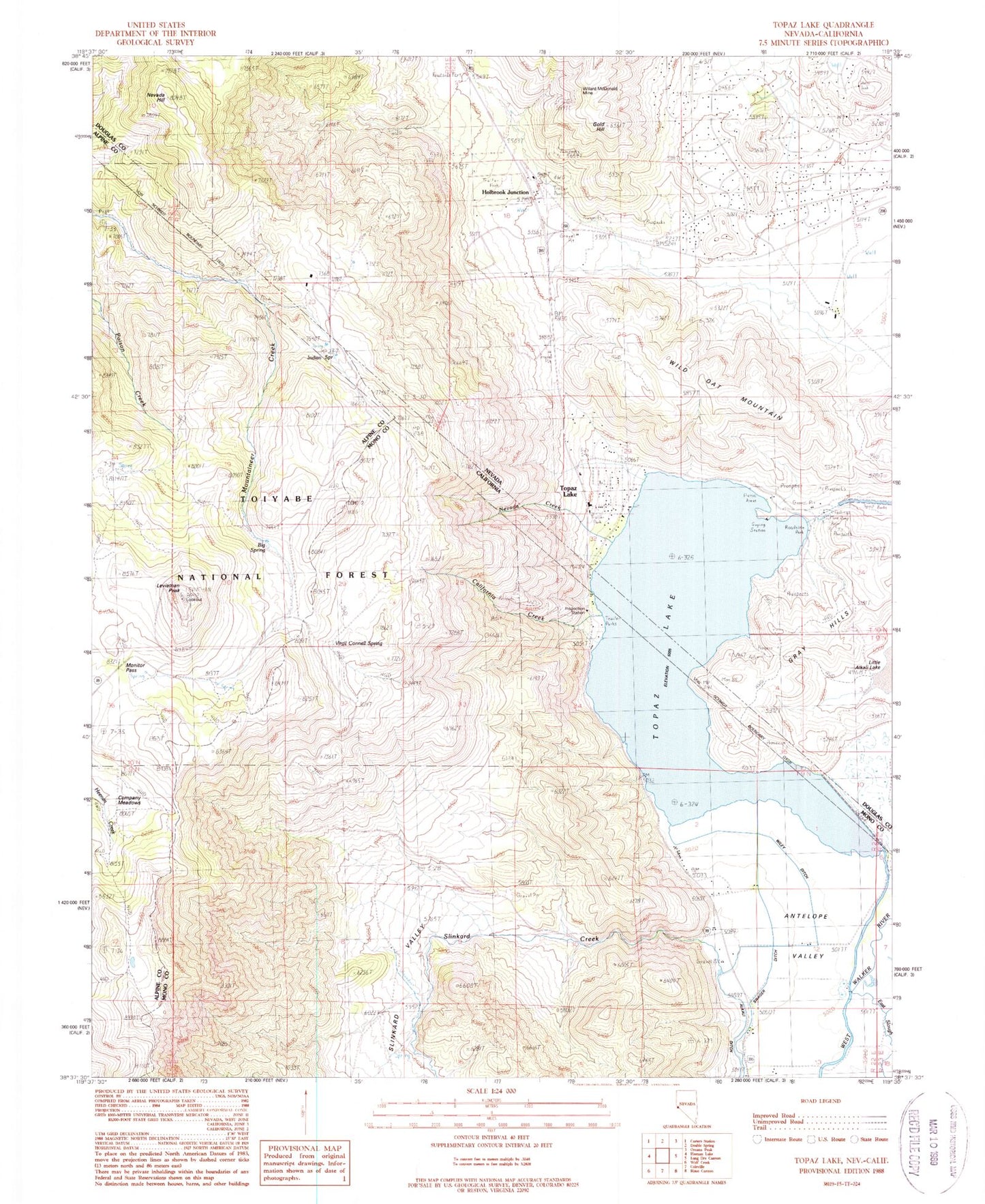
Classic USGS Topaz Lake Nevada 7.5'x7.5' Topo Map
Couldn't load pickup availability
Historical USGS topographic quad map of Topaz Lake in the states of Nevada, California. Map scale may vary for some years, but is generally around 1:24,000. Print size is approximately 24" x 27"
This quadrangle is in the following counties: Alpine, Douglas, Mono.
The map contains contour lines, roads, rivers, towns, and lakes. Printed on high-quality waterproof paper with UV fade-resistant inks, and shipped rolled.
Contains the following named places: Big Spring, California Creek, Carson Valley Medical Center - Topaz Ranch Medical Clinic, Company Meadows, Dome Two, East Fork Fire and Paramedic Districts Station 4 Topaz Ranch Estates, East Fork Fire and Paramedic Districts Station 5 Topaz Volunteer Fire Department, East Slough, Fairfield Ranch, Gold Hill, Gray Hills, Holbrook Junction, Holbrook Post Office, Indian Spring, Kittle Kral Wells Mine, Leviathan Peak, Little Alkali Lake, Monitor Pass, Mountain House, Mountain House Rest Area, Nevada Creek, Nevada Hill, Slinkard Creek, Slinkard Valley, Tessues Bridge, Topaz Census Designated Place, Topaz Guard Station, Topaz Lake, Topaz Lake Census Designated Place, Topaz Lake Park, Topaz Lake Public Fishing Area, Topaz Ranch Estates Census Designated Place, Virgil Connell Spring, Wild Oat Mountain, Wiley Ditch, Willard-McDonald Mine