
MyTopo
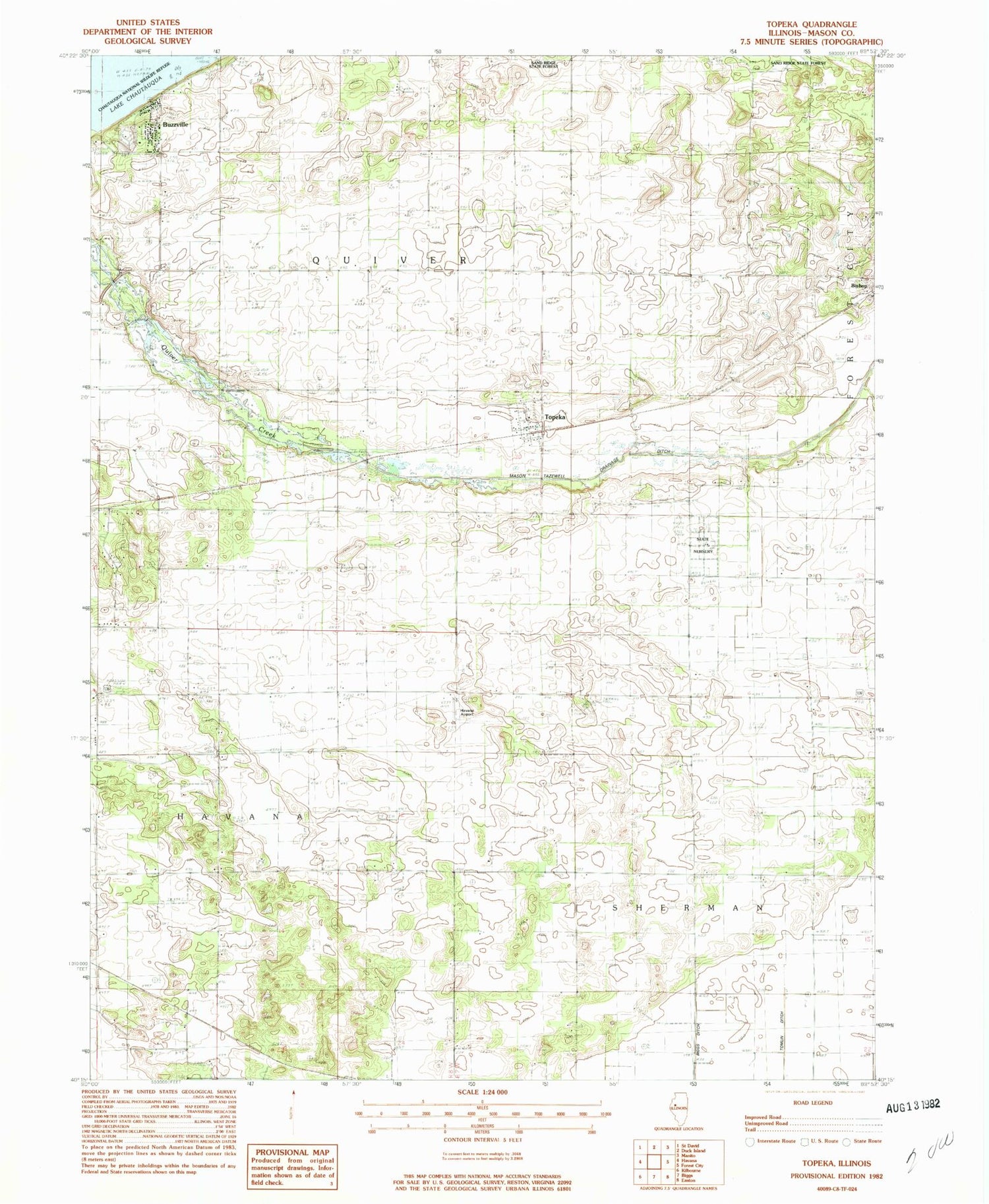
Classic USGS Topeka Illinois 7.5'x7.5' Topo Map
Couldn't load pickup availability
Historical USGS topographic quad map of Topeka in the state of Illinois. Map scale may vary for some years, but is generally around 1:24,000. Print size is approximately 24" x 27"
This quadrangle is in the following counties: Mason.
The map contains contour lines, roads, rivers, towns, and lakes. Printed on high-quality waterproof paper with UV fade-resistant inks, and shipped rolled.
Contains the following named places: Buzzville, Christian Church, Coon School, Deverman School, Dieffenbacher School, Ebenezer School, Eckard, Havana Airport, Heater Cemetery, Heston Cemetery, Larry Barrett RLA Airport, Mason State Nursery, Mason Tazewell Drainage Ditch, McHarry Pond, Pleasant Row School, Presbyterian Church, Quiver Presbyterian Cemetery, Quiver School, Rakestraw Cemetery, Roat Cemetery, Samms Cemetery, South Heater School, Steging Cemetery, Topeka, Topeka Post Office, Township of Quiver, Township of Sherman, Trout School, Village of Topeka, Walker School, Zion Cemetery, ZIP Code: 61567


