MyTopo
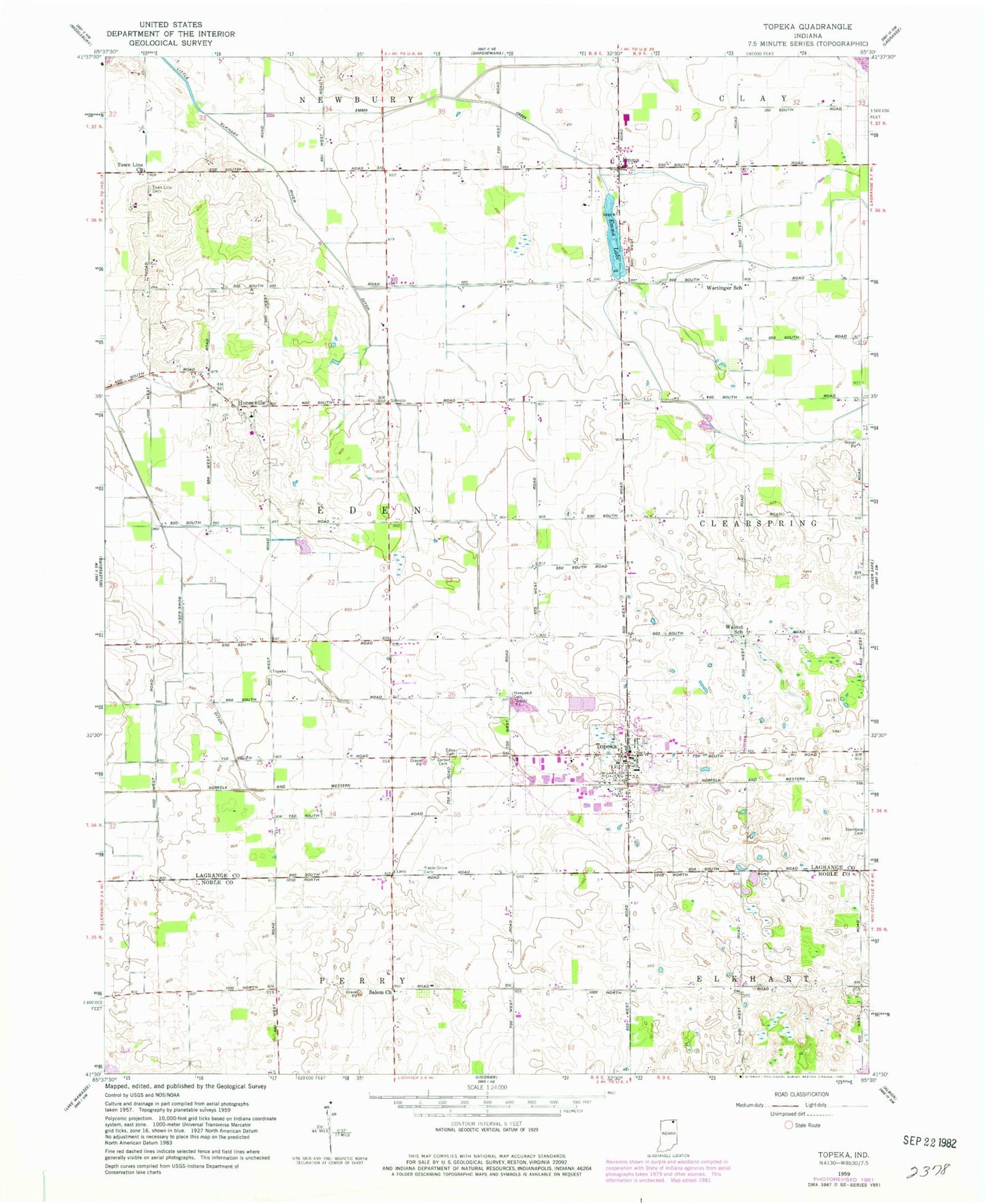
Classic USGS Topeka Indiana 7.5'x7.5' Topo Map
Couldn't load pickup availability
Historical USGS topographic quad map of Topeka in the state of Indiana. Map scale may vary for some years, but is generally around 1:24,000. Print size is approximately 24" x 27"
This quadrangle is in the following counties: LaGrange, Noble.
The map contains contour lines, roads, rivers, towns, and lakes. Printed on high-quality waterproof paper with UV fade-resistant inks, and shipped rolled.
Contains the following named places: Bontrager Ditch, Byler Ditch, Eden Cemetery, Emma, Emma Creek, Emma Lake, Erb Ditch, Gerber Cemetery, Hawpatch Cemetery, Honeyville, Honeyville Elementary School, Little Elkhart River Ditch, Maple Grove Cemetery, Miller Field, Poynter School, Salem Church, Steinberg Cemetery, Topeka, Topeka Elementary School, Topeka Police Department, Topeka Post Office, Topeka Volunteer Fire Department, Town Line Cemetery, Town Line Church, Town of Topeka, Township of Eden, Walnut School, Westview Junior-Senior High School, Wortinger School, Yoder Airport, ZIP Code: 46571