MyTopo
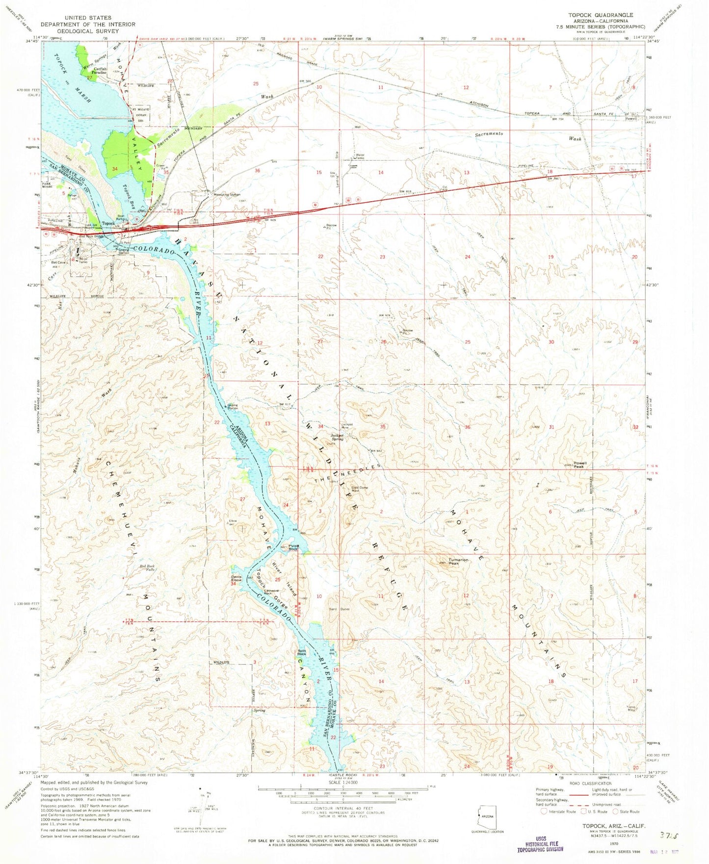
Classic USGS Topock Arizona 7.5'x7.5' Topo Map
Couldn't load pickup availability
Historical USGS topographic quad map of Topock in the states of Arizona, California. Typical map scale is 1:24,000, but may vary for certain years, if available. Print size: 24" x 27"
This quadrangle is in the following counties: Mohave, San Bernardino.
The map contains contour lines, roads, rivers, towns, and lakes. Printed on high-quality waterproof paper with UV fade-resistant inks, and shipped rolled.
Contains the following named places: Yucca Mine, Cathedral Rock, Gold Dome Mine, Jackpot Mine, Jackpot Spring, Powell Peak, Pulpit Rock, River Island, Sacramento Wash, The Needles, Topock Bay, Topock Gorge, Tumarion Peak, Yucca Mine, Powell Railroad Station, Catfish Paradise, Powell, Topock, Mohave Mountains, Havasu National Wildlife Refuge, Havasu Wilderness, Topock Census Designated Place, Picture Rock Window, Bat Cave Wash, Devils Elbow, Mohave Wash, Red Rock Falls, Topock Gorge, Red Rock Bridge, Split Rock