MyTopo
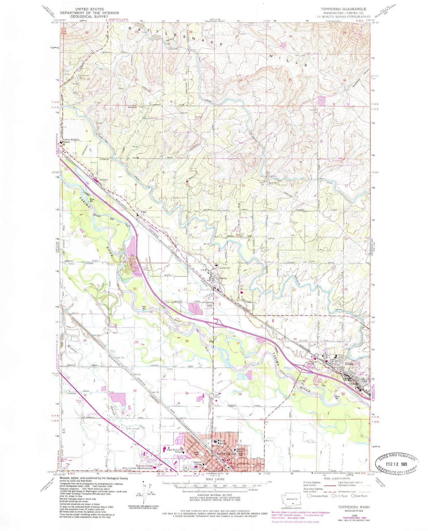
Classic USGS Toppenish Washington 7.5'x7.5' Topo Map
Couldn't load pickup availability
Historical USGS topographic quad map of Toppenish in the state of Washington. Map scale may vary for some years, but is generally around 1:24,000. Print size is approximately 24" x 27"
This quadrangle is in the following counties: Yakima.
The map contains contour lines, roads, rivers, towns, and lakes. Printed on high-quality waterproof paper with UV fade-resistant inks, and shipped rolled.
Contains the following named places: Buena, Buena Airport, Buena Census Designated Place, Buena Post Office, City of Toppenish, City of Zillah, Flint, Garfield Elementary School, Hilton Elementary School, Keck, KENE-AM (Toppenish), Kirkwood Elementary School, Lincoln Elementary School, McCoy Cemetery, Monte, Racehorse Canyon, Sawyer, Toppenish, Toppenish High School, Toppenish Middle School, Toppenish Police Department, Toppenish Post Office, Wasteway 3, Wesley Junction, Yakama Indian Reservation Headquarters, Yakama Tribal Police Department, Yakama Tribal School, Yakima County Fire District 5 Station 10 Zillah, Yakima County Fire District 5 Station 7 Sawyer, Yakima County Fire District 5 Station 8 Buena, Yakima County Fire District 5 Station 9 Toppenish, Yakima County Sheriff's Office, Zillah, Zillah Fire Department, Zillah Intermediate School, Zillah Police Department, Zillah Post Office, ZIP Code: 98921