
MyTopo
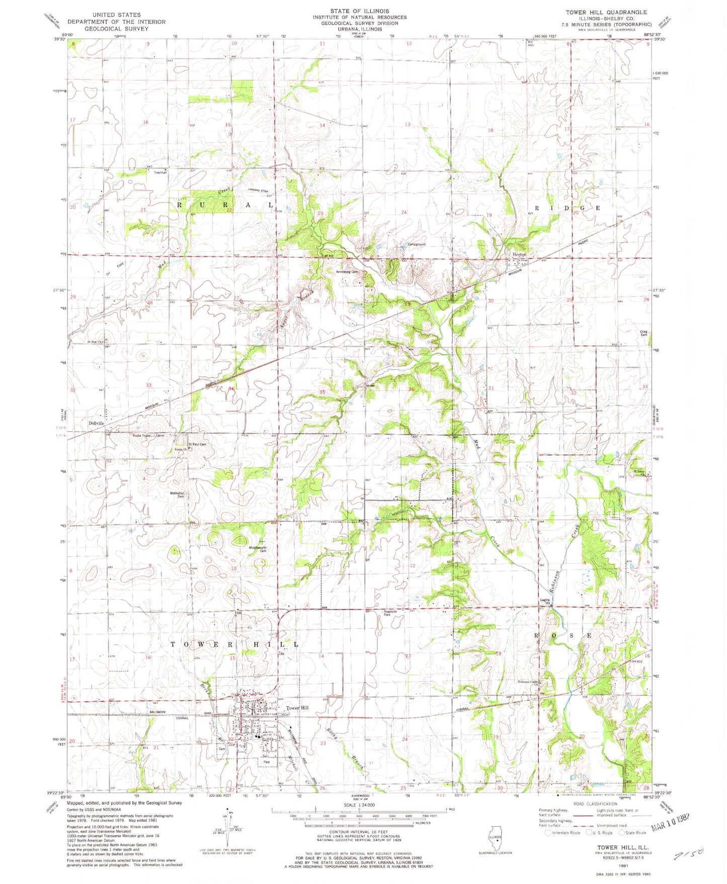
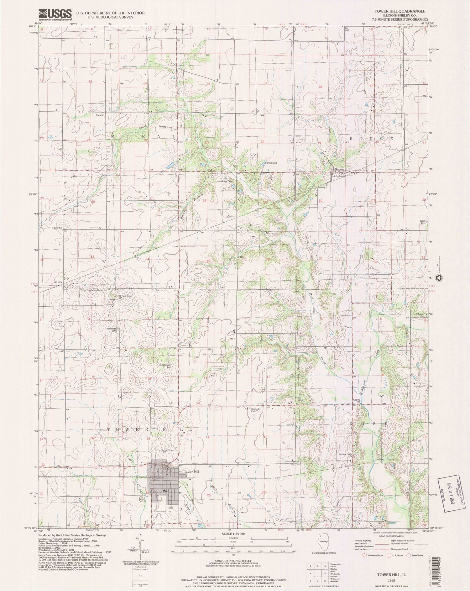
Classic USGS Tower Hill Illinois 7.5'x7.5' Topo Map
Couldn't load pickup availability
Historical USGS topographic quad map of Tower Hill in the state of Illinois. Map scale may vary for some years, but is generally around 1:24,000. Print size is approximately 24" x 27"
This quadrangle is in the following counties: Shelby.
The map contains contour lines, roads, rivers, towns, and lakes. Printed on high-quality waterproof paper with UV fade-resistant inks, and shipped rolled.
Contains the following named places: Angel Branch, Armstrong Cemetery, Center School, Champion School, Craig Cemetery, Dollville, Empire School, Frogpond School, Henton, Henton Cemetery, Knobs Baptist Cemetery, Knobs Baptist Church, Knobs School, Methodist Cemetery, Middlesworth Cemetery, Mud Creek, Ragweed School, Redbud School, Ridge School, Robinson Creek Cemetery, Robinson Creek Church, Robinson Creek School, Robinson Creek Station, Rural Townhall, Saint Johns Cemetery, Saint Johns Church, Saint Paul Cemetery, Saint Pauls United Church of Christ, Sandy Hill School, Smith School, Stoune RLA Airport, Tower Hill, Tower Hill Cemetery, Tower Hill Christian Church, Tower Hill Elementary School, Tower Hill Fire Protection District, Tower Hill High School, Tower Hill Post Office, Tower Hill United Methodist Church, Township of Rural, Township of Tower Hill, Victory School, Village of Tower Hill, ZIP Code: 62571