MyTopo
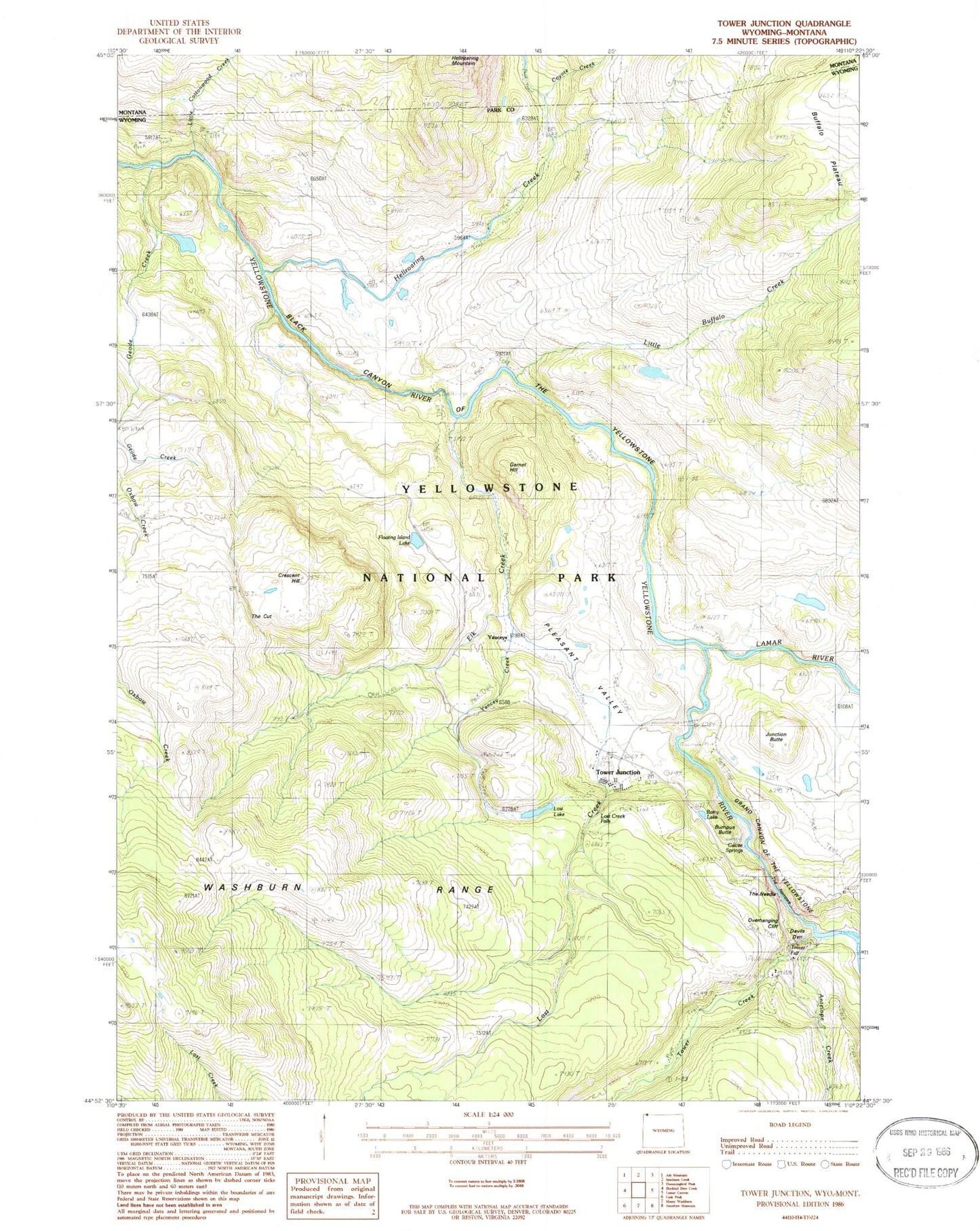
Classic USGS Tower Junction Wyoming 7.5'x7.5' Topo Map
Couldn't load pickup availability
Historical USGS topographic quad map of Tower Junction in the states of Wyoming, Montana. Typical map scale is 1:24,000, but may vary for certain years, if available. Print size: 24" x 27"
This quadrangle is in the following counties: Park.
The map contains contour lines, roads, rivers, towns, and lakes. Printed on high-quality waterproof paper with UV fade-resistant inks, and shipped rolled.
Contains the following named places: Hellroaring Creek, Little Cottonwood Creek, Antelope Creek, Bump-Sullivan Reservoir, Bumpus Butte, Coyote Creek Trail, Elk Creek, Floating Island Lake, Garnet Hill, Geode Creek, Hellroaring Ranger Station, Junction Butte, Little Buffalo Creek, Lost Creek Falls, Pleasant Valley, Rainy Lake, Roosevelt Lodge, The Cut, The Narrows, Tower Creek, Tower Fall, Tower Fall Campground, Tower Ranger Station, Yancy Creek, Yellowstone River Trail, Barronette Bridge (historical), Nymph Spring, Bannock Ford, Buffalo Ford, Devils Den, Tower Junction, Yanceys, Lamar River, Calcite Springs, Crescent Hill, Lost Creek, Lost Lake, Grand Canyon of the Yellowstone, The Needle, Overhanging Cliff, Yellowstone National Park Fire Department Tower Junction Station, Buffalo Plateau Trail, Coyote Creek