MyTopo
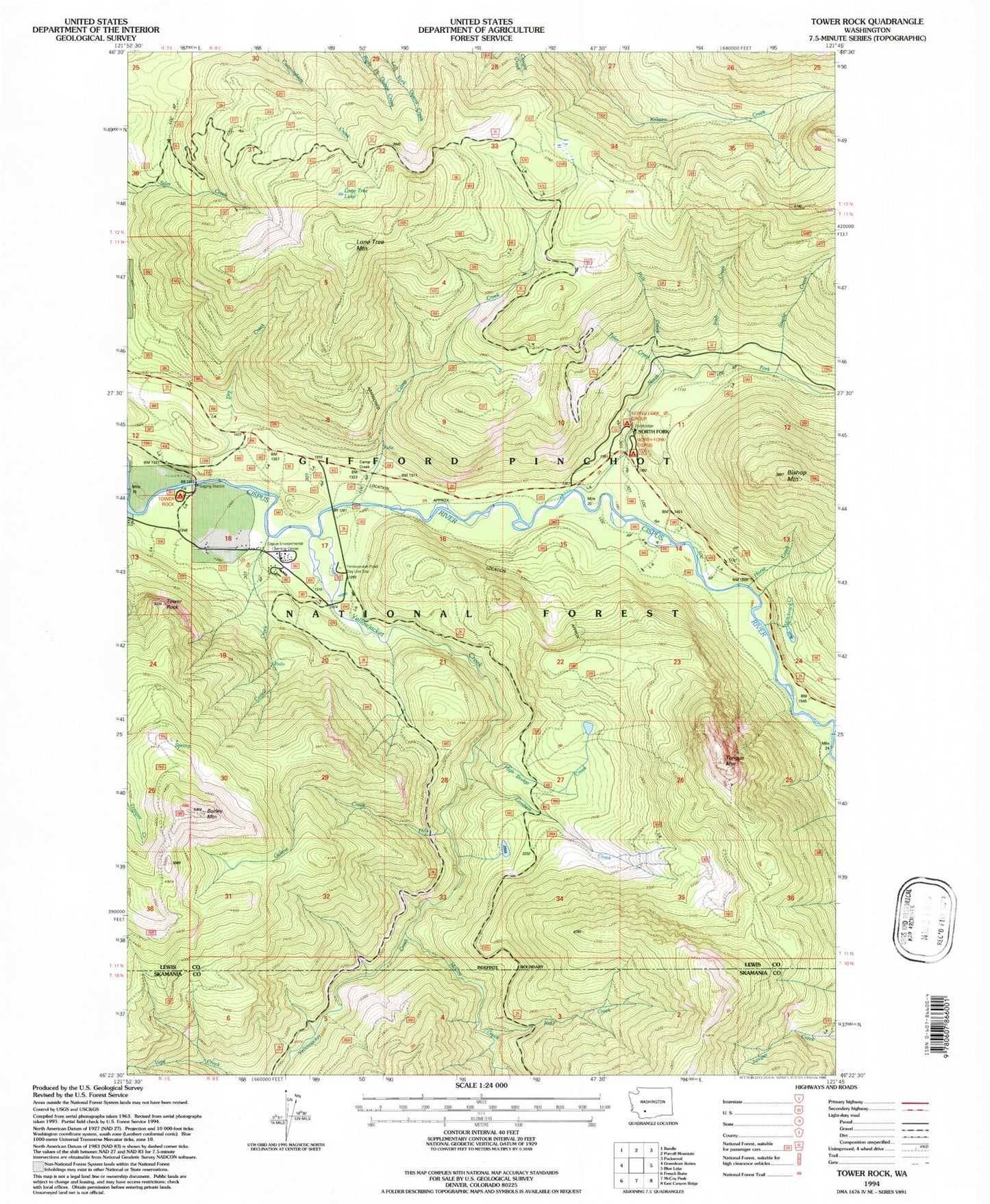
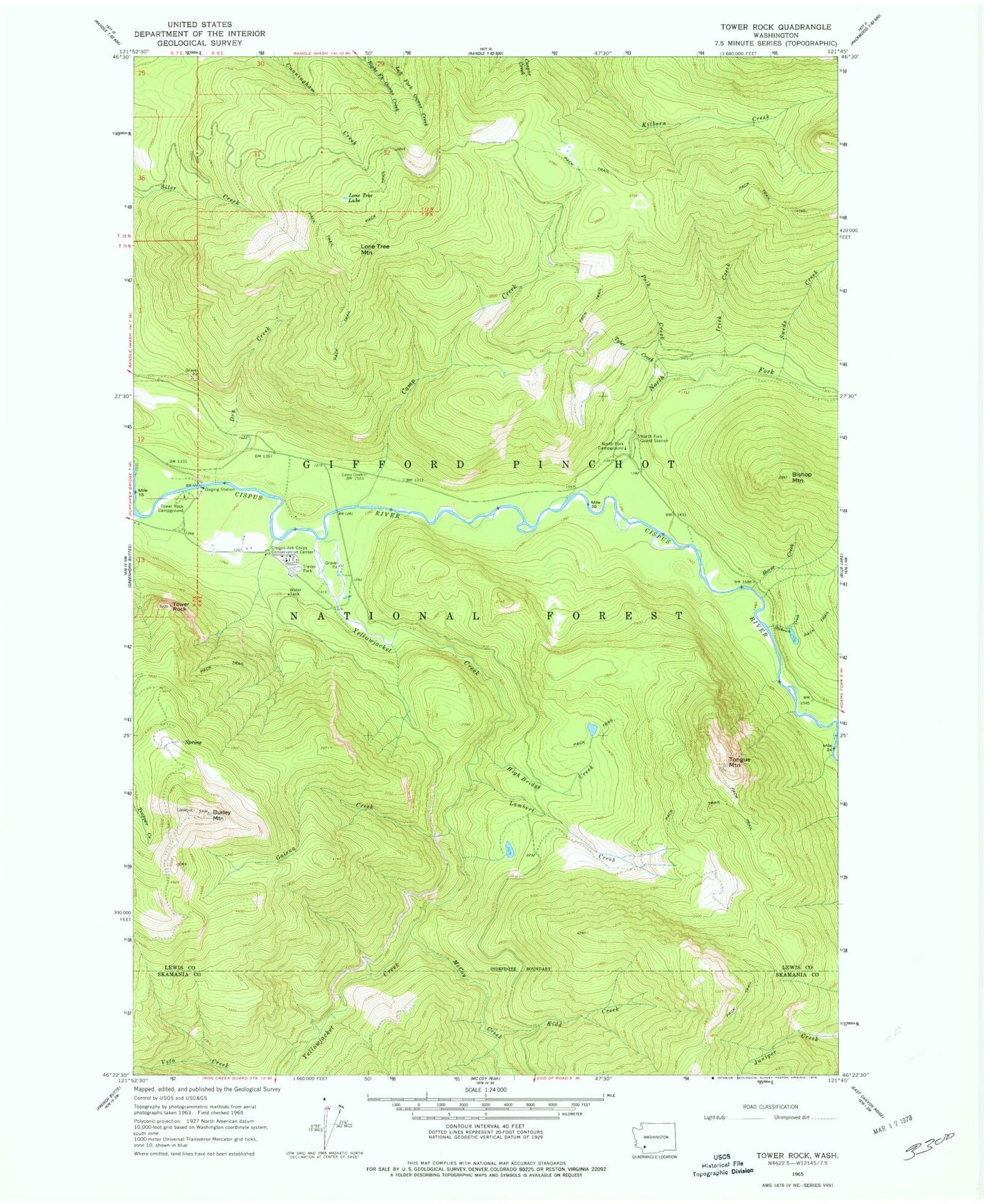
Classic USGS Tower Rock Washington 7.5'x7.5' Topo Map
Couldn't load pickup availability
Historical USGS topographic quad map of Tower Rock in the state of Washington. Typical map scale is 1:24,000, but may vary for certain years, if available. Print size: 24" x 27"
This quadrangle is in the following counties: Lewis, Skamania.
The map contains contour lines, roads, rivers, towns, and lakes. Printed on high-quality waterproof paper with UV fade-resistant inks, and shipped rolled.
Contains the following named places: Bishop Mountain, Burley Mountain, Camp Creek, Cispus Job Corps Conservation Center, Dry Creek, Galena Creek, High Bridge Creek, Horse Creek, Irish Creek, Kidd Creek, Lambert Creek, Lone Tree Lake, Lone Tree Mountain, McCoy Creek, North Fork Campground, North Fork Cispus River, North Fork Guard Station, Polk Creek, Slickrock Creek, Smoothrock Creek, Swede Creek, Tongue Mountain, Tower Rock, Tower Rock Campground, Tyler Creek, Yellowjacket Creek, Covell Creek, Yellowjacket Pond Day Use Site, North Fork Group Camp, Tower Rock Beaver Ponds, Black Rock Pond, Lewis County Fire District 14 Randle Fire and Emergency Medical Services Station 2