
MyTopo
Classic USGS Town Point Utah 7.5'x7.5' Topo Map
Regular price
$16.95
Regular price
Sale price
$16.95
Unit price
per
Couldn't load pickup availability
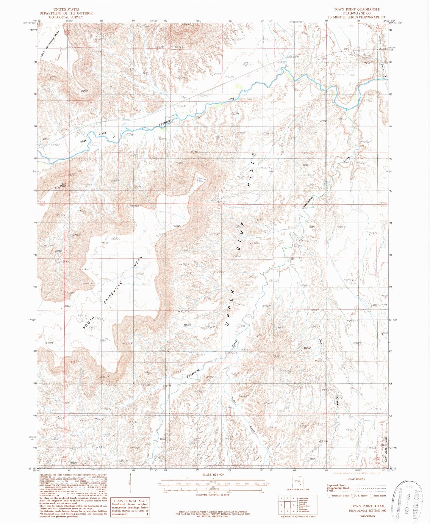
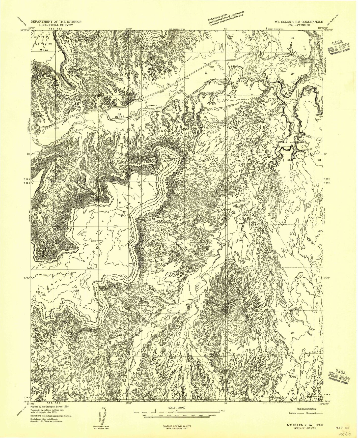
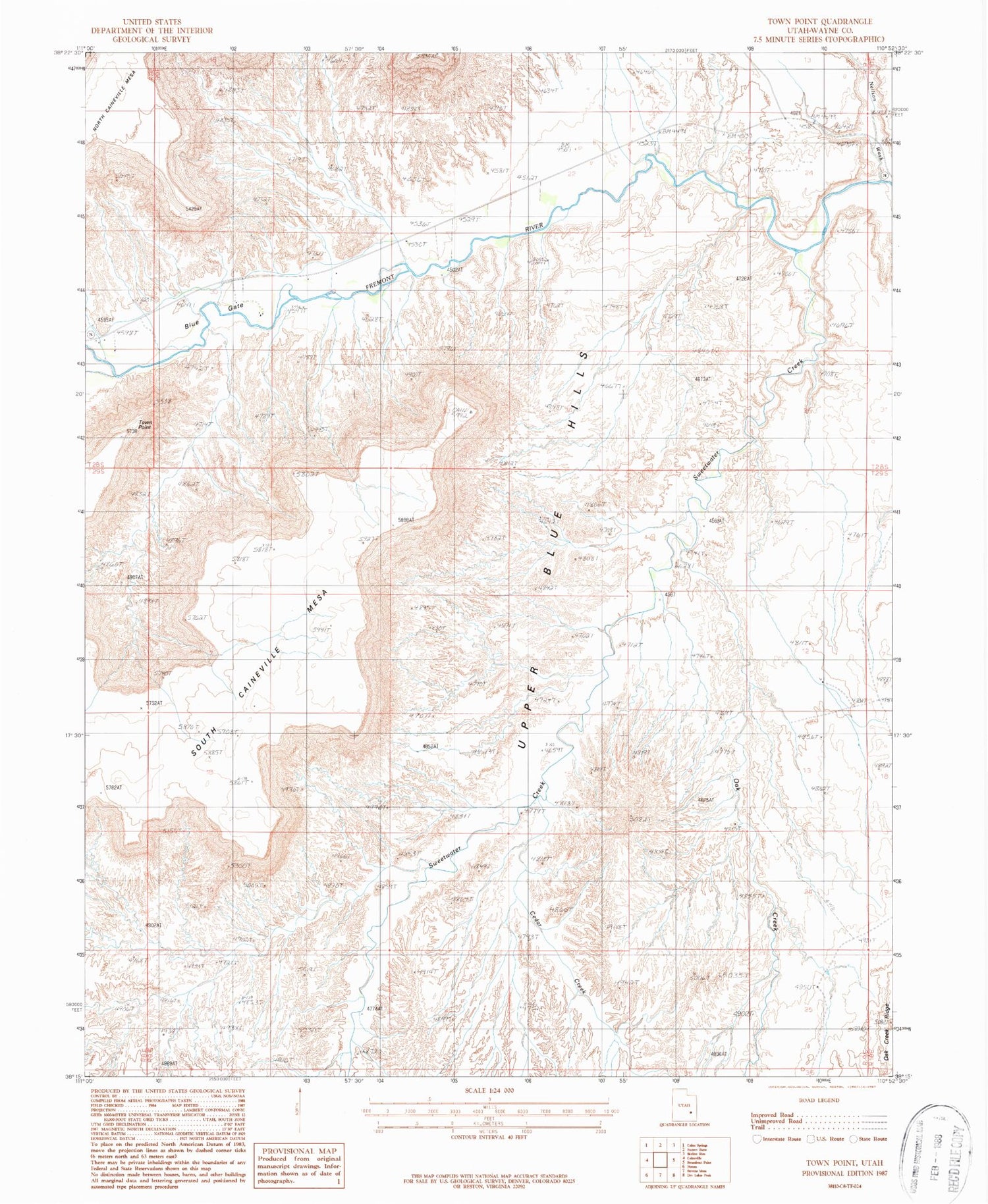
Historical USGS topographic quad map of Town Point in the state of Utah. Map scale may vary for some years, but is generally around 1:24,000. Print size is approximately 24" x 27"
This quadrangle is in the following counties: Wayne.
The map contains contour lines, roads, rivers, towns, and lakes. Printed on high-quality waterproof paper with UV fade-resistant inks, and shipped rolled.
Contains the following named places: Blue Gate, Cedar Creek, Huntington North Dam, Neilson Wash, Oak Creek, South Caineville Mesa, Sweetwater Creek, Town Point, Town Point Cemetery, Upper Blue Hills, Wayne County