MyTopo
Classic USGS Townsend Georgia 7.5'x7.5' Topo Map
Regular price
$16.95
Regular price
Sale price
$16.95
Unit price
per
Couldn't load pickup availability
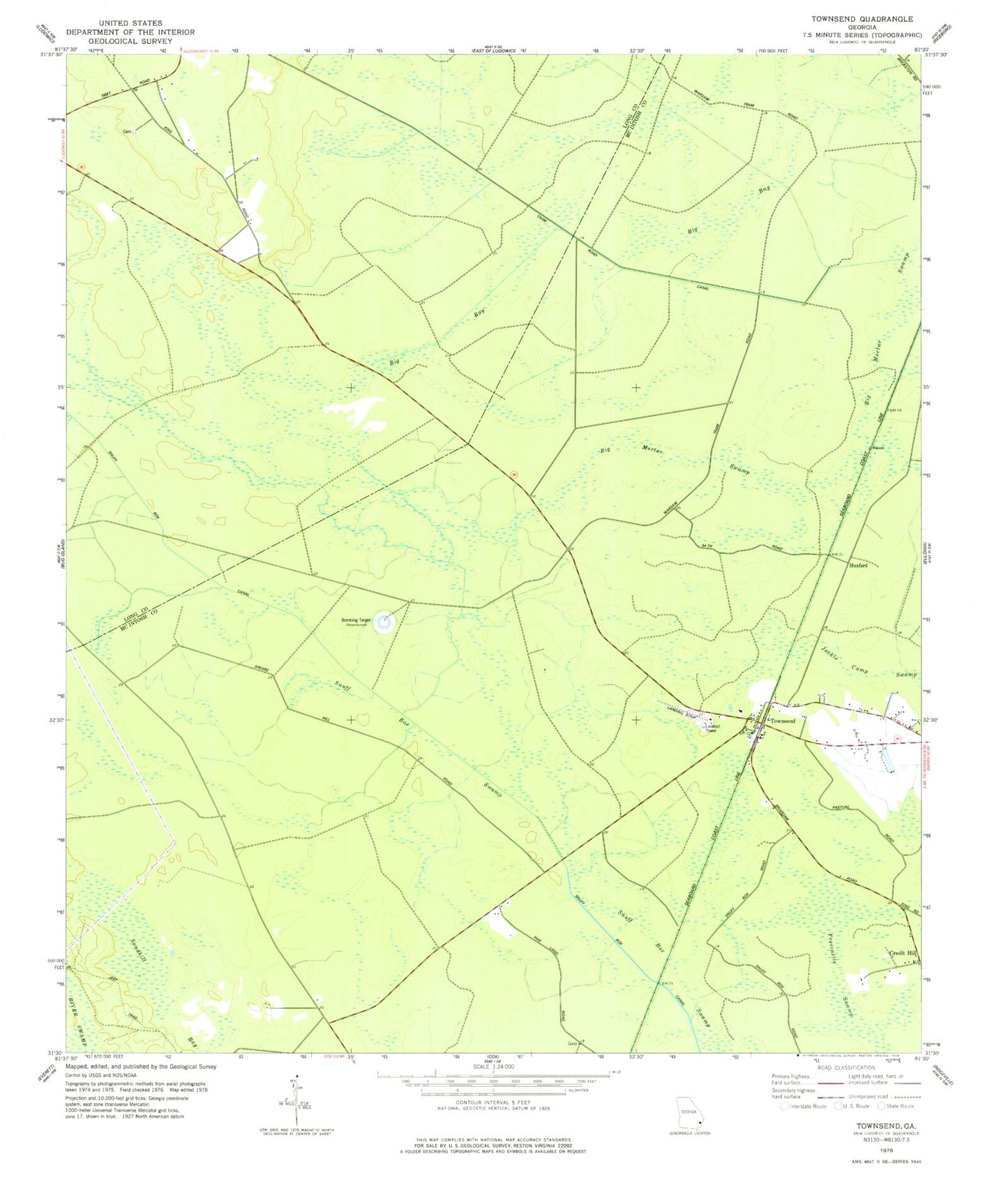
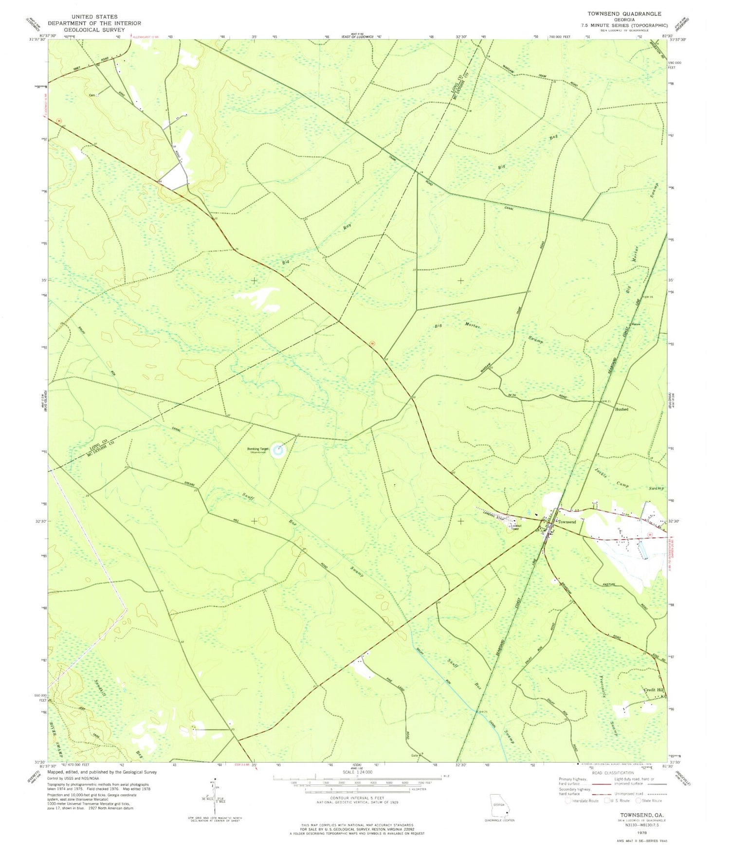
Historical USGS topographic quad map of Townsend in the state of Georgia. Map scale may vary for some years, but is generally around 1:24,000. Print size is approximately 24" x 27"
This quadrangle is in the following counties: Long, McIntosh.
The map contains contour lines, roads, rivers, towns, and lakes. Printed on high-quality waterproof paper with UV fade-resistant inks, and shipped rolled.
Contains the following named places: Big Bay, Big Mortar Swamp, Church of God, Credit Hill, Davis Cemetery, Dixie School, Freecastle Swamp, Huxford, Snuff Box Canal, Snuff Box Swamp, Tibet, Townsend, Townsend Air Strip, Townsend Air-To-Ground Range, Townsend Baptist Church