MyTopo
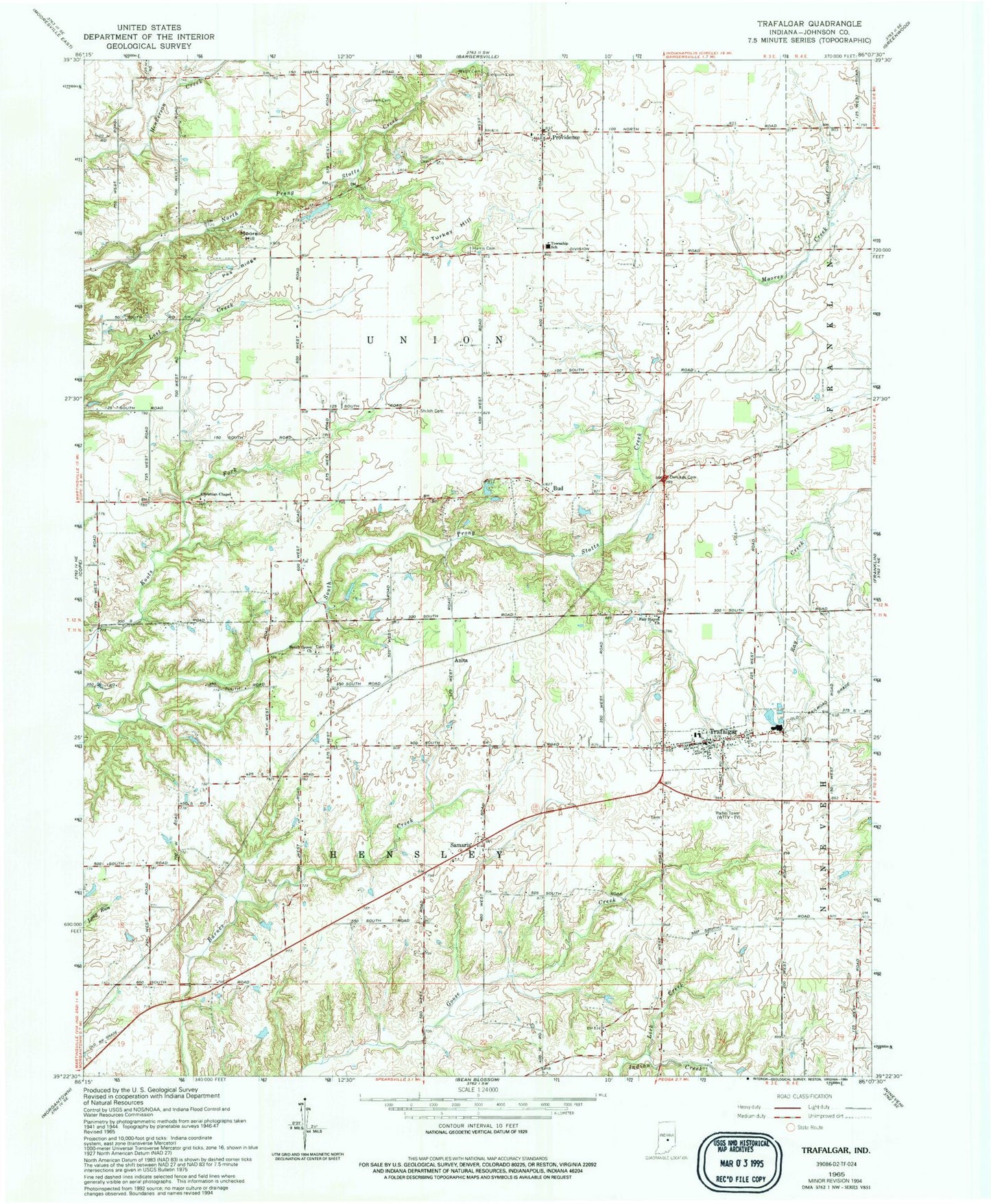
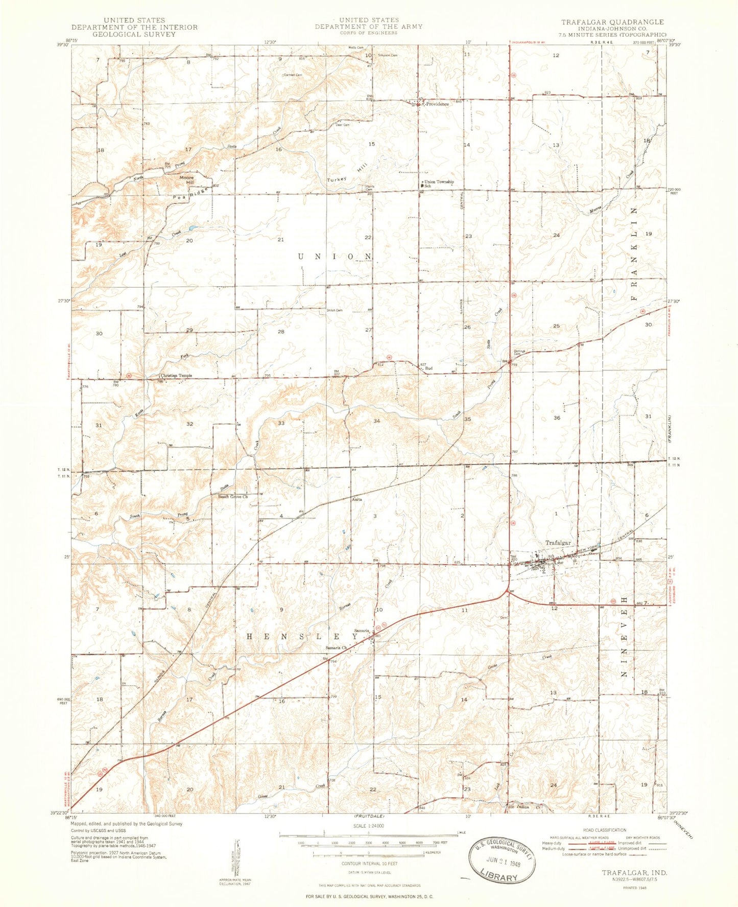
Classic USGS Trafalgar Indiana 7.5'x7.5' Topo Map
Couldn't load pickup availability
Historical USGS topographic quad map of Trafalgar in the state of Indiana. Map scale may vary for some years, but is generally around 1:24,000. Print size is approximately 24" x 27"
This quadrangle is in the following counties: Johnson.
The map contains contour lines, roads, rivers, towns, and lakes. Printed on high-quality waterproof paper with UV fade-resistant inks, and shipped rolled.
Contains the following named places: Anita, Beech Grove Church, Bronson Airport, Bud, Carmen Cemetery, Christian Chapel, Deer Cemetery, Dollings Cemetery, Fair Haven Church, Harris Cemetery, Kephart Field, Lick Creek, Moore Hill, Murray Lake, Murray Lake Dam, Pea Ridge, Providence, Samaria, Shiloh Cemetery, Simpson Cemetery, Teeters Lake, Teeters Lake Dam, Town of Trafalgar, Township of Hensley, Township of Union, Trafalgar, Trafalgar Police Department, Trafalgar Post Office, Trafalgar Volunteer Fire Department, Turkey Hill, Union Elementary School, Watts Cemetery, WFCI-FM (Franklin), WGTC-FM (Bloomington), WTTV-TV (Bloomington)