MyTopo
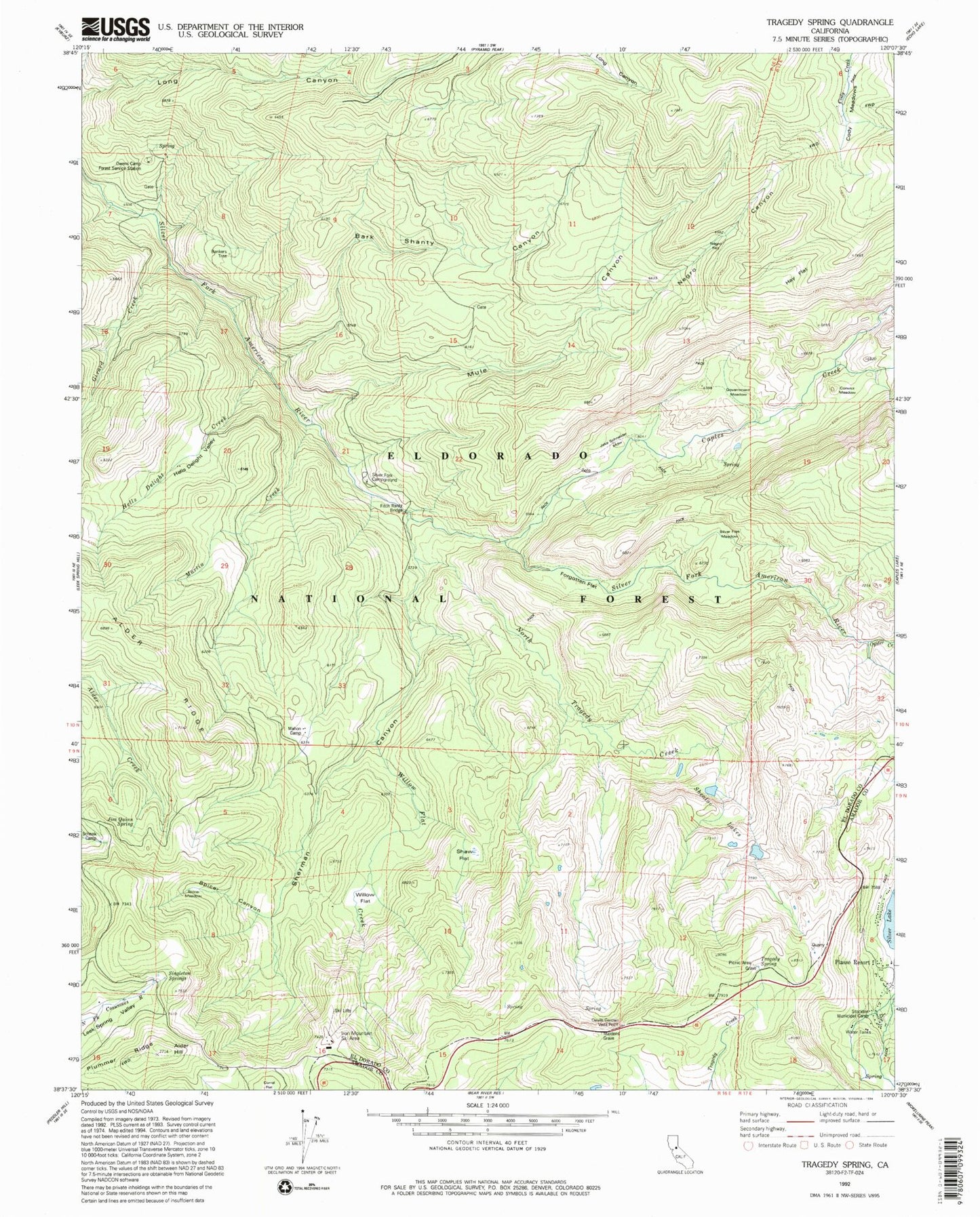
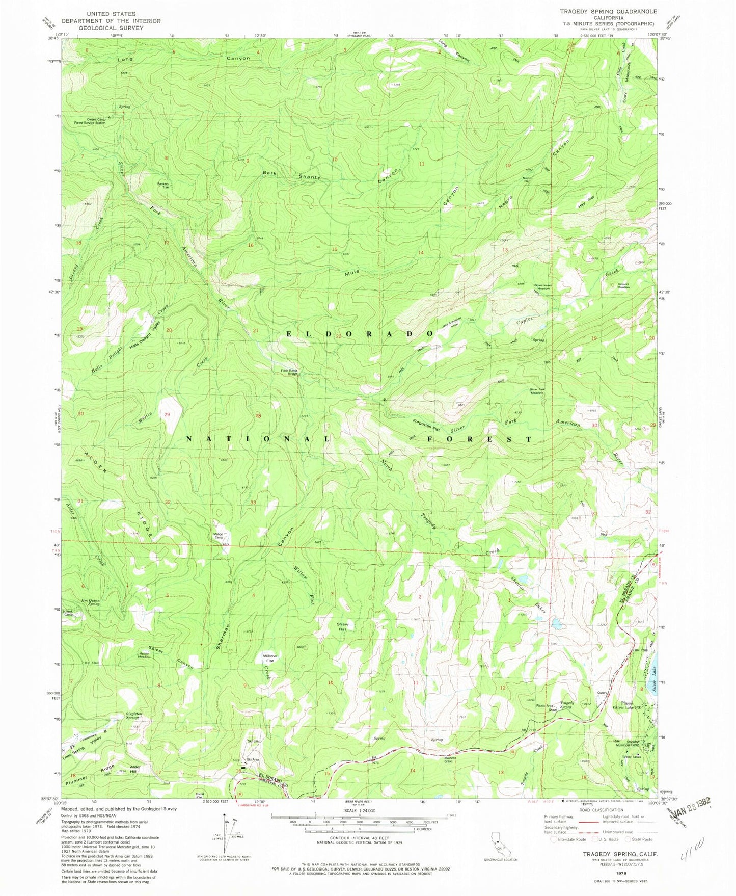
Classic USGS Tragedy Spring California 7.5'x7.5' Topo Map
Couldn't load pickup availability
Historical USGS topographic quad map of Tragedy Spring in the state of California. Typical map scale is 1:24,000, but may vary for certain years, if available. Print size: 24" x 27"
This quadrangle is in the following counties: Amador, El Dorado.
The map contains contour lines, roads, rivers, towns, and lakes. Printed on high-quality waterproof paper with UV fade-resistant inks, and shipped rolled.
Contains the following named places: Bark Sharrly Canyon, Cody Meadow, Girard Creek, Hells Delight Creek, Hells Delight Valley, Martin Creek, North Tragedy Creek, Shaw Flat, Shealor Lakes, Sherman Canyon, Spicer Canyon, Spicer Meadow, Willow Flat, Willow Flat Creek, Hay Flat, Tragedy Spring, Baltic Ridge, Alder Ridge, Plummer Ridge, Silver Basin Ski Area, Schenk Camp, Silver Fork Campground, Tragedy Spring Campground, Owens Camp Forest Service Station, Alder Hill, Plasse, Devils Garden Vista, Caples Creek, Maiden's Grave, Stockton Municipal Camp, Tragedy Spring (historical), Bankers Tree, Convict Meadow, Fitch Rantz Bridge, Forgotten Flat, Government Meadow, Jake Schneider Meadow, Jim Quinn Spring, Negro Canyon, Negro Flat, Owens Camp (historical), Silver Fork Meadow, Singleton Springs