MyTopo
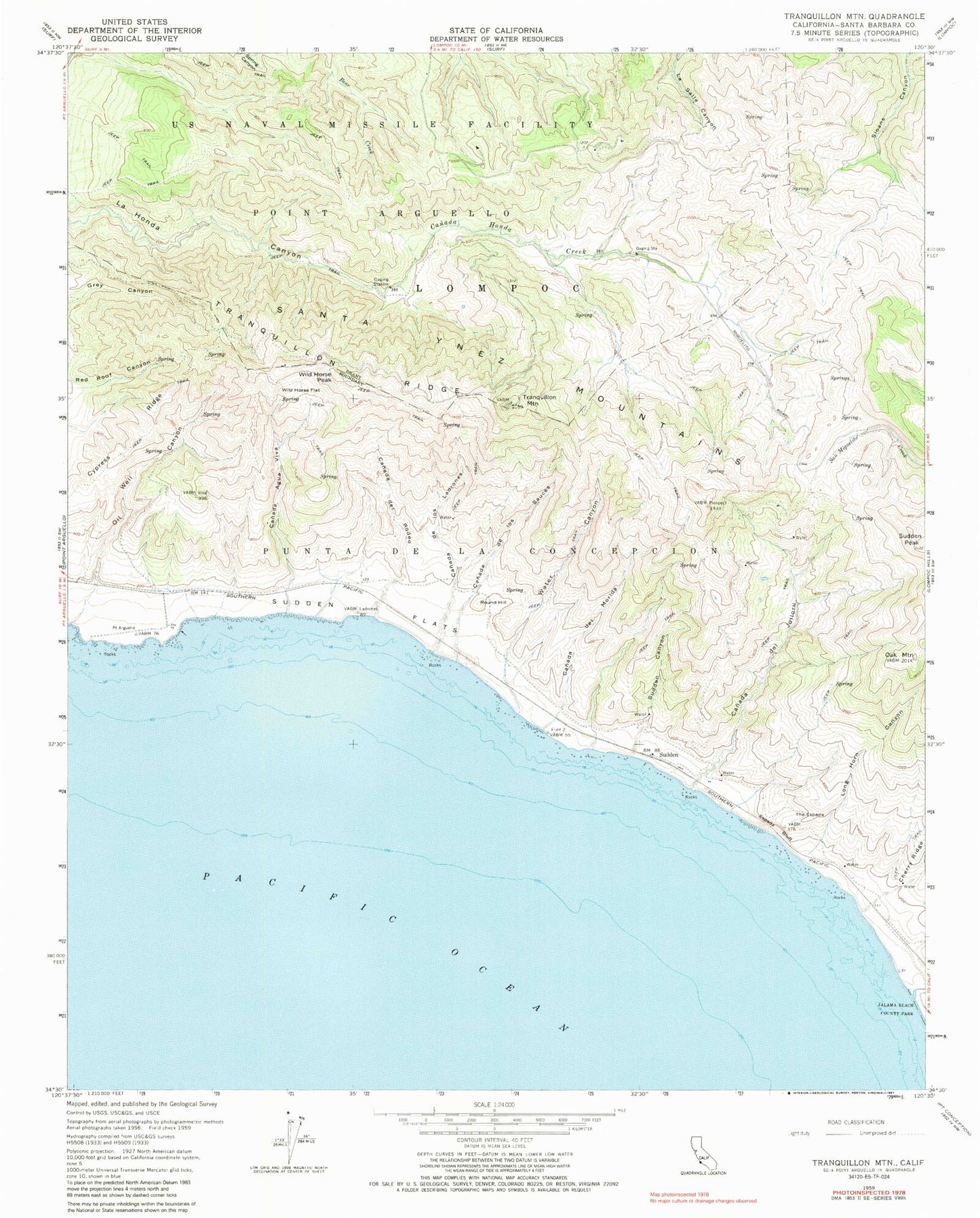
Classic USGS Tranquillon Mountain California 7.5'x7.5' Topo Map
Couldn't load pickup availability
Historical USGS topographic quad map of Tranquillon Mountain in the state of California. Map scale may vary for some years, but is generally around 1:24,000. Print size is approximately 24" x 27"
This quadrangle is in the following counties: Santa Barbara.
The map contains contour lines, roads, rivers, towns, and lakes. Printed on high-quality waterproof paper with UV fade-resistant inks, and shipped rolled.
Contains the following named places: Canada Agua Viva, Canada De Los Ladrones, Canada De Los Sauces, Canada Del Jolloru, Canada Del Morida, Canada Del Rodeo, Cypress Ridge, Espada Bluff, Jalama Beach County Park, Jalama Creek, Lompoc, Lompoc Air Force Station, Long Horn Canyon, Oak Mountain, Oil Well Canyon, Punta De La Concepcion, Round Hill, Sudden, Sudden Canyon, Sudden Flats, Sudden Peak, The Espada, Tranquillon Mountain, Tranquillon Ridge, Vandenberg Air Force Base, Vandenberg Air Force Base Fire Department Station 4, Water Canyon, Wild Horse Flat, Wild Horse Peak