MyTopo
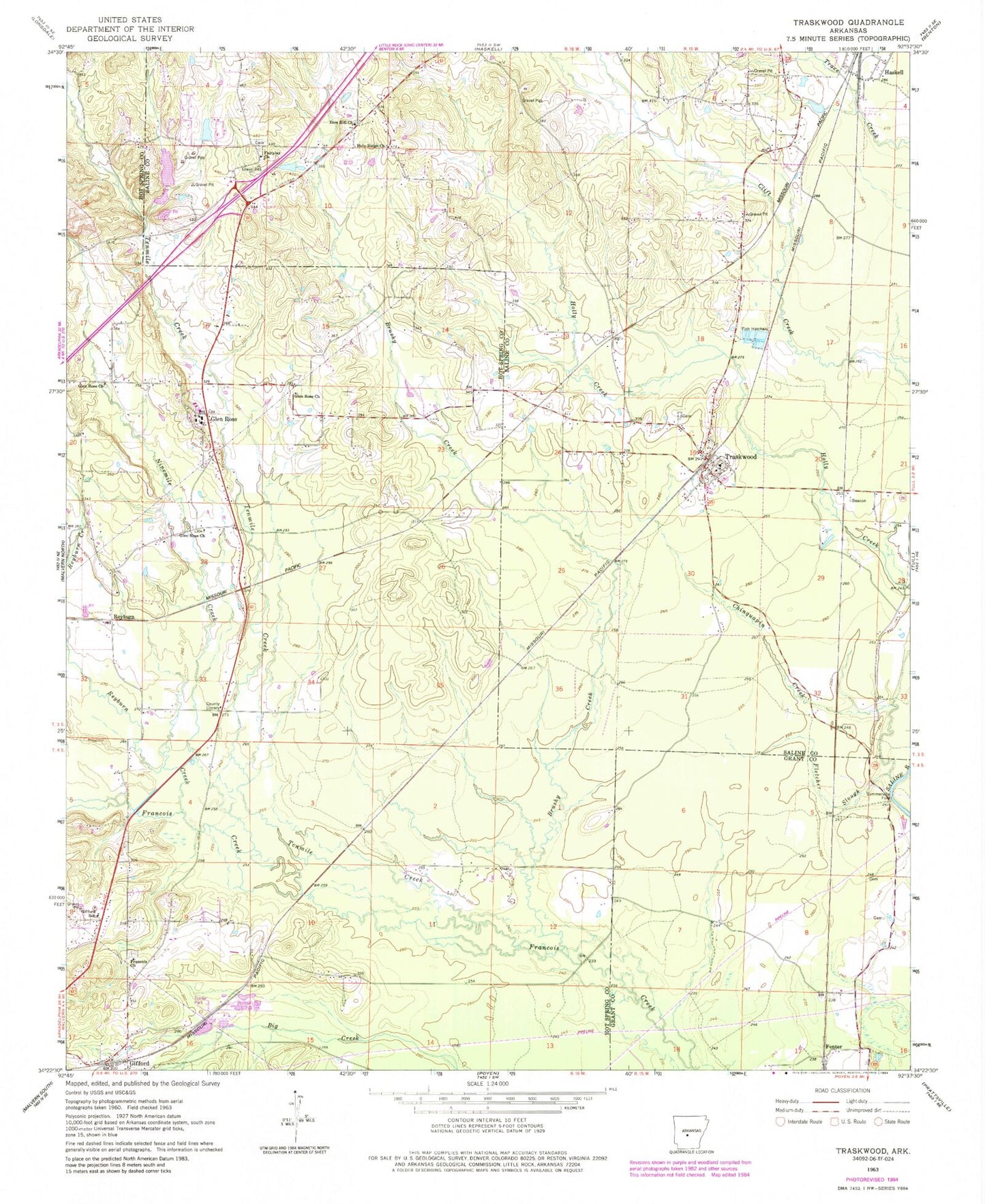
Classic USGS Traskwood Arkansas 7.5'x7.5' Topo Map
Couldn't load pickup availability
Historical USGS topographic quad map of Traskwood in the state of Arkansas. Map scale may vary for some years, but is generally around 1:24,000. Print size is approximately 24" x 27"
This quadrangle is in the following counties: Grant, Hot Spring, Saline.
The map contains contour lines, roads, rivers, towns, and lakes. Printed on high-quality waterproof paper with UV fade-resistant inks, and shipped rolled.
Contains the following named places: Barr Lake, Barr Lake Dam, Brushy Creek, Chinquapin Creek, City of Traskwood, Cunningham, Dawson Lake, Dawson Lake Dam, Fairplay Baptist Church, Fairplay Cemetery, Fenter, Fletcher Slough, Francois Church, Gifford, Gifford School, Glen Rose, Glen Rose Church, Glen Rose Elementary School, Glen Rose High School, Glen Rose Middle School, Glen Rose Volunteer Fire Department, Glen Rose Volunteer Fire Department Gifford Station, Holy Ridge Church, Lake Krislor, Lake Krislor Dam, Ninemile Creek, Opitz, Pathway Youth Camp Lake, Pathway Youth Camp Lake Dam, Reyburn Creek, Summerville Ford, Tenmile Creek, Township of Gifford, Township of Saline, Township of Traskwood, Traskwood, Traskwood Cemetery, Traskwood Post Office, Traskwood Volunteer Fire Station, Wyandotte, Zion Hill Church, ZIP Code: 72167