MyTopo
Classic USGS Traver California 7.5'x7.5' Topo Map
Couldn't load pickup availability
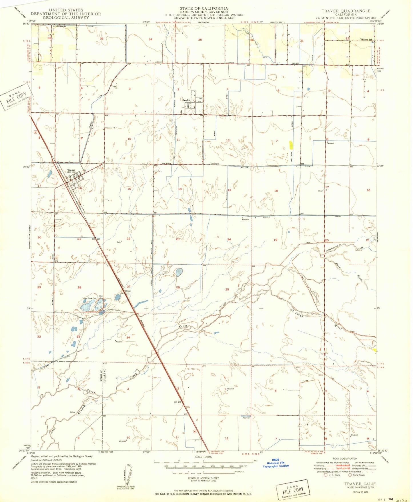
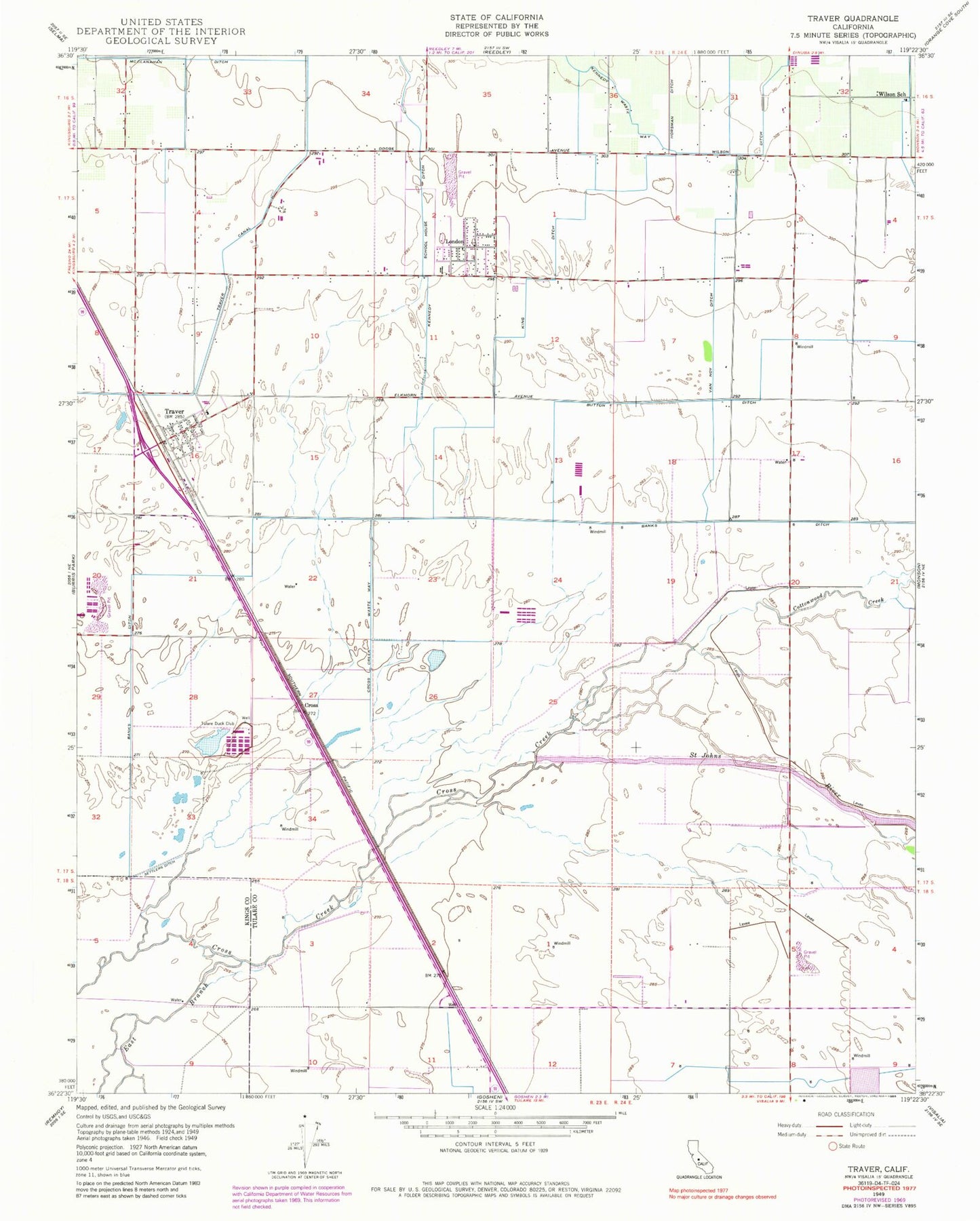
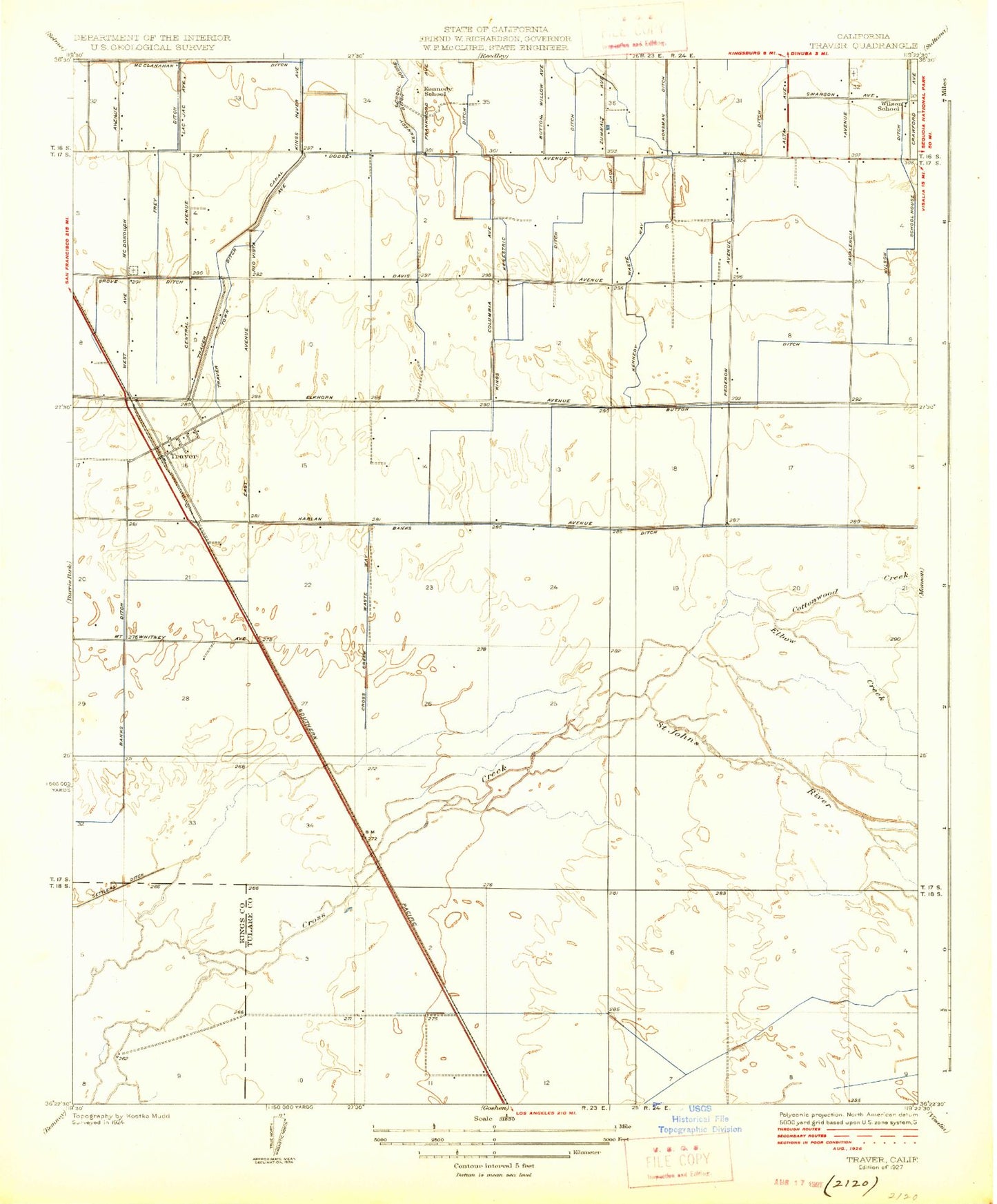
Historical USGS topographic quad map of Traver in the state of California. Map scale may vary for some years, but is generally around 1:24,000. Print size is approximately 24" x 27"
This quadrangle is in the following counties: Kings, Tulare.
The map contains contour lines, roads, rivers, towns, and lakes. Printed on high-quality waterproof paper with UV fade-resistant inks, and shipped rolled.
Contains the following named places: Banks Ditch, Cottonwood Creek, Cross, Cross Creek Dairy, Dinuba Division, Double J Dairy, Elbow Creek, Kennedy School, Kennedy School House Ditch, King Ditch, London, London Census Designated Place, Lopes Dairy, Rocky Road Daries Complex, Saint Johns River, Sunrise Dairy, Traver, Traver Canal, Traver Cemetery, Traver Census Designated Place, Traver Elementary School, Traver Post Office, Tulare Duck Club, Van Noy Ditch, Vanderham Dairy, Wilson Ditch, Wilson School, ZIP Code: 93673