MyTopo
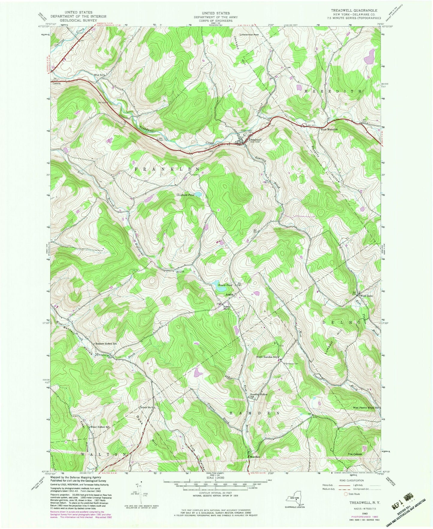
Classic USGS Treadwell New York 7.5'x7.5' Topo Map
Couldn't load pickup availability
Historical USGS topographic quad map of Treadwell in the state of New York. Typical map scale is 1:24,000, but may vary for certain years, if available. Print size: 24" x 27"
This quadrangle is in the following counties: Delaware.
The map contains contour lines, roads, rivers, towns, and lakes. Printed on high-quality waterproof paper with UV fade-resistant inks, and shipped rolled.
Contains the following named places: Bennett Hollow School (historical), Blue School (historical), Bourn Pond, Chisholm Pond, Croton Union Cemetery, Crystal Brook, Dunk Hill, Freer Hollow School (historical), Goldsmith Cemetery, Lumbert Hill, North Hamden School (historical), Poverty Hollow, Roaring Brook, School Number 5 (historical), Stoodley Hollow School (historical), The Cobble, Treadwell, Jackson Hill, Waterman Peak, Arabia, Mundale, West Delhi, West Meredith, School Number 11 (historical), Town of Franklin, Blueberry Field, West Delhi Presbyterian Church, West Delhi Cemetery, Arabia Cemetery, West Meredith Cemetery, Milk And Maple Farm, Stony Creek Farm, Treadwell United Methodist Church, Treadwell Fire Department