MyTopo
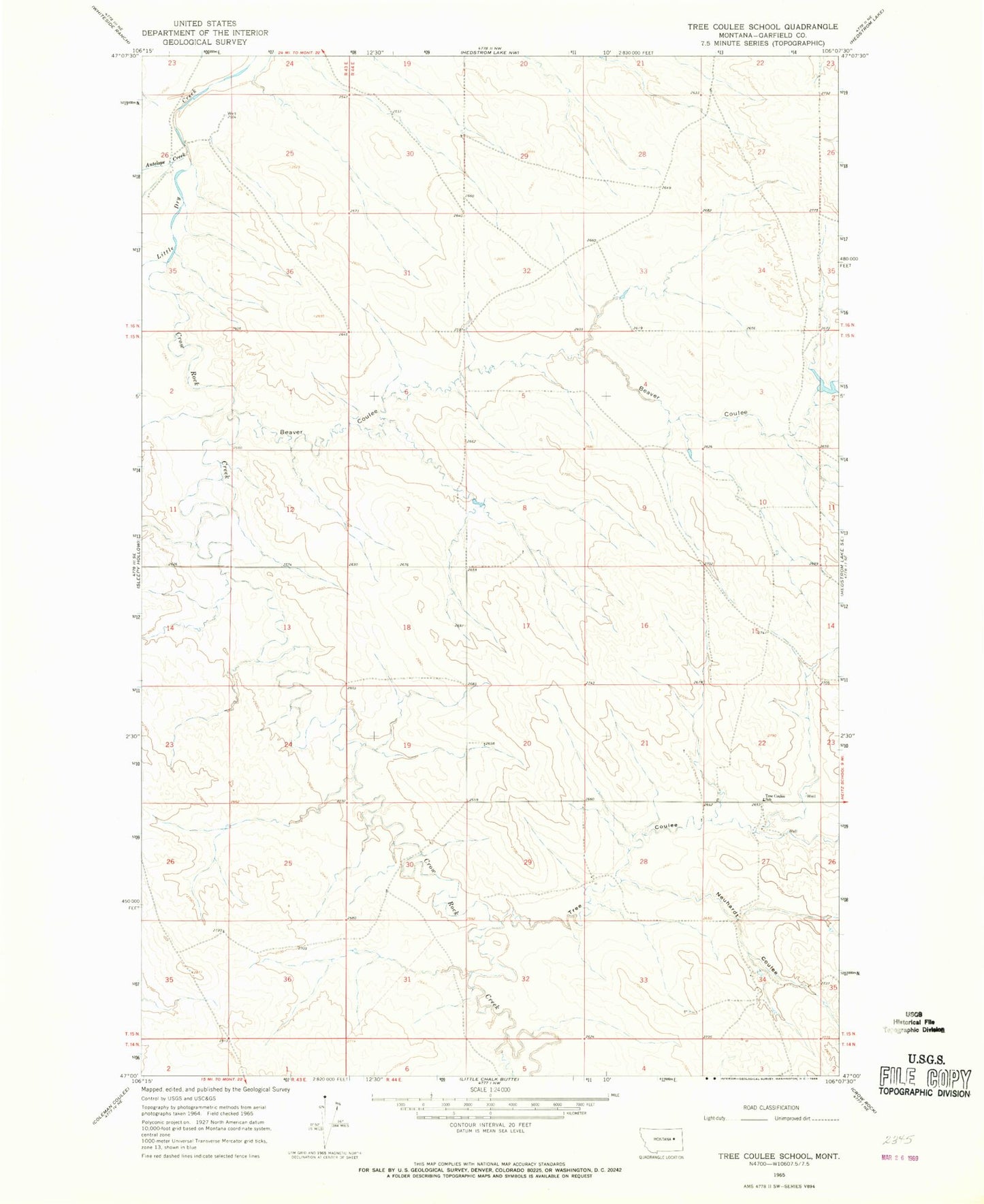
Classic USGS Tree Coulee School Montana 7.5'x7.5' Topo Map
Regular price
$16.95
Regular price
Sale price
$16.95
Unit price
per
Couldn't load pickup availability
Historical USGS topographic quad map of Tree Coulee School in the state of Montana. Map scale may vary for some years, but is generally around 1:24,000. Print size is approximately 24" x 27"
This quadrangle is in the following counties: Garfield.
The map contains contour lines, roads, rivers, towns, and lakes. Printed on high-quality waterproof paper with UV fade-resistant inks, and shipped rolled.
Contains the following named places: 15N44E08CDAD01 Well, 15N44E22CCCD01 Well, 15N44E27ACAA01 Well, 15N44E28AADA01 Well, 16N44E22CCCD01 Well, 16N44E30ADAD01 Well, 59312, Alfred Jordan Number 1 Dam, Antelope Creek, Beaver Coulee, Crow Rock Creek, Neuhardt Coulee, Tree Coulee, Tree Coulee School, Tree Creek