MyTopo
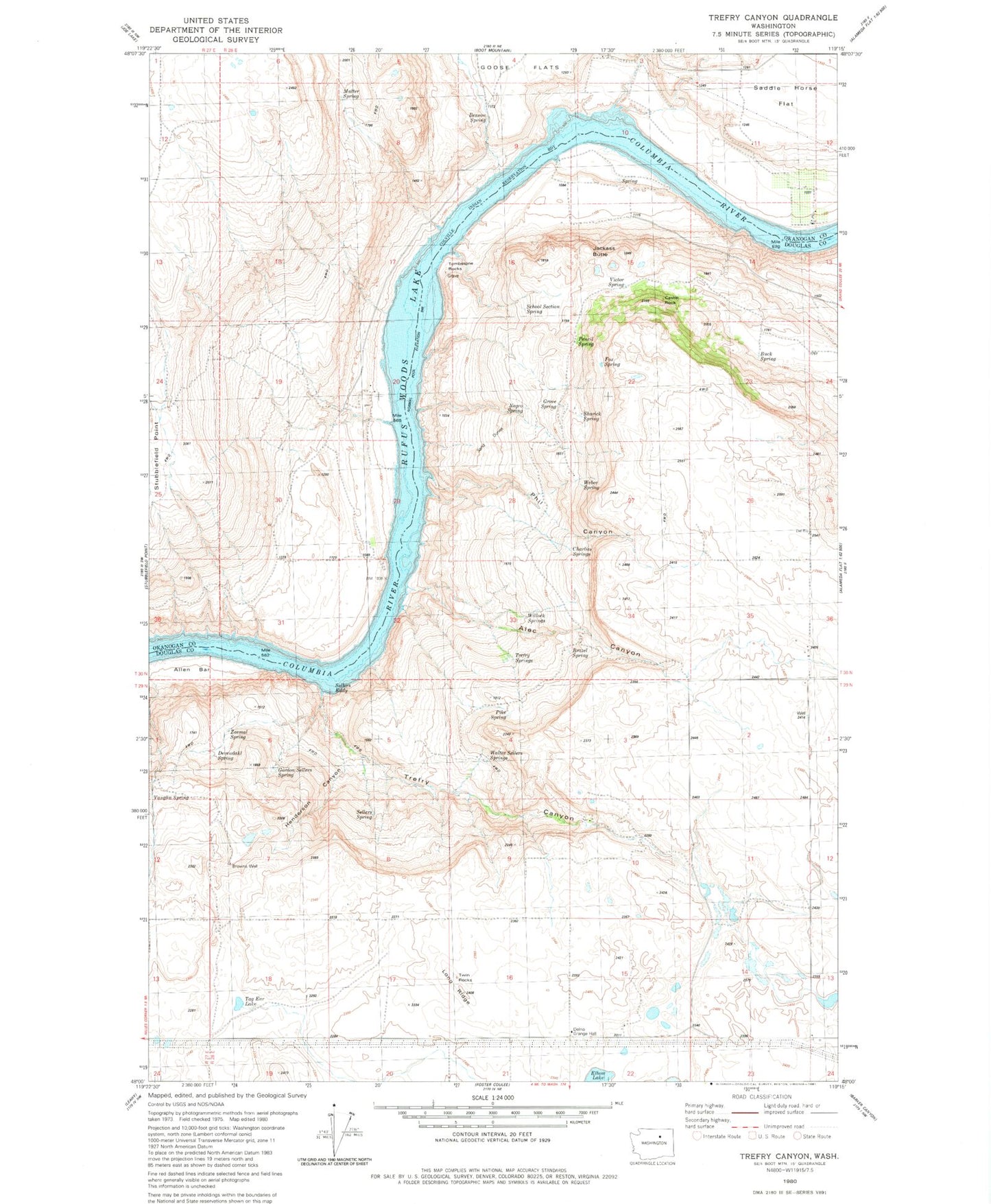
Classic USGS Trefry Canyon Washington 7.5'x7.5' Topo Map
Couldn't load pickup availability
Historical USGS topographic quad map of Trefry Canyon in the state of Washington. Map scale may vary for some years, but is generally around 1:24,000. Print size is approximately 24" x 27"
This quadrangle is in the following counties: Douglas, Okanogan.
The map contains contour lines, roads, rivers, towns, and lakes. Printed on high-quality waterproof paper with UV fade-resistant inks, and shipped rolled.
Contains the following named places: Alec Canyon, Allen Bar, Benson Spring, Brazel Spring, Browns Well, Buck Spring, Castle Rock, Charlies Springs, Del Rio, Del Rio Grange Hall, Del Rio School, Devendahl Spring, Fox Spring, Gordon Sellers Spring, Granite Rapids, Grove Spring, Henderson Canyon, Island Shoal, Jackass Butte, Long Ridge, Mutter Spring, Negro Spring, Okanogan County Fire District 8 Timm Unit, Okanogan County Fire District 8 Wells Unit, Parson Rapids, Pencil Spring, Phil Canyon, Pike Spring, Rufus Woods Lake, Saddle Horse Flat, School Section Spring, Sellers Spring, Sharick Spring, Tag Ear Lake, Tombstone Rocks, Trefry Canyon, Trefry Springs, Twin Rocks, Victor Spring, Walter Sellers Springs, Weber Spring, Willock Springs, Zeemal Spring