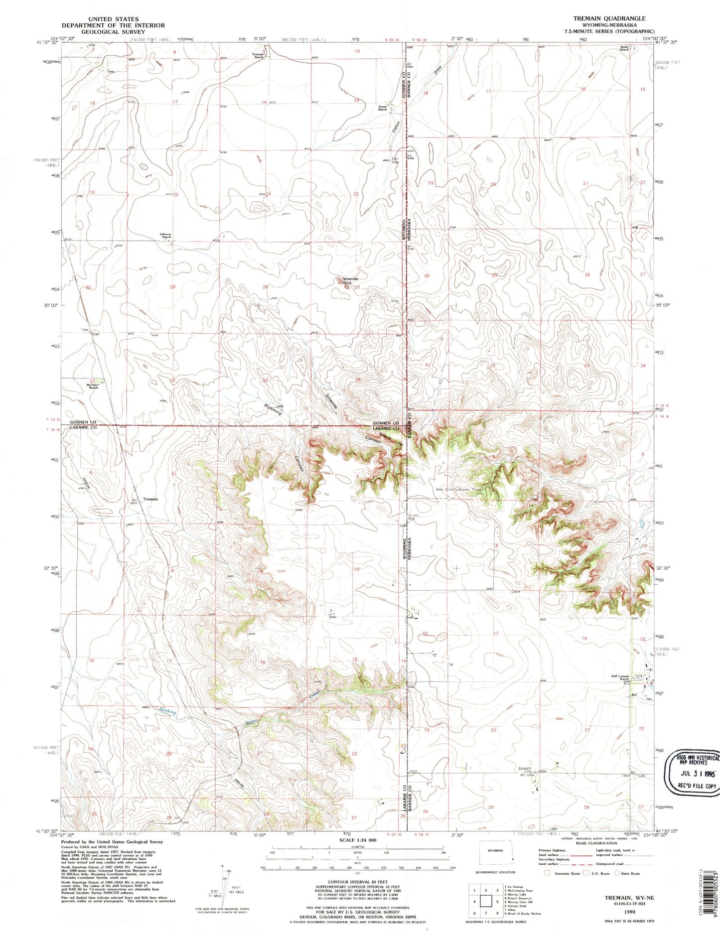
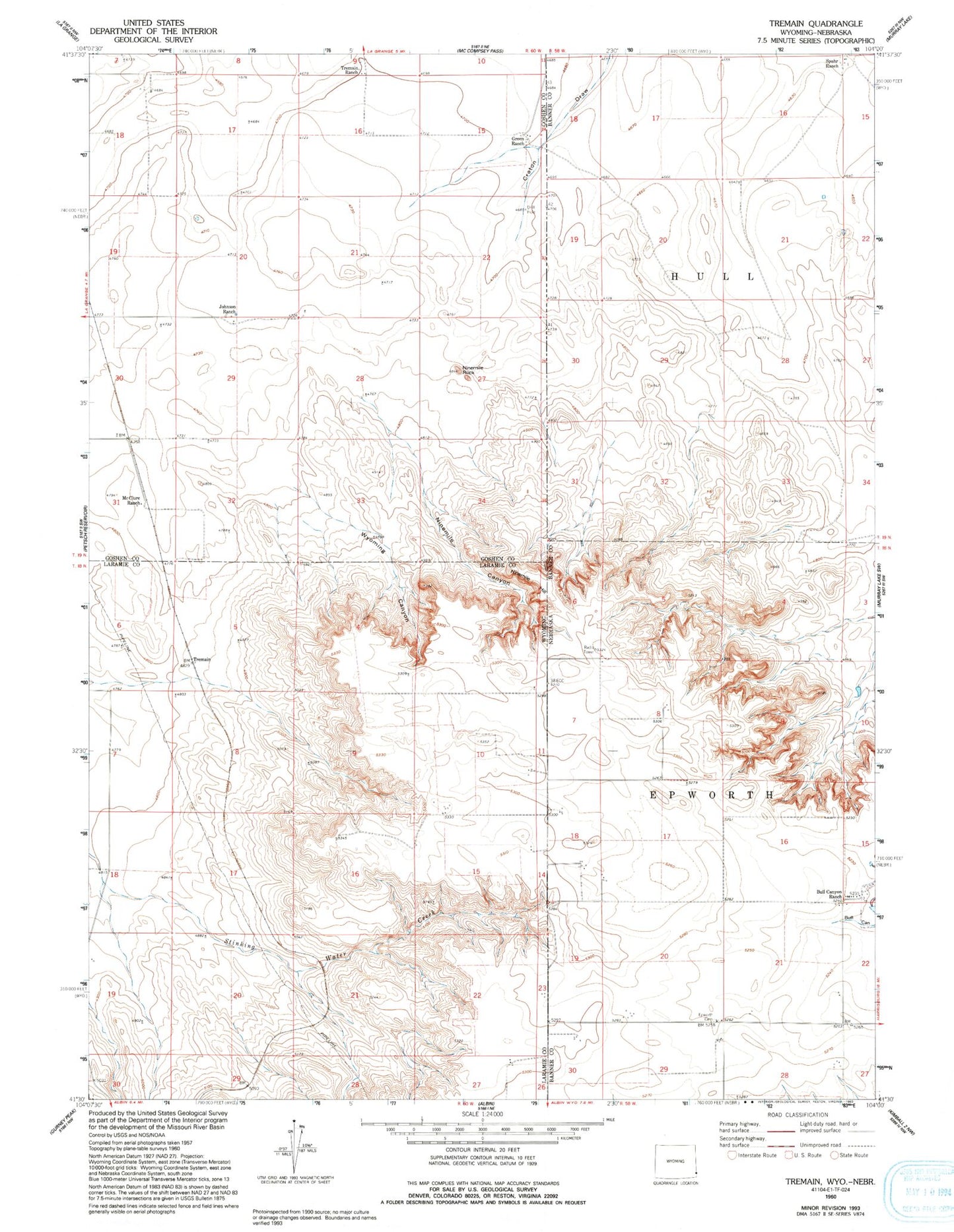
MyTopo
Classic USGS Tremain Wyoming 7.5'x7.5' Topo Map
Regular price
$16.95
Regular price
Sale price
$16.95
Unit price
per
Couldn't load pickup availability
Historical USGS topographic quad map of Tremain in the states of Wyoming, Nebraska. Map scale may vary for some years, but is generally around 1:24,000. Print size is approximately 24" x 27"
This quadrangle is in the following counties: Banner, Goshen, Laramie.
The map contains contour lines, roads, rivers, towns, and lakes. Printed on high-quality waterproof paper with UV fade-resistant inks, and shipped rolled.
Contains the following named places: Bull Canyon Ranch, Epworth Cemetery, Epworth Post Office, Green Ranch, Johnson Ranch, McClure Ranch, Ninemile Canyon, Ninemile Hill, Ninemile Rock, Spahr Ranch, Tremain, Tremain Ranch, Wyoming Canyon