MyTopo
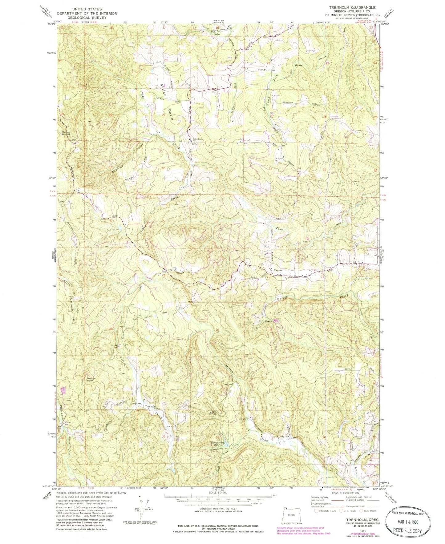
Classic USGS Trenholm Oregon 7.5'x7.5' Topo Map
Couldn't load pickup availability
Historical USGS topographic quad map of Trenholm in the state of Oregon. Typical map scale is 1:24,000, but may vary for certain years, if available. Print size: 24" x 27"
This quadrangle is in the following counties: Columbia.
The map contains contour lines, roads, rivers, towns, and lakes. Printed on high-quality waterproof paper with UV fade-resistant inks, and shipped rolled.
Contains the following named places: Apilton Creek, Bishop Creek, Canaan, Endicott Creek, Meissner Lookout, Salmonberry Creek, Salmonberry Reservoir, Shiloh Basin, Shiloh Basin School (historical), Smith Creek, Trenholm, Shiloh Basin Cemetery, Goble Cemetery, Serafin Point, Carico Post Office (historical), Tidecreek Post Office (historical), Valley Post Office (historical), Trenholm Post Office (historical), Wilark Guard Station (historical), Goble Division, Royal Oaks City Park, Canaan Community Church