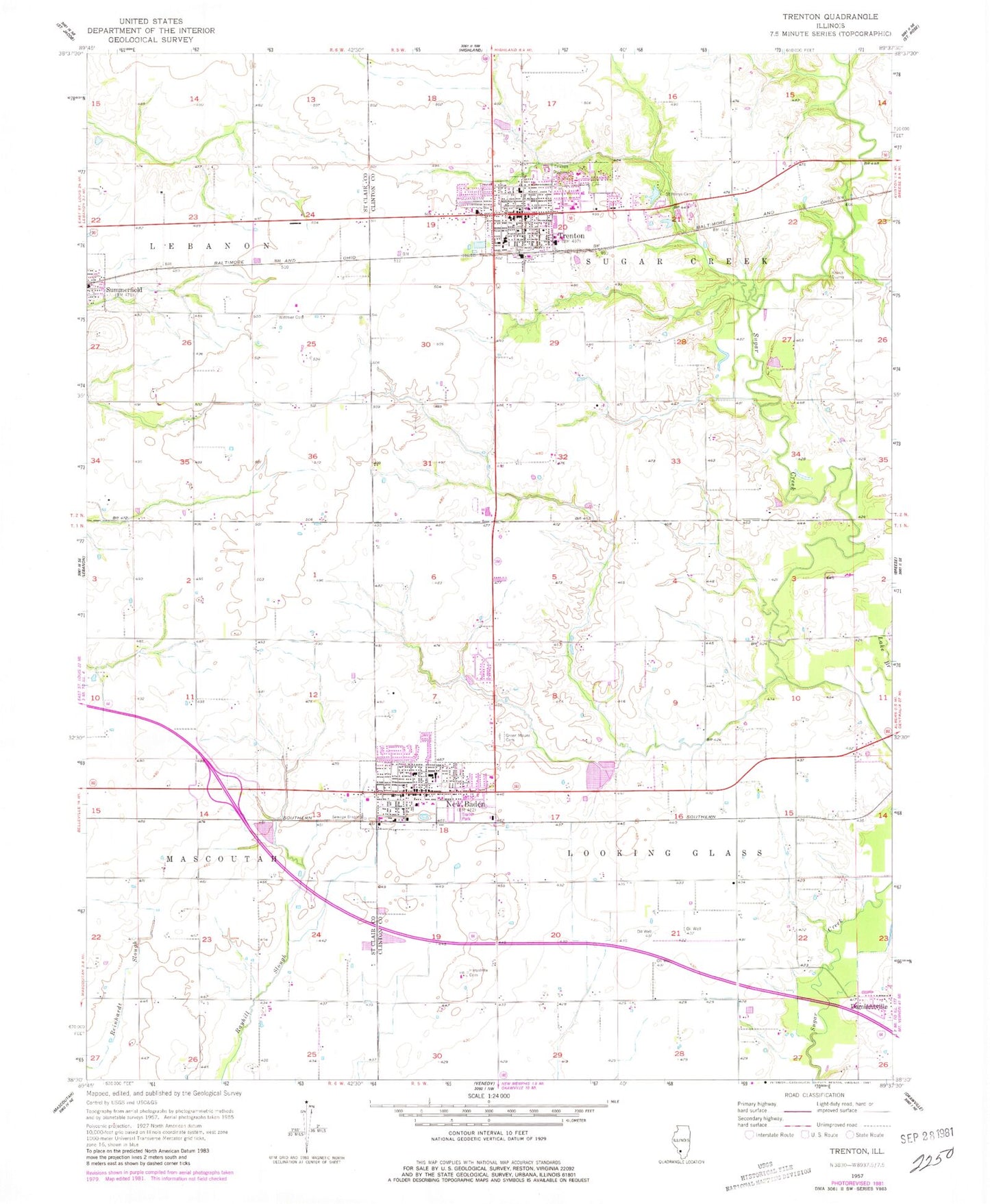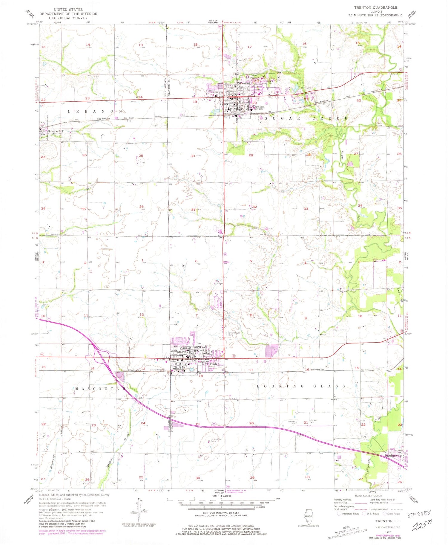
MyTopo
Classic USGS Trenton Illinois 7.5'x7.5' Topo Map
Couldn't load pickup availability
Historical USGS topographic quad map of Trenton in the state of Illinois. Map scale may vary for some years, but is generally around 1:24,000. Print size is approximately 24" x 27"
This quadrangle is in the following counties: Clinton, St. Clair.
The map contains contour lines, roads, rivers, towns, and lakes. Printed on high-quality waterproof paper with UV fade-resistant inks, and shipped rolled.
Contains the following named places: City of Trenton, First United Methodist Church, Grace Community Baptist Church, Green Mount Cemetery, Harpstrite Cemetery, Kalmer School, Knaus Quarry, McKee School, Neis School, New Baden, New Baden Ambulance Service, New Baden Elementary School, New Baden Police Department, New Baden Post Office, New Baden United Methodist Church, New Baden Village Cemetery, New Baden Volunteer Fire Protection District, North Grove School, Richter School, Rocky Ford Pond, Rocky Ford Pond Dam, Ruth School, Saint George Church, Saint John United Church of Christ, Saint Marys Cemetery, Saint Marys Church, Saint Marys Elementary School, Sharon School, Sugar Creek Ambulance Services, Sugar Creek Township Fire Protection District, Township of Looking Glass, Township of Sugar Creek, Trenton, Trenton Cemetery, Trenton Elementary School, Trenton Police Department, Trenton Post Office, Village of New Baden, Village of Summerfield, Volmer School, Wellens Dairy Farm, Wittmer Cemetery, Zion United Church of Christ, ZIP Code: 62293