MyTopo
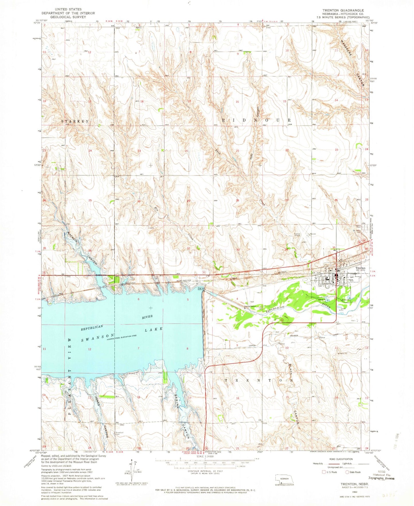
Classic USGS Trenton Nebraska 7.5'x7.5' Topo Map
Couldn't load pickup availability
Historical USGS topographic quad map of Trenton in the state of Nebraska. Map scale may vary for some years, but is generally around 1:24,000. Print size is approximately 24" x 27"
This quadrangle is in the following counties: Hitchcock.
The map contains contour lines, roads, rivers, towns, and lakes. Printed on high-quality waterproof paper with UV fade-resistant inks, and shipped rolled.
Contains the following named places: Bakers Acres Airport, Black Canyon, Bush Creek, Church of God Indiana, El Dorado Manor, Elm Creek, Farmers Cooperative Grain and Supply Company Elevator, Hidy Canyon, Hitchcock County, Hitchcock County Court House, Hitchcock County Museum, Hitchcock County Sheriff's Office, Jones Canyon, Macklin Bay Campground, Macklin Canyon, Poe, Ridnour Election Precinct, Rosefield Cemetery, Saint James Catholic Church, Saint James Cemetery, Spring Canyon, Spring Canyon Campground, Swanson Lake, Swanson Reservoir State Recreation Area, Township of Ridnour, Trenton, Trenton Cemetery, Trenton City Police, Trenton Dam, Trenton Election Precinct, Trenton Municipal Airport, Trenton Post Office, Trenton Public Library, Trenton Public Schools, Trenton Regional Medical Center, Trenton Rescue Squad, Trenton Volunteer Fire Department, United Church of Christ Congregational, United Methodist Church, Village of Trenton, ZIP Code: 69044