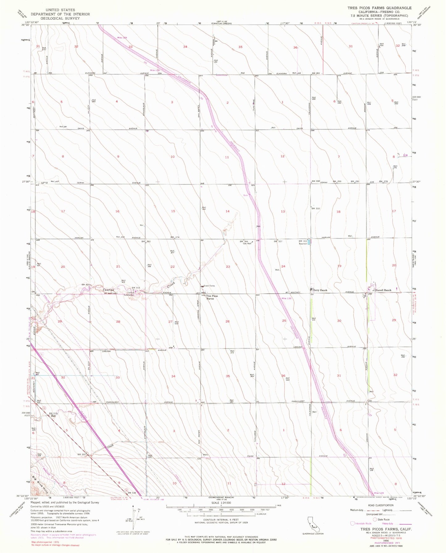
MyTopo
Classic USGS Tres Picos Farms California 7.5'x7.5' Topo Map
Regular price
$16.95
Regular price
Sale price
$16.95
Unit price
per
Couldn't load pickup availability
Historical USGS topographic quad map of Tres Picos Farms in the state of California. Map scale may vary for some years, but is generally around 1:24,000. Print size is approximately 24" x 27"
This quadrangle is in the following counties: Fresno.
The map contains contour lines, roads, rivers, towns, and lakes. Printed on high-quality waterproof paper with UV fade-resistant inks, and shipped rolled.
Contains the following named places: Cantua Creek, Cantua Substation, Farrell Ranch, Five Points Ranch Airport, Martinez Creek, Salt Creek, Terry Ranch, Tres Picos Farms, ZIP Code: 93608