MyTopo
Classic USGS Tres Pinos California 7.5'x7.5' Topo Map
Couldn't load pickup availability
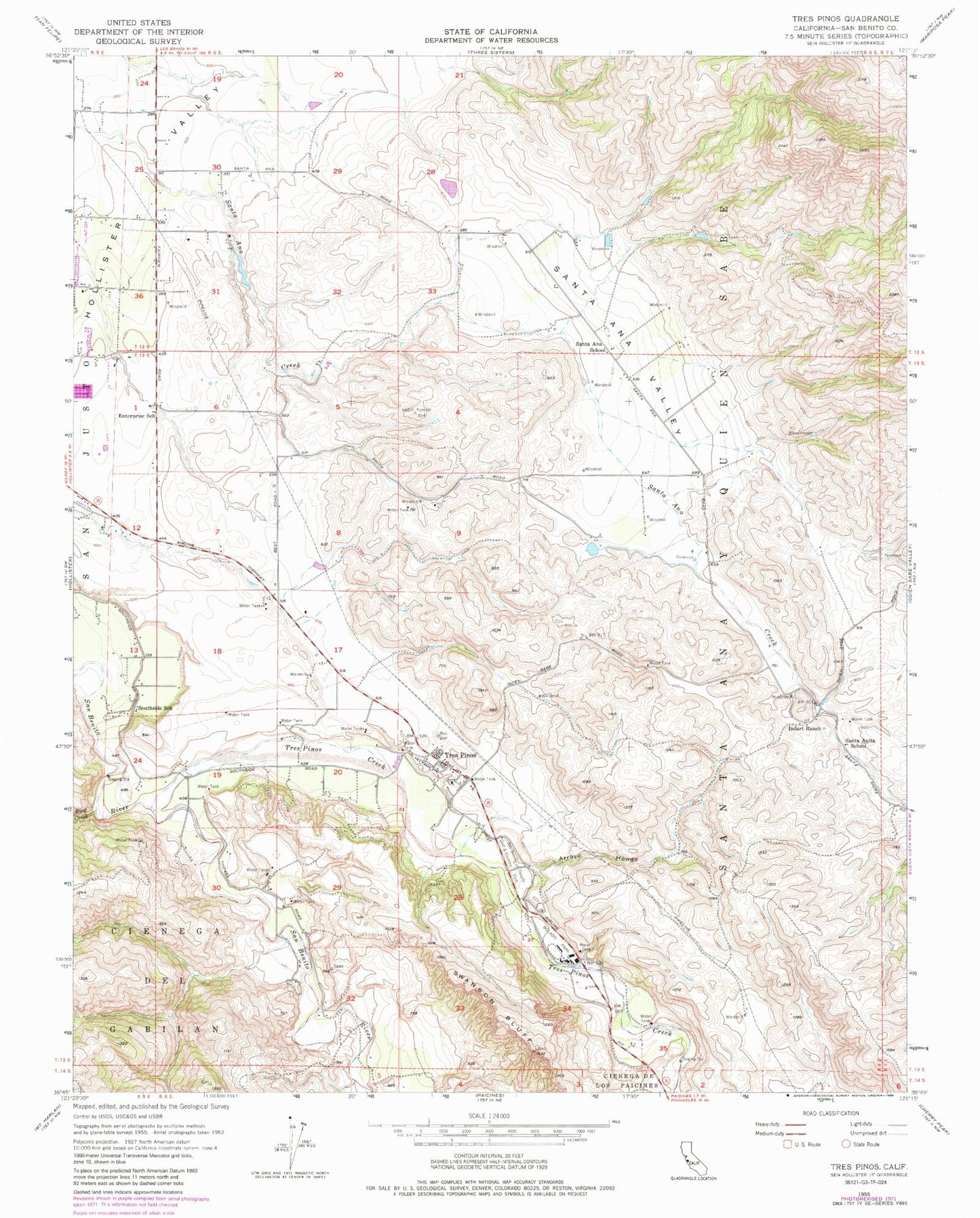
Historical USGS topographic quad map of Tres Pinos in the state of California. Map scale may vary for some years, but is generally around 1:24,000. Print size is approximately 24" x 27"
This quadrangle is in the following counties: San Benito.
The map contains contour lines, roads, rivers, towns, and lakes. Printed on high-quality waterproof paper with UV fade-resistant inks, and shipped rolled.
Contains the following named places: American Medical Response San Benito County, Apostolic Christian School, Arroyo Hondo, Bird Creek, Bolado Park, Cal Fire Hollister Fire Station, Calvary Christian School, Cerra Vista Elementary School, Christensen Ranch Airport, Enterprise School, Hollister Division, Hollister SDA Christian School, Indart Ranch, John Smith Landfill, Ridgemark, Ridgemark Census Designated Place, Ridgemark Golf and Country Club, San Benito County Golf and Country Club, San Benito Historical Park, Santa Ana School, Santa Ana Valley, Santa Anita School, Southside Elementary School, Swanson Bluff, Thomas Ranch, Tres Pinos, Tres Pinos Census Designated Place, Tres Pinos Creek, Tres Pinos Elementary School, Tres Pinos Post Office