MyTopo
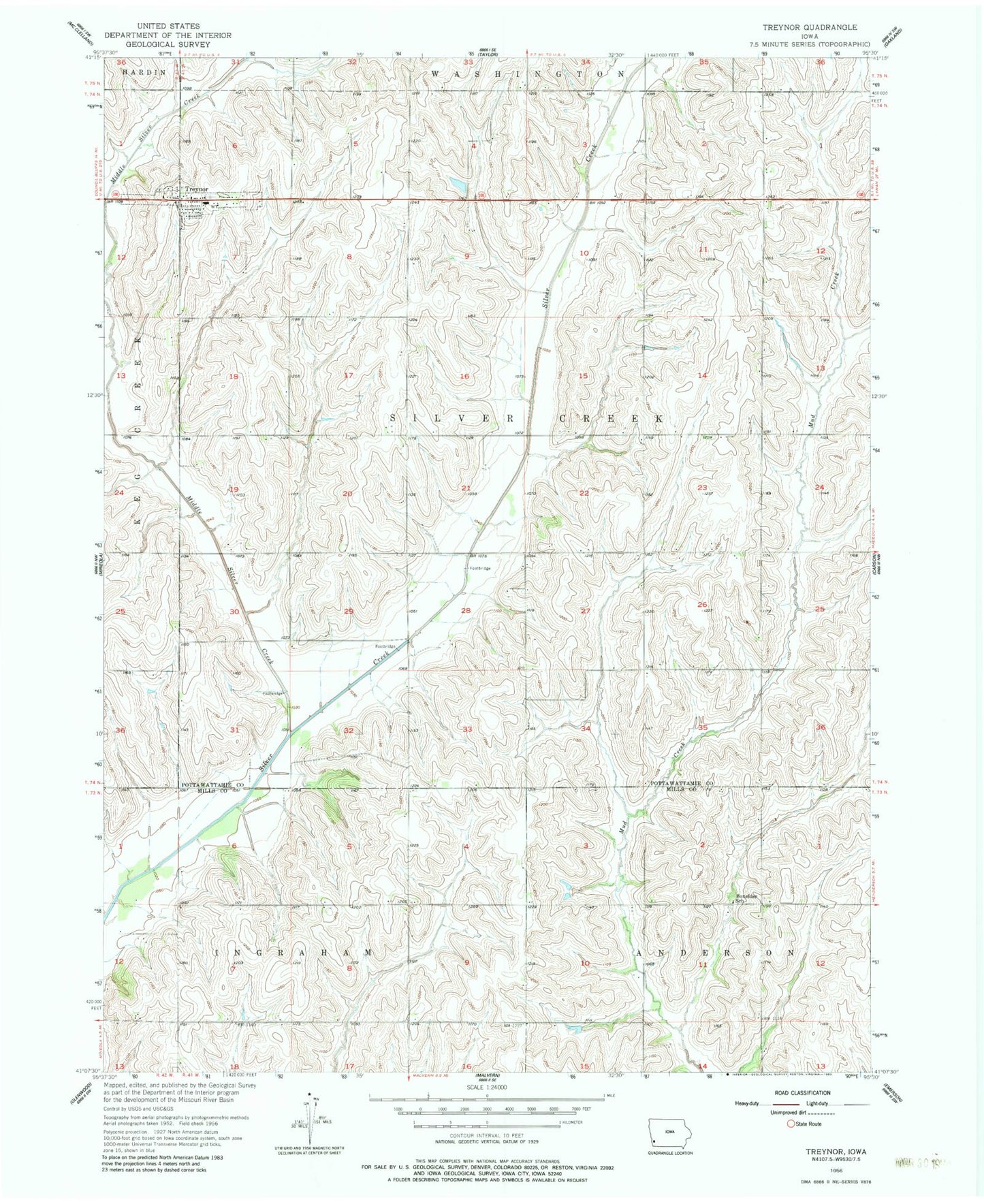
Classic USGS Treynor Iowa 7.5'x7.5' Topo Map
Couldn't load pickup availability
Historical USGS topographic quad map of Treynor in the state of Iowa. Map scale may vary for some years, but is generally around 1:24,000. Print size is approximately 24" x 27"
This quadrangle is in the following counties: Mills, Pottawattamie.
The map contains contour lines, roads, rivers, towns, and lakes. Printed on high-quality waterproof paper with UV fade-resistant inks, and shipped rolled.
Contains the following named places: Boxelder Post Office, Boxelder School, City of Treynor, Little Silver Creek, Living Spring, Living Spring Post Office, Middle Silver Creek, Ridge Family Practice Center, Saint Pauls Lutheran Church, Township of Silver Creek, Treynor, Treynor City Town Hall, Treynor Elementary School, Treynor Fire Department and Ambulance Service, Treynor High School, Treynor Post Office, Treynor Recreation Area, Zion Congregational Cemetery, Zion Congregational Church, ZIP Codes: 51571, 51575