
MyTopo
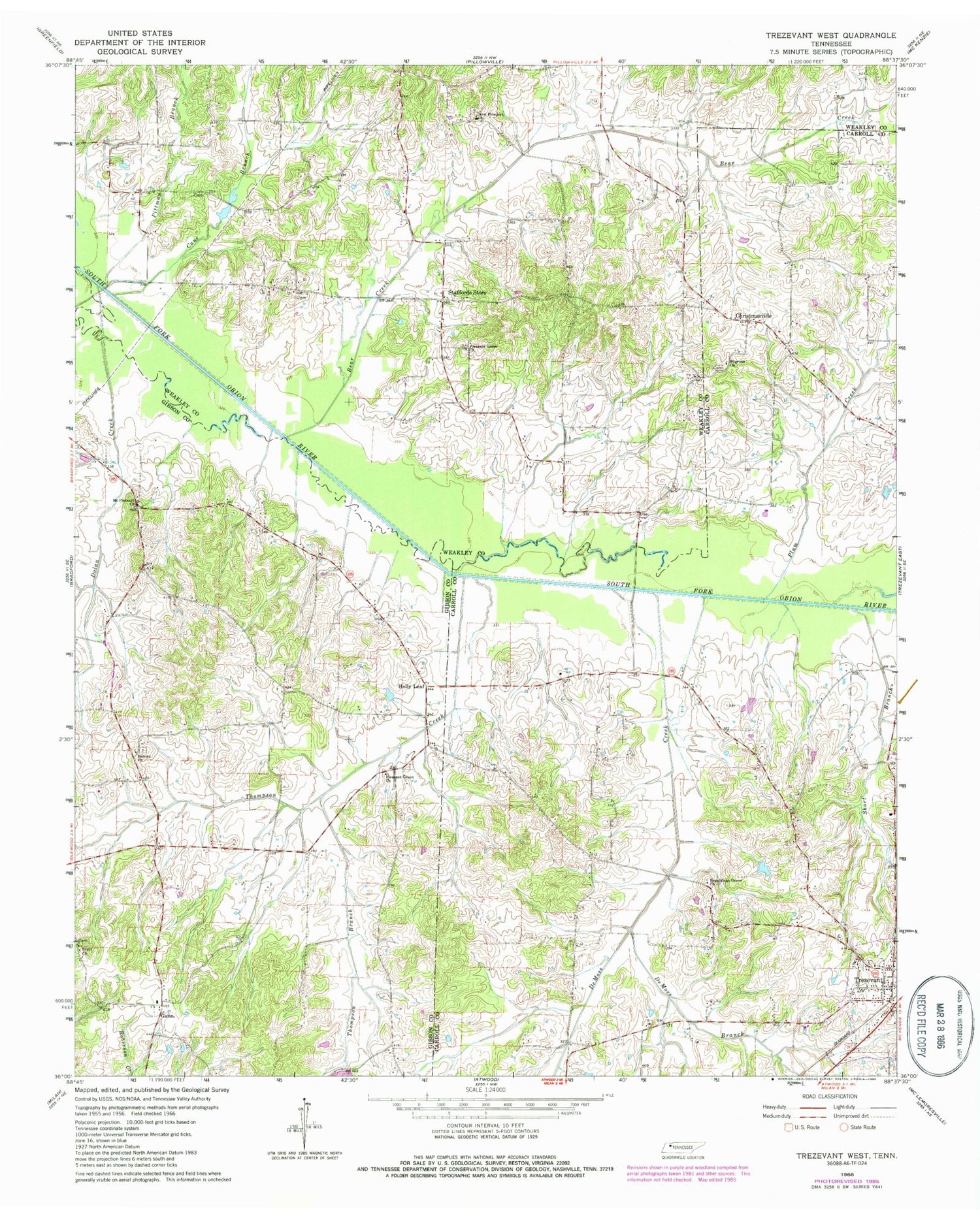
Classic USGS Trezevant West Tennessee 7.5'x7.5' Topo Map
Couldn't load pickup availability
Historical USGS topographic quad map of Trezevant West in the state of Tennessee. Map scale may vary for some years, but is generally around 1:24,000. Print size is approximately 24" x 27"
This quadrangle is in the following counties: Carroll, Gibson, Weakley.
The map contains contour lines, roads, rivers, towns, and lakes. Printed on high-quality waterproof paper with UV fade-resistant inks, and shipped rolled.
Contains the following named places: Austin Hank Lake, Austin Hank Lake Dam, Bear Creek, Belews Chapel Cemetery, Belews Church, Brock Cemetery, Cane Branch, Christmasville, DeMoss Branch, DeMoss Creek, Dinwiddie Store, District 15, District 2, District 3, Dolan Creek, Flippen School, Gann, Gann School, Gibson County Fire Department Station 4 Gann, Holly Leaf, Holt School, Mount Aries School, Mount Pleasant Cemetery, Mount Pleasant Church, Mount Zion Church of Christ, New Prospect Cemetery, New Prospect Church, Oak Grove School, Oak Hill School, Pilgrims Church, Pilgrims Rest Cemetery, Pittman Branch, Pittman Cemetery, Pittman School, Pleasant Green Cemetery, Pleasant Green Church, Pleasant Grove Baptist Church, Pleasant Grove Cemetery, Plum Creek, Pratt Cemetery, Pratt Church, Republican Grove Missionary Baptist Church, Short Branch, Smiths Chapel School, Staffords Store, Thompson Branch, Thompson Creek


