MyTopo
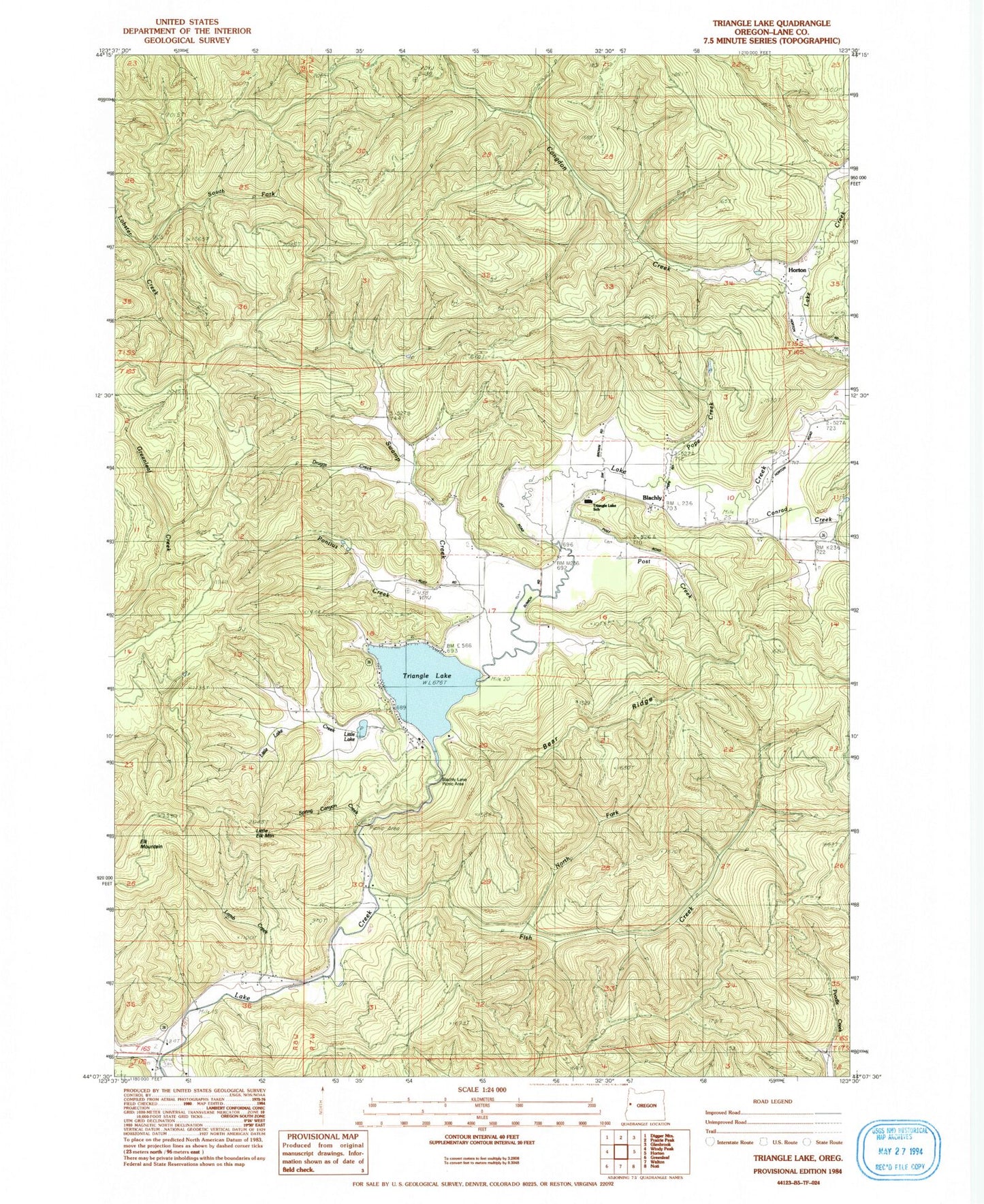
Classic USGS Triangle Lake Oregon 7.5'x7.5' Topo Map
Couldn't load pickup availability
Historical USGS topographic quad map of Triangle Lake in the state of Oregon. Map scale may vary for some years, but is generally around 1:24,000. Print size is approximately 24" x 27"
This quadrangle is in the following counties: Lane.
The map contains contour lines, roads, rivers, towns, and lakes. Printed on high-quality waterproof paper with UV fade-resistant inks, and shipped rolled.
Contains the following named places: Bear Ridge, Blachly, Blachly Cemetery, Blachly Lane Picnic Area, Blachly Post Office, Congdon Creek, Conrad Creek, Druggs Creek, Elk Mountain, Fish Creek, Greenleaf Creek, John Griffith Reservoir, Lake Creek Fire and Rescue, Lake Creek Recreation Area, Lamb Creek, Little Elk Mountain, Little Lake, Little Lake Creek, Little Lake Spring, North Fork Fish Creek, Pontius Creek, Pope Creek, Post Creek, Pucker Creek, South Fork Lobster Creek, Spring Canyon Creek, Swamp Creek, Triangle Lake, Triangle Lake County Park, Triangle Lake Landing Boat Ramp, Triangle Lake School, ZIP Code: 97412