MyTopo
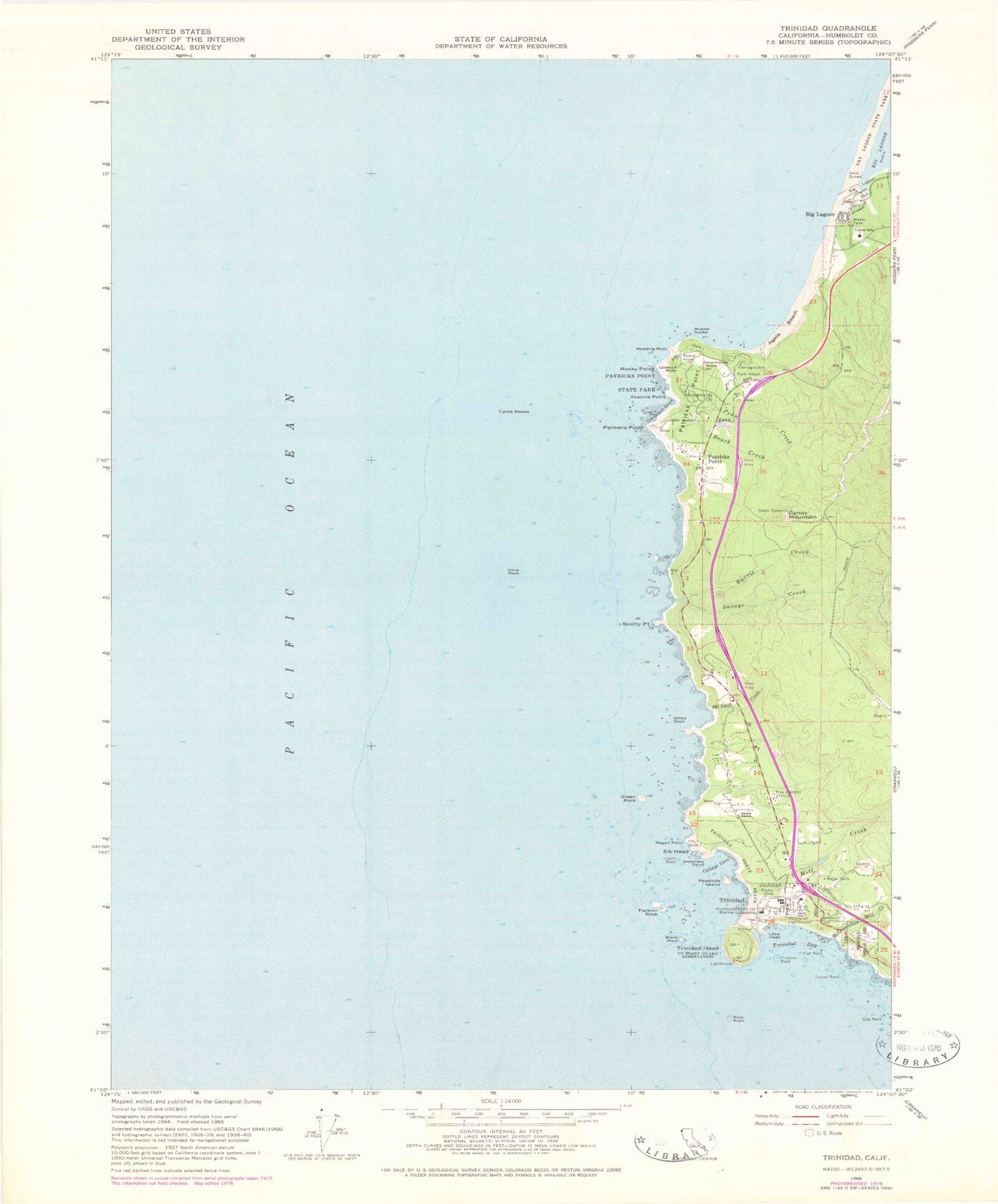
Classic USGS Trinidad California 7.5'x7.5' Topo Map
Couldn't load pickup availability
Historical USGS topographic quad map of Trinidad in the state of California. Map scale may vary for some years, but is generally around 1:24,000. Print size is approximately 24" x 27"
This quadrangle is in the following counties: Humboldt.
The map contains contour lines, roads, rivers, towns, and lakes. Printed on high-quality waterproof paper with UV fade-resistant inks, and shipped rolled.
Contains the following named places: Abalone Campground, Abalone Point, Agate Beach, Agate Beach Trail, Agate Campground, Beach Creek, Beach Creek Group Camp, Big Lagoon, Big Lagoon Census Designated Place, Big Lagoon County Park, Bishop Pine Group Picnic Area, Blank Rock, Burris Creek, California Department of Forestry and Fire Protection Trinidad Station, Camel Rock, Candy Mountain, Cannonball Beach, Cap Rock, Ceremonial Rock, City of Trinidad, College Cove, Cone Rock, Elk Head, Flat Rock, Flatiron Rock, Green Rock, Holy Trinity Church, Humboldt State College Marine Laboratory, Lepoil Rock, Little Head, Lookout Rock, McConnahas Mill Creek, McNeil Creek, Megwil Point, Memorial Lighthouse, Mill Creek, Mussel Rocks, Octopuc Trees Trail, Omenoku Point, Palmers Point, Patricks Point, Patricks Point School, Patrick's Point State Park, Penn Campground, Penn Creek, Pewetole Island, Pilot Rock, Prisoner Rock, Red Alder Group Picnic Area, Rim Trail, Rocky Point, Savage Creek, Scotty Point, Shumig, Sotsin Point, The Portal, Trinidad, Trinidad Bay, Trinidad Cemetery, Trinidad Elementary School, Trinidad Harbor, Trinidad Head, Trinidad Head Lighthouse, Trinidad Police Department, Trinidad Post Office, Trinidad Rancheria, Trinidad State Beach, Trinidad Volunteer Fire Department, Tsurai Trail, Tsurau, Turtle Rocks, Union School, Wedding Rock, White Rock, ZIP Code: 95570