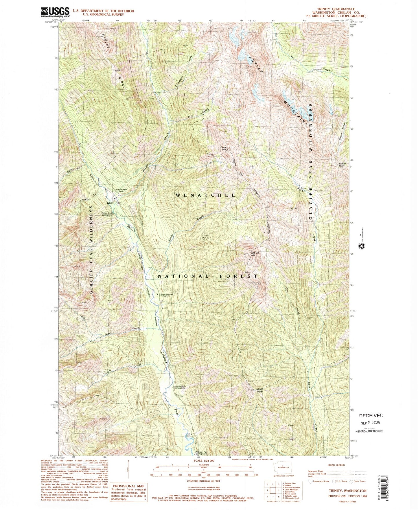
MyTopo
Classic USGS Trinity Washington 7.5'x7.5' Topo Map
Couldn't load pickup availability
Historical USGS topographic quad map of Trinity in the state of Washington. Typical map scale is 1:24,000, but may vary for certain years, if available. Print size: 24" x 27"
This quadrangle is in the following counties: Chelan.
The map contains contour lines, roads, rivers, towns, and lakes. Printed on high-quality waterproof paper with UV fade-resistant inks, and shipped rolled.
Contains the following named places: Alpine Creek, Box Creek, Carne Mountain, Chipmunk Creek, Estes Butte, Gib Creek, James Creek, Little Giant Creek, Maple Creek, Old Gib Mountain, Phelps Creek, Pomas Pass, Red Mountain Mine, Trinity, Willow Creek, Phelps Creek Campground, Alpine Meadows Campground, Nineteenmile Campground, Maple Creek Campground, Estes Ridge