MyTopo
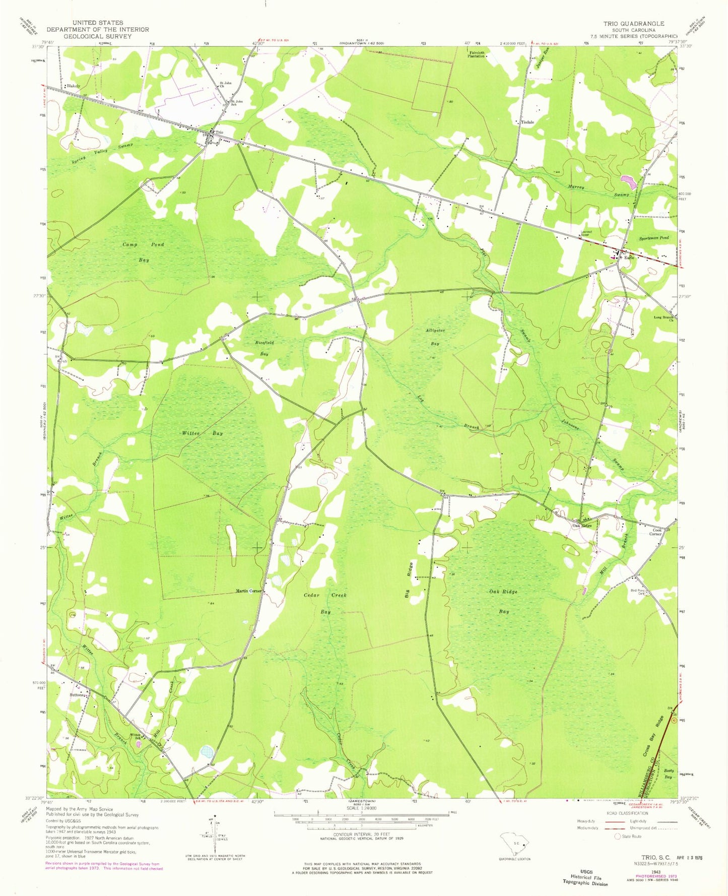
Classic USGS Trio South Carolina 7.5'x7.5' Topo Map
Couldn't load pickup availability
Historical USGS topographic quad map of Trio in the state of South Carolina. Map scale may vary for some years, but is generally around 1:24,000. Print size is approximately 24" x 27"
This quadrangle is in the following counties: Georgetown, Williamsburg.
The map contains contour lines, roads, rivers, towns, and lakes. Printed on high-quality waterproof paper with UV fade-resistant inks, and shipped rolled.
Contains the following named places: Ackerman Pond, Ackerman Pond Dam D-3096, Aimwell School, Alligator Bay, Big Ridge, Bird Pond Cemetery, Camp Pond Bay, Cedar Creek Bay, Cook Corner, Cross Bay Ridge, Earle, Earle Lookout Tower, Earle School, Earls Methodist Episcopal Church South, Faircloth Plantation, Flat Swamp, Juniper Run, Log Branch, Martin Corner, Mill Branch, Mill Creek, Nazareth African Methodist Episcopal Church, Oak Ridge, Oak Ridge Bay, Oak Ridge Church, Oak Ridge School, Ricefield Bay, Saint John Church, Saint John School, Sportsman Pond, Spring Pond Church, Spring Valley Swamp, Suttons, Tisdale, Trio, Trio Division, Trio Methodist Episcopal Church South, Williamsburg County Fire Department 11 - Trio, Williamsburg County Fire Department Station 15, Williamsburg County Headstart School, Wittee Bay, Wittee School