
MyTopo
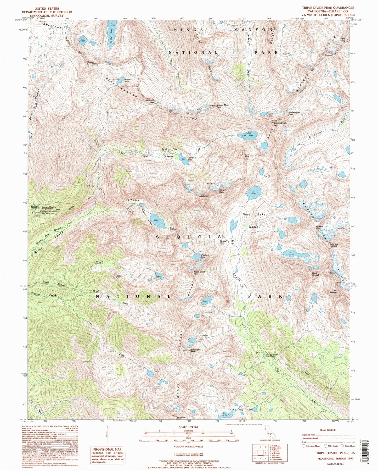
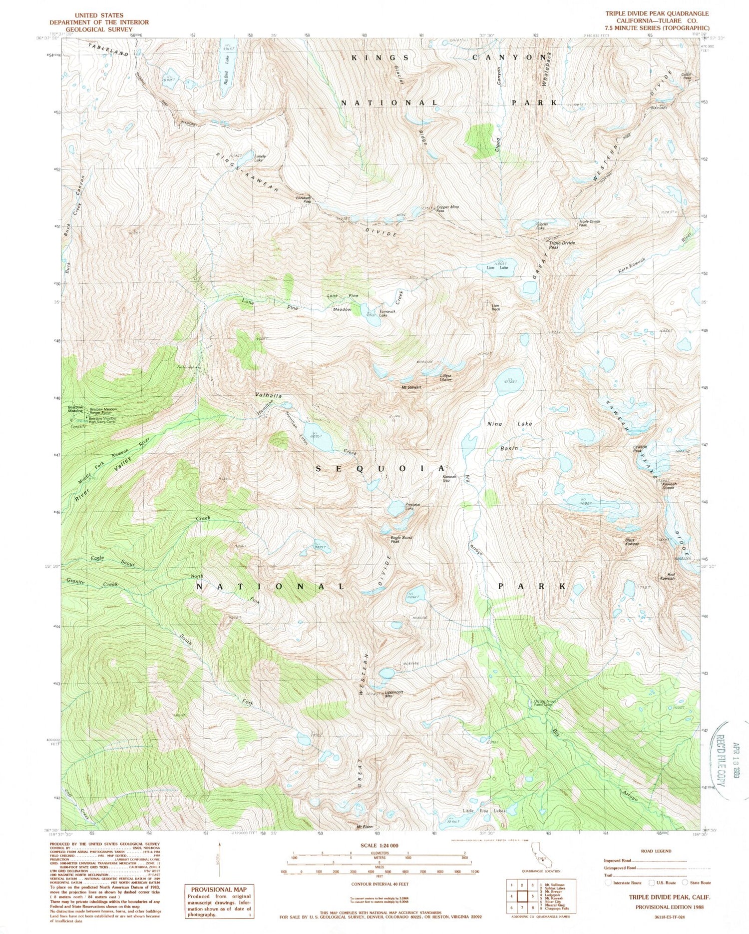
USGS Classic Triple Divide Peak California 7.5'x7.5' Topo Map
Couldn't load pickup availability
Historical USGS topographic quad map of Triple Divide Peak in the state of California. Scale: 1:24000. Print size: 24" x 27"
This quadrangle is in the following counties: Tulare.
The map contains contour lines, roads, rivers, towns, lakes, and grids including latitude / longitude and UTM / MGRS. Printed on high-quality waterproof paper with UV fade-resistant inks.
Contains the following named places: Bearpaw Meadow Ranger Station, Eagle Scout Peak, Glacier Lake, Glacier Ridge, Tamarack Lake, High Sierra Trail, Lonely Lake, Copper Mine Pass, Triple Divide Pass, Lilliput Glacier, Lawson Peak, Hamilton Creek, Hamilton Lakes, Elizabeth Pass, Precipice Lake, Mount Stewart, Bearpaw Meadow, Big Bird Lake, Black Kaweah, Colby Pass, Kaweah Gap, Lion Lake, Lion Rock, Lippincott Mountain, Lone Pine Creek, Lone Pine Meadow, Nine Lake Basin, Triple Divide Peak, Valhalla, Sequoia National Park, Kings-Kaweah Divide, Kaweah Queen, Red Kaweah, Bearpaw Meadow High Sierra Camp, Old Big Arroyo Patrol Cabin