MyTopo
Classic USGS Trona East California 7.5'x7.5' Topo Map
Couldn't load pickup availability
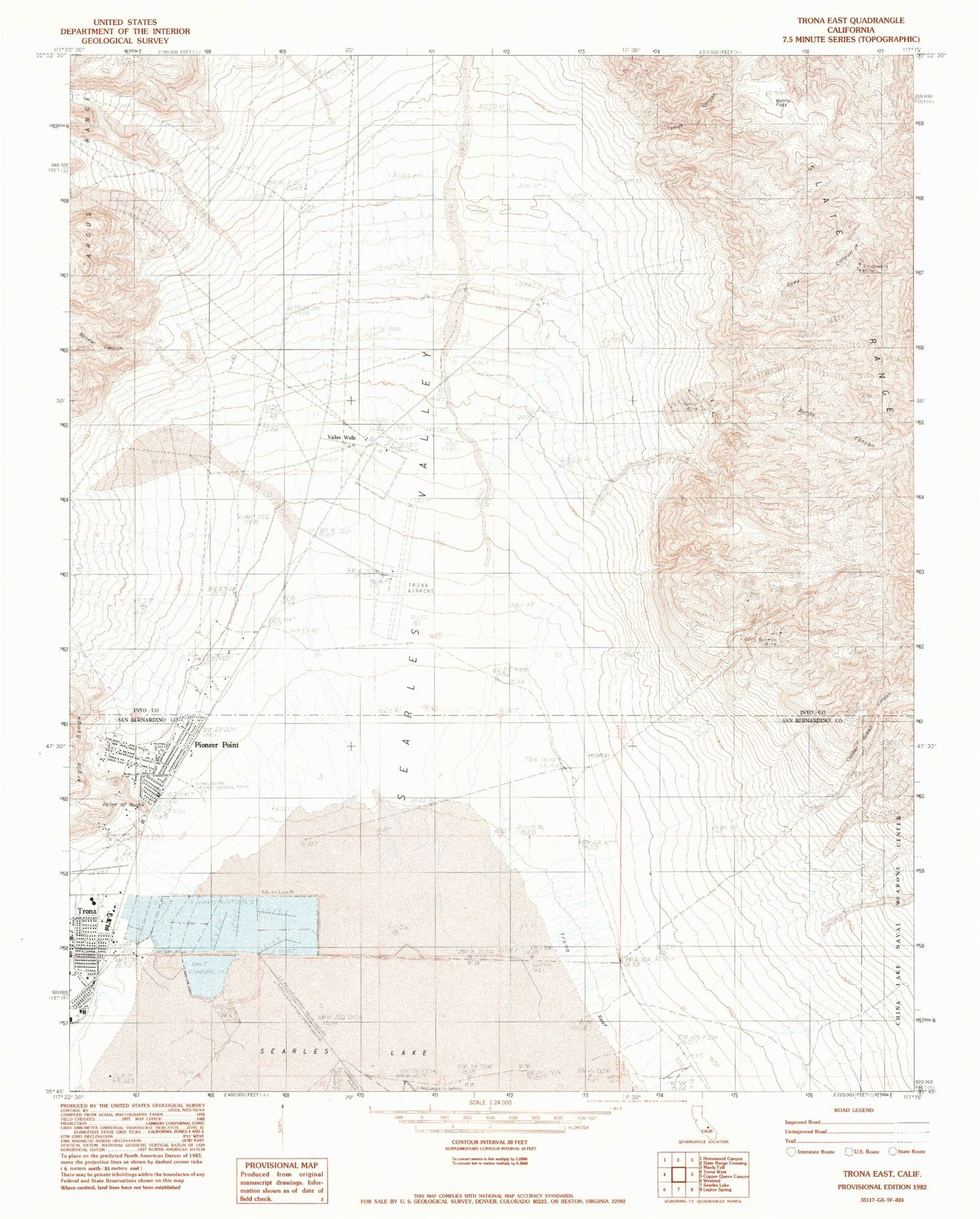
Historical USGS topographic quad map of Trona East in the state of California. Map scale may vary for some years, but is generally around 1:24,000. Print size is approximately 24" x 27"
This quadrangle is in the following counties: Inyo, San Bernardino.
The map contains contour lines, roads, rivers, towns, and lakes. Printed on high-quality waterproof paper with UV fade-resistant inks, and shipped rolled.
Contains the following named places: Bainter Canyon, Borax Flat, Bundy Canyon, Copper Queen Canyon, Goff Canyon, Gold Bottom Mine, Isham Canyon, Manly Pass, Ophir Mine, Pioneer Point, Point of Rocks, Rattlesnake Canyon, San Bernardino County Fire Department Station 57 Trona, Stockwell Mine, The Tanks, Trona, Trona Airport, Trona Census Designated Place, Trona Elementary School, Trona High School, Trona Reef, Valley Wells