MyTopo
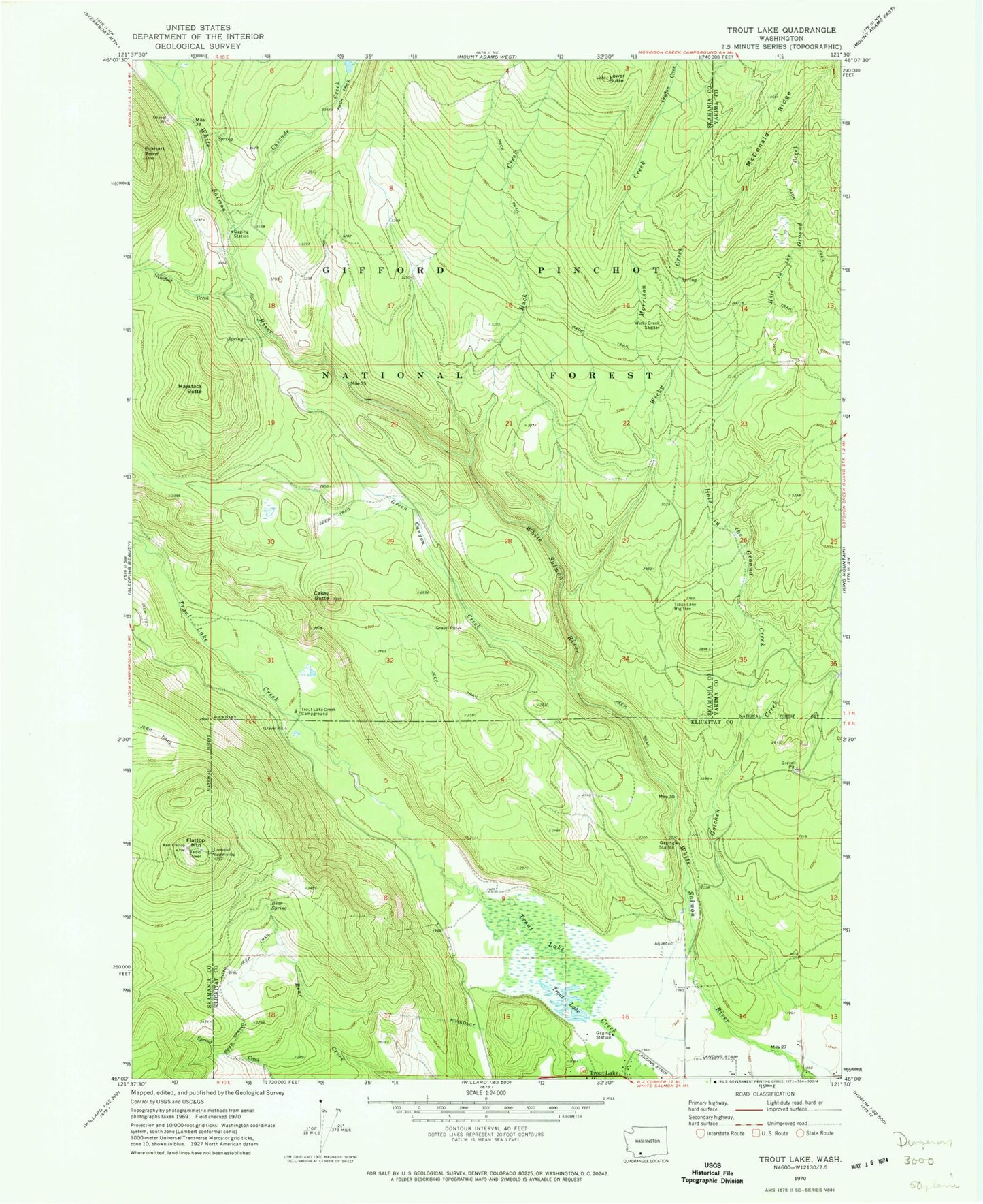
Classic USGS Trout Lake Washington 7.5'x7.5' Topo Map
Couldn't load pickup availability
Historical USGS topographic quad map of Trout Lake in the state of Washington. Typical map scale is 1:24,000, but may vary for certain years, if available. Print size: 24" x 27"
This quadrangle is in the following counties: Klickitat, Skamania, Yakima.
The map contains contour lines, roads, rivers, towns, and lakes. Printed on high-quality waterproof paper with UV fade-resistant inks, and shipped rolled.
Contains the following named places: Bear Spring, Buck Creek, Cakey Butte, Cascade Creek, Crofton Creek, Eckhart Point, Flattop Mountain, Gotchen Creek, Green Canyon Creek, Haystack Butte, Hole in the Ground Creek, Lower Butte, Morrison Creek, Ninefoot Creek, Trout Lake, Trout Lake Big Tree, Trout Lake Creek Campground, Wicky Creek, Wicky Creek Shelter, Morrison Creek Horse Camp, Green Canyon, West Flattop Lookout, East Flattop Lookout, Trout Lake Airport, Mount Adams Forest Camp, Hollenbeck Landing Strip (historical), Klickitat County Fire District 1, White Salmon Wild and Scenic River