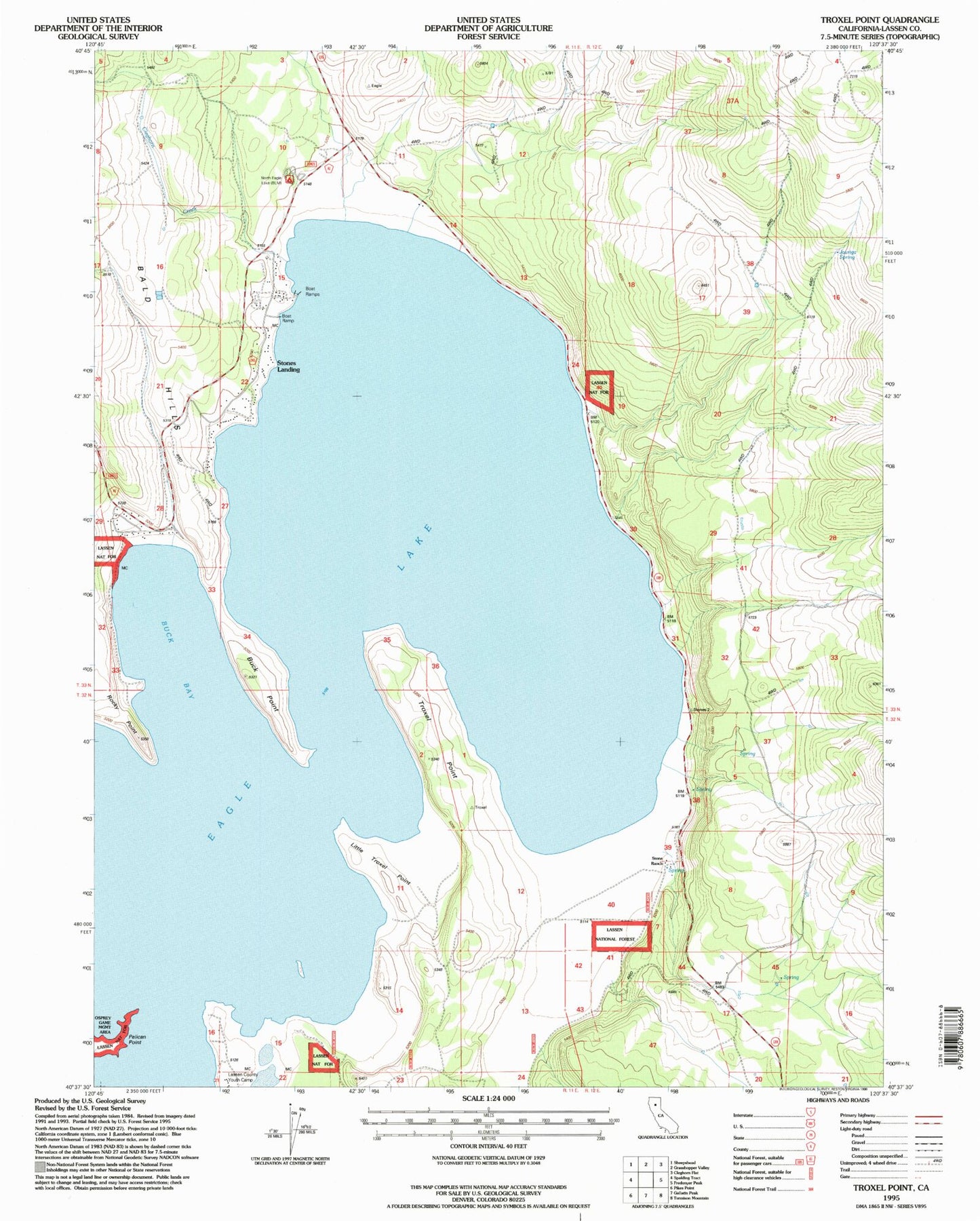
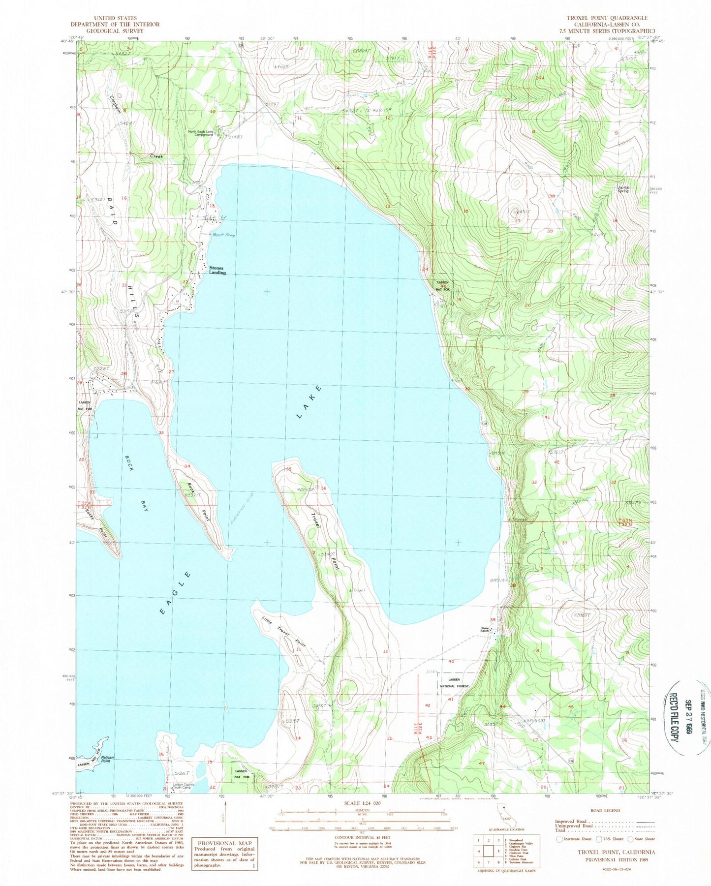
MyTopo
Classic USGS Troxel Point California 7.5'x7.5' Topo Map
Couldn't load pickup availability
Historical USGS topographic quad map of Troxel Point in the state of California. Map scale may vary for some years, but is generally around 1:24,000. Print size is approximately 24" x 27"
This quadrangle is in the following counties: Lassen.
The map contains contour lines, roads, rivers, towns, and lakes. Printed on high-quality waterproof paper with UV fade-resistant inks, and shipped rolled.
Contains the following named places: Buck Bay, Buck Point, Cleghorn Creek, Eagle Lake, Jauriga Spring, Lassen County Youth Camp, Little Troxel Point, North Eagle Lake Campground, Pelican Point, Rocky Point, Stone Ranch, Stones Bengard Community Services District Fire Station, Stones Landing, Stones Landing Census Designated Place, Troxel Point