
MyTopo
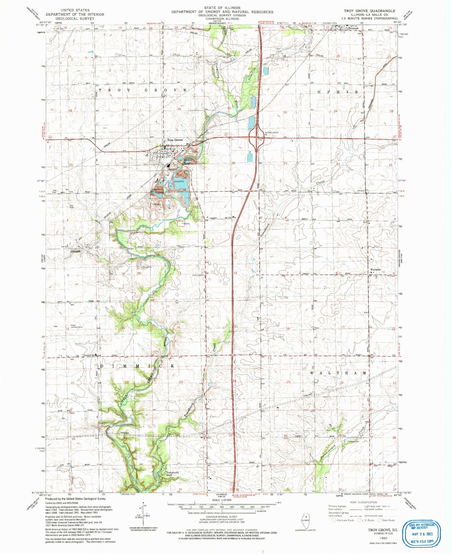
Classic USGS Troy Grove Illinois 7.5'x7.5' Topo Map
Couldn't load pickup availability
Historical USGS topographic quad map of Troy Grove in the state of Illinois. Map scale may vary for some years, but is generally around 1:24,000. Print size is approximately 24" x 27"
This quadrangle is in the following counties: LaSalle.
The map contains contour lines, roads, rivers, towns, and lakes. Printed on high-quality waterproof paper with UV fade-resistant inks, and shipped rolled.
Contains the following named places: Aitkin School, Brush School, Carr School, Culton, Davis Airport, Deener School, Dimmick, Dimmick Cemetery, Dimmick Community Consolidated School, Dimmick Pit, Gammel School, Mendota - Troy Grove Rural Fire Protection District, Mitchel School, Mitchells Grove Nature Preserve, Nellis School, Ophir Community Consolidated School, Tomahawk Bluff, Tomahawk Creek, Township of Dimmick, Township of Troy Grove, Triumph, Triumph Census Designated Place, Triumph Post Office, Troy Grove, Troy Grove Stone Quarry, Vermilion Creek, Village of Troy Grove, Waltham, Waltham School, Whipple School, Wylie School, ZIP Codes: 61301, 61372


