MyTopo
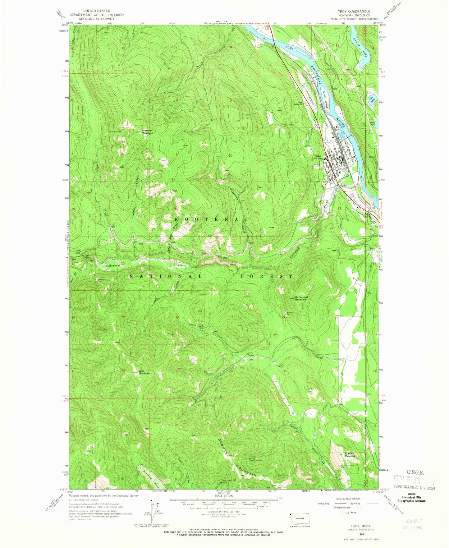
Classic USGS Troy Montana 7.5'x7.5' Topo Map
Couldn't load pickup availability
Historical USGS topographic quad map of Troy in the state of Montana. Map scale may vary for some years, but is generally around 1:24,000. Print size is approximately 24" x 27"
This quadrangle is in the following counties: Lincoln.
The map contains contour lines, roads, rivers, towns, and lakes. Printed on high-quality waterproof paper with UV fade-resistant inks, and shipped rolled.
Contains the following named places: 31N33W18CCAA01 Well, 31N34W01CCCD01 Well, 31N34W13BCAA01 Well, 31N34W36ABDC01 Well, 32N34W35DCCD01 Well, Alvord Lake, Assembly of God Church, Big Eight Mine, Black Bear Creek, Callahan Creek, City of Troy, Copper Mountain, Crescent Mine, Crescent Tunnel, Faith Christian Church, First Christian Church of Troy, Giant Sunrise Mine, Goat Creek, Goat Mountain, Goat Mountain Trail, Gordon Creek, Grouse Mountain, Grouse Mountain Mine, Grouse Mountain Number 3 Mine, Grouse Mountain Number 4 Mine, Grouse Mountain Number 6 Mine, Grouse Mountain Number 7 Mine, Hale Creek, Hale Creek Mine, Immaculate Conception Mission, July Creek, Kootenai River Campground, Lake Creek, Lake Creek Dam, La-Vi RV Park, Liberty Mine, Lower Hale Mine, McConnell Mountain, Medicine Tree Primary Care, Montana Morning Mine, Montana Premier Mine, Moose Lake, Preacher Mountain, Scott Island, Silver Grouse Mine, Slee Lake, Snowstorm Mine, The Church of Jesus Christ of Latter Day Saints, Three Lakes Community Bible Church, Threemile Creek, Troy, Troy Airport, Troy Branch Library, Troy Bridge, Troy Cemetery, Troy City Park, Troy Community Baptist Church, Troy High School, Troy Museum and Visitor Center, Troy Police Department, Troy Post Office, Troy Ranger Station, Troy United Methodist Church, Troy Volunteer Ambulance Service, Troy Volunteer Fire Department, W F Morrison Elementary School


