MyTopo
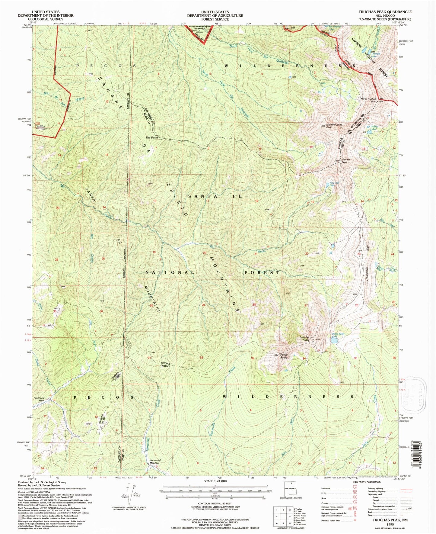
USGS Classic Truchas Peak New Mexico 7.5'x7.5' Topo Map
Couldn't load pickup availability
Historical USGS topographic quad map of Truchas Peak in the state of New Mexico. Scale: 1:24000. Print size: 24" x 27"
This quadrangle is in the following counties: Mora, Rio Arriba, Santa Fe.
The map contains contour lines, roads, rivers, towns, lakes, and grids including latitude / longitude and UTM / MGRS. Printed on high-quality waterproof paper with UV fade-resistant inks.
Contains the following named places: Rio Quemado Falls, Brazos Cabin, Jose Vigil Lake, Middle Truchas Peak, North Truchas Peak, Panchuela West Cabin, Pecos Baldy, Rio Medio Trail, Rito Canejo, Rito Jaroso, The Dome, Trailriders Wall, Trampas Lakes, Truchas Lakes, Horsethief Meadow, Truchas Peak, Pecos Wilderness, East Pecos Baldy, Pecos Baldy Lake