MyTopo
Classic USGS Truckee California 7.5'x7.5' Topo Map
Couldn't load pickup availability
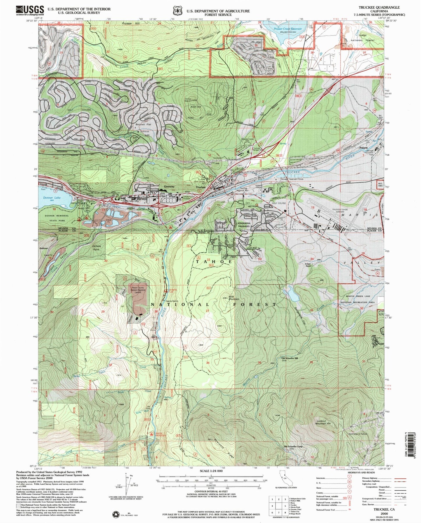
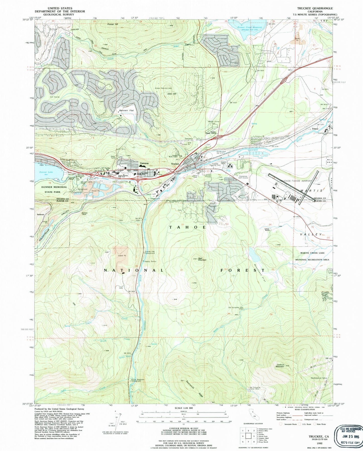
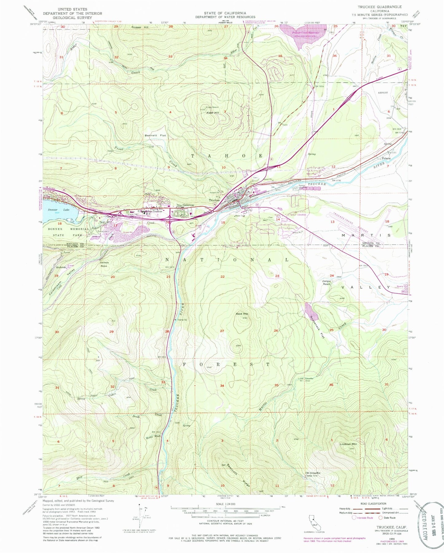
Historical USGS topographic quad map of Truckee in the state of California. Typical map scale is 1:24,000, but may vary for certain years, if available. Print size: 24" x 27"
This quadrangle is in the following counties: Nevada, Placer.
The map contains contour lines, roads, rivers, towns, and lakes. Printed on high-quality waterproof paper with UV fade-resistant inks, and shipped rolled.
Contains the following named places: Alder Hill, Bald Mountain, Bennett Flat, Brush Creek, Cabin Creek, Cold Creek, Coldstream Valley, Deep Creek, Donner Creek, Donner Memorial State Park, Donner Monument, Gooseneck Flat, Graves Cabin, Joerger Ranch, Lookout Mountain, Murphy Cabin, Old Schaeffer Camp, Rocky Wash, Old Schaeffer Mill, Station Creek, Tahoe - Truckee High School, Trout Creek, Truckee Ranger Station, Granite Flat Campground, Ponderosa Palisades, Goose Meadows Campground, Truckee-Tahoe Airport, Tahoe Forest Hospital Heliport, Truckee Work Center, Andover, Gateway, Jackass Point, Polaris, Donner Lake 301 Dam, KHTZ-AM (Truckee), Truckee, Armstrong, Breen Cabin (historical), China Cove Trail, Creek Campground, Donner Pines Tract, Emigrant Trail Museum, Jim McIvers Memorial Arena, Meadow Lake Park, Olympic Heights, Ponderosa Fairway Estates, Ponderosa Golf Course, Prosser Lake Heights, Prosser Lakeview Estates, Ridge Campground, Splitrock Campground, Truckee Branch Nevada County Public Library, Truckee Cemetery, Truckee Elementary School, Truckee Post Office, Truckee River Regional Park, Ponderosa Palisades, Prosser (historical), Town of Truckee, Truckee Fire Protection District Station 94 Tahoe Donner, Truckee Fire Protection District Station 92 Gateway, Truckee Fire Protection District Station 91 Downtown, Truckee Fire Protection District Station 96, Tahoe Forest Hospital, Cold Stream Pit, Nevada County Sheriff's Office, Truckee Police Department, California Highway Patrol Valley Division - Truckee, Donner Post Office, Sawtooth Ridge, Sawtooth Ridge, Alder Hill, Bald Mountain, Bennett Flat, Brush Creek, Cabin Creek, Cold Creek, Coldstream Valley, Deep Creek, Donner Creek, Donner Memorial State Park, Donner Monument, Gooseneck Flat, Graves Cabin, Joerger Ranch, Lookout Mountain, Murphy Cabin, Old Schaeffer Camp, Rocky Wash, Old Schaeffer Mill, Station Creek, Tahoe - Truckee High School, Trout Creek, Truckee Ranger Station, Granite Flat Campground, Ponderosa Palisades, Goose Meadows Campground, Truckee-Tahoe Airport, Tahoe Forest Hospital Heliport, Truckee Work Center, Andover, Gateway, Jackass Point, Polaris, Donner Lake 301 Dam, KHTZ-AM (Truckee), Truckee, Armstrong, Breen Cabin (historical), China Cove Trail, Creek Campground, Donner Pines Tract, Emigrant Trail Museum, Jim McIvers Memorial Arena, Meadow Lake Park, Olympic Heights, Ponderosa Fairway Estates, Ponderosa Golf Course, Prosser Lake Heights, Prosser Lakeview Estates, Ridge Campground, Splitrock Campground, Truckee Branch Nevada County Public Library, Truckee Cemetery, Truckee Elementary School, Truckee Post Office, Truckee River Regional Park, Ponderosa Palisades, Prosser (historical), Town of Truckee, Truckee Fire Protection District Station 94 Tahoe Donner, Truckee Fire Protection District Station 92 Gateway, Truckee Fire Protection District Station 91 Downtown, Truckee Fire Protection District Station 96, Tahoe Forest Hospital, Cold Stream Pit, Nevada County Sheriff's Office, Truckee Police Department, California Highway Patrol Valley Division - Truckee, Donner Post Office, Sawtooth Ridge, Sawtooth Ridge