MyTopo
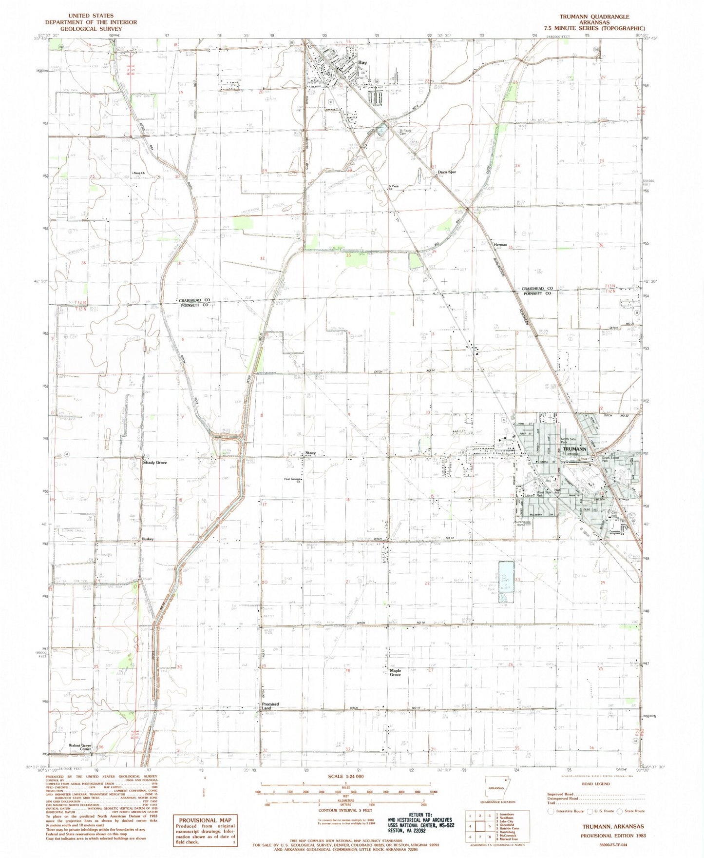
Classic USGS Trumann Arkansas 7.5'x7.5' Topo Map
Couldn't load pickup availability
Historical USGS topographic quad map of Trumann in the state of Arkansas. Map scale may vary for some years, but is generally around 1:24,000. Print size is approximately 24" x 27"
This quadrangle is in the following counties: Craighead, Poinsett.
The map contains contour lines, roads, rivers, towns, and lakes. Printed on high-quality waterproof paper with UV fade-resistant inks, and shipped rolled.
Contains the following named places: Alsup Church, Alsup School, Bay, Bay Elementary School, Bay Fire Department Station 1, Bay Fire Department Station 2, Bay High School, Bay Police Department, Bay Post Office, Bay-Brown High School, Byrns School, Campbell Civic Center, Carr, City of Bay, City of Trumann, Davis Spur, Davis Spur School, Ditch Number 12, Ditch Number 13, Ditch Number 14, Ditch Number 15, Ditch Number 16, Ditch Number 17, Ditch Number 30, Ditch Number 5, Ditch Number 6, Ditch Number 9, Dobell, First General Church, First United Methodist Church, First United Pentecostal Church, Good Luck School, Herman, Herman School, Hurds Chapel, Huskey, KXRQ-AM (Trumann), Longs Chapel, Maple Grove, Maple Grove Baptist Church, Maple Grove School, Medic One Ambulance Service, Melody Nursing Home, Merced, North Mart Shopping Center, North Side Park, Oak Grove School, Ozark Street Park, Promised Land, Promised Land School, Ruffin, Safford Spur, Saint Pauls Cemetery, Saint Pauls Church, Shady Grove, Shady Grove School, Stacy, Township of Maumelle, Township of Willis, Trumann, Trumann City Hall, Trumann Elementary School, Trumann Fire Station, Trumann High School, Trumann Police Department, Trumann Post Office, Viva Drive Church of Christ, Walnut Grove Church, Walnut Grove Corner, West Side Park, Whiteman Creek, ZIP Code: 72411