MyTopo
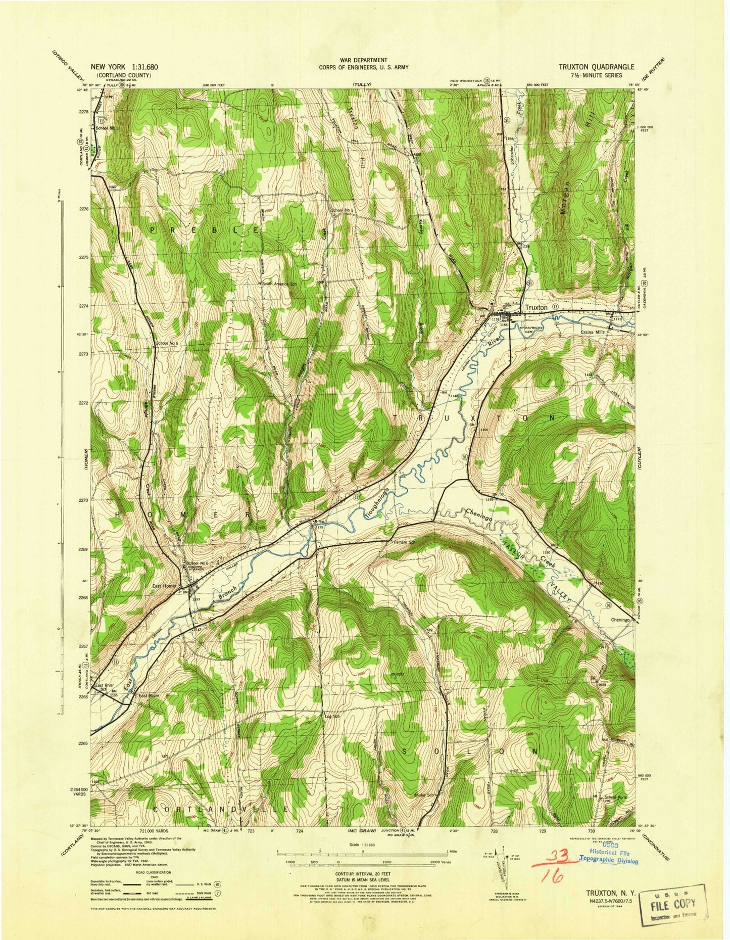
Classic USGS Truxton New York 7.5'x7.5' Topo Map
Couldn't load pickup availability
Historical USGS topographic quad map of Truxton in the state of New York. Map scale may vary for some years, but is generally around 1:24,000. Print size is approximately 24" x 27"
This quadrangle is in the following counties: Cortland.
The map contains contour lines, roads, rivers, towns, and lakes. Printed on high-quality waterproof paper with UV fade-resistant inks, and shipped rolled.
Contains the following named places: Albright Creek, Cheningo Creek, Cortland County Landfill, Crains Mills, East Branch Tioughnioga River Bridge, East Homer, East Homer Cemetery, East Homer School, East River, East River School, Haights Creek, Hartnett Elementary School, Heritage Farms, Hilltop Divine Dairy, Kenney Brook, Labrador Creek, Log School, Morgan Hill Creek, Old Presbyterian Church Cemetery, Pelham School, Saint Patricks Cemetery, Saint Patricks Church, School Number 3, School Number 5, School Number 8, Shuler School, South America School, Spring Valley Dairy Farm, Spruce Eden Farms, Town of Truxton, Trout Brook, Truxton, Truxton Fire Department, Truxton Methodist Church, Truxton Post Office, Truxton Rural Cemetery, Walter's Field, Weeks Brook