MyTopo
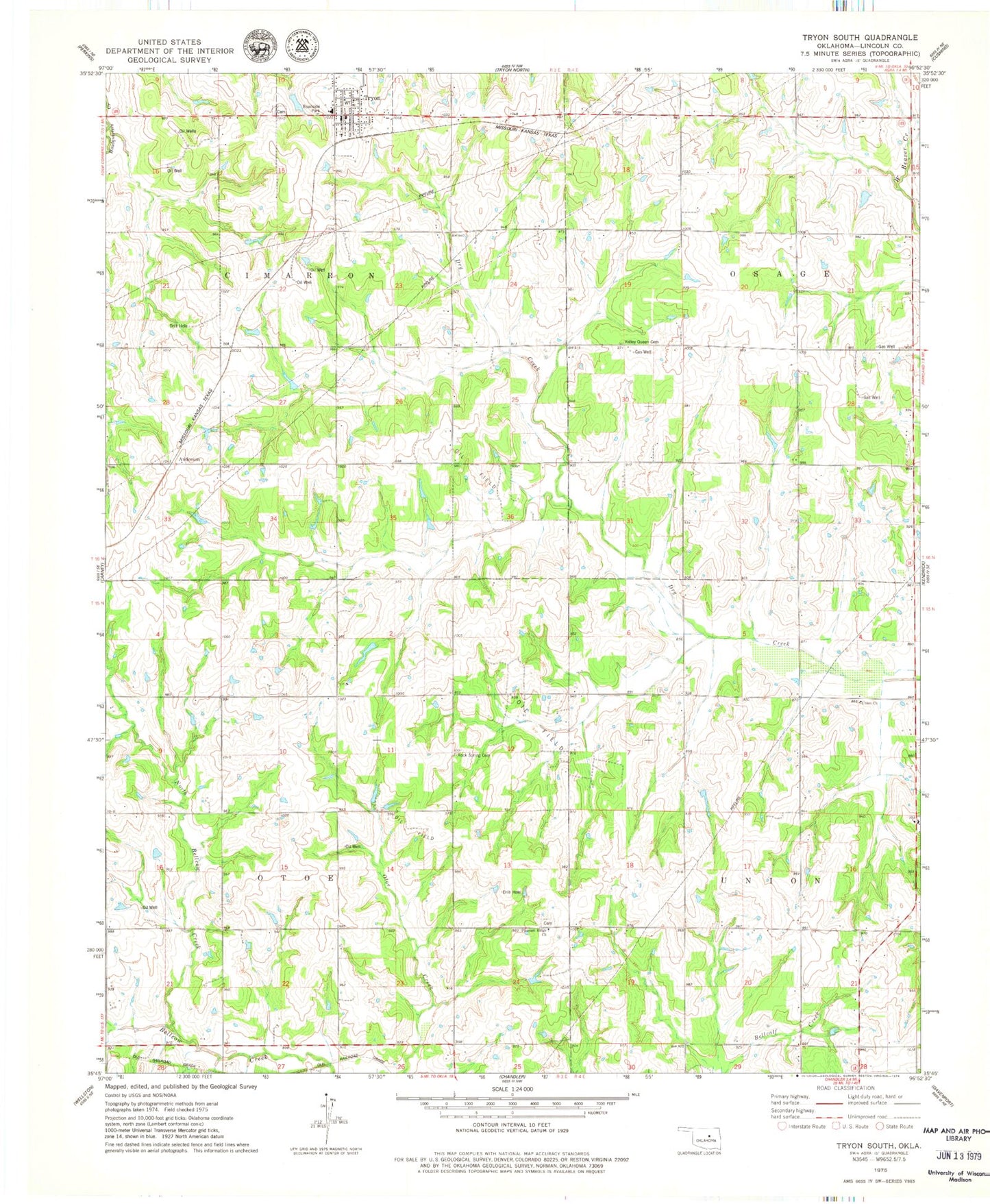
Classic USGS Tryon South Oklahoma 7.5'x7.5' Topo Map
Couldn't load pickup availability
Historical USGS topographic quad map of Tryon South in the state of Oklahoma. Map scale may vary for some years, but is generally around 1:24,000. Print size is approximately 24" x 27"
This quadrangle is in the following counties: Lincoln.
The map contains contour lines, roads, rivers, towns, and lakes. Printed on high-quality waterproof paper with UV fade-resistant inks, and shipped rolled.
Contains the following named places: Anderson, Iowa-Sac and Fox Tribal Jurisdiction Statistical Area, Melton Airport, North Bellcow Creek, Northwest Lincoln Division, Oknoname 037034 Dam, Oknoname 037034 Reservoir, Oknoname 08116 Dam, Oknoname 08116 Reservoir, Pleasant Ridge Cemetery, Pleasant Ridge Church, Rock Spring Cemetery, Township of Otoe, Township of Union, Tryon, Tryon Cemetery, Tryon Elementary School, Tryon Police Department, Tryon Post Office, Tryon Volunteer Fire Department, Union Church, Valley Queen Cemetery