MyTopo
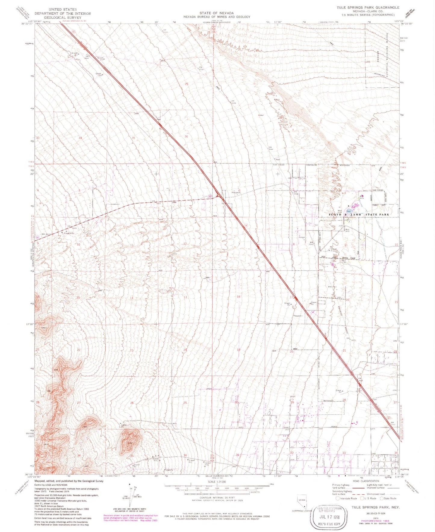
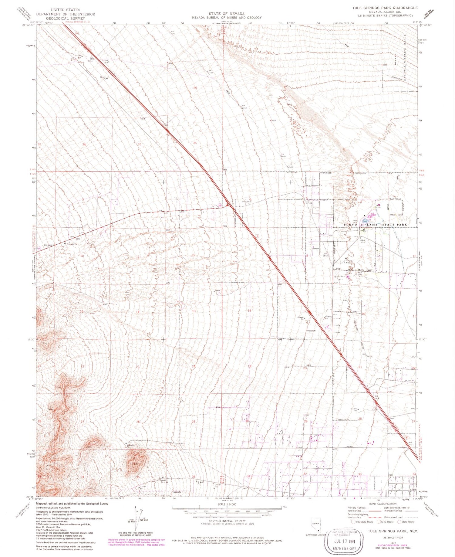
Classic USGS Tule Springs Lake Nevada 7.5'x7.5' Topo Map
Couldn't load pickup availability
Historical USGS topographic quad map of Tule Springs Lake in the state of Nevada. Map scale may vary for some years, but is generally around 1:24,000. Print size is approximately 24" x 27"
This quadrangle is in the following counties: Clark.
The map contains contour lines, roads, rivers, towns, and lakes. Printed on high-quality waterproof paper with UV fade-resistant inks, and shipped rolled.
Contains the following named places: Arbor View High School, Betsy Rhodes Elementary School, Bright Angel Church of Christ, Centennial Academy, Centennial Centre Shopping Center, Centennial High School, Centennial Hills Hospital Medical Center, Cimarron Rose Park, Cottonwood Lake, Dean Lamar Allen Elementary School, Desert Willow Lake, Floyd R Lamb State Park, James Bilbray Elementary School, KRBO-FM (Las Vegas), Las Vegas Fire and Rescue Station 41, Las Vegas Gun Club, Las Vegas Indian Colony, Marshall C Darnell Elementary School, Mountain View Baptist Church, Mulberry Lake, Peterson Behaviour Junior / Senior High School, Ralph Cadwallader Middle School, Stillwell Spring, Tule Spring, Tule Springs, Tule Springs Lake, Tule Springs Ranch, William and Mary Scherkenbach Elementary School, ZIP Codes: 89143, 89149