MyTopo
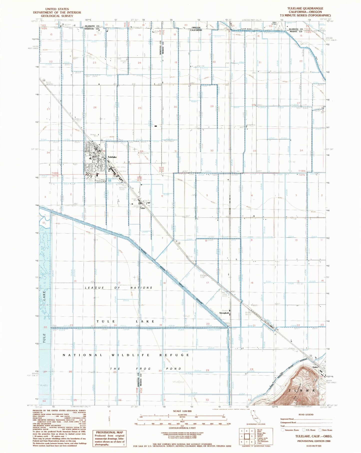
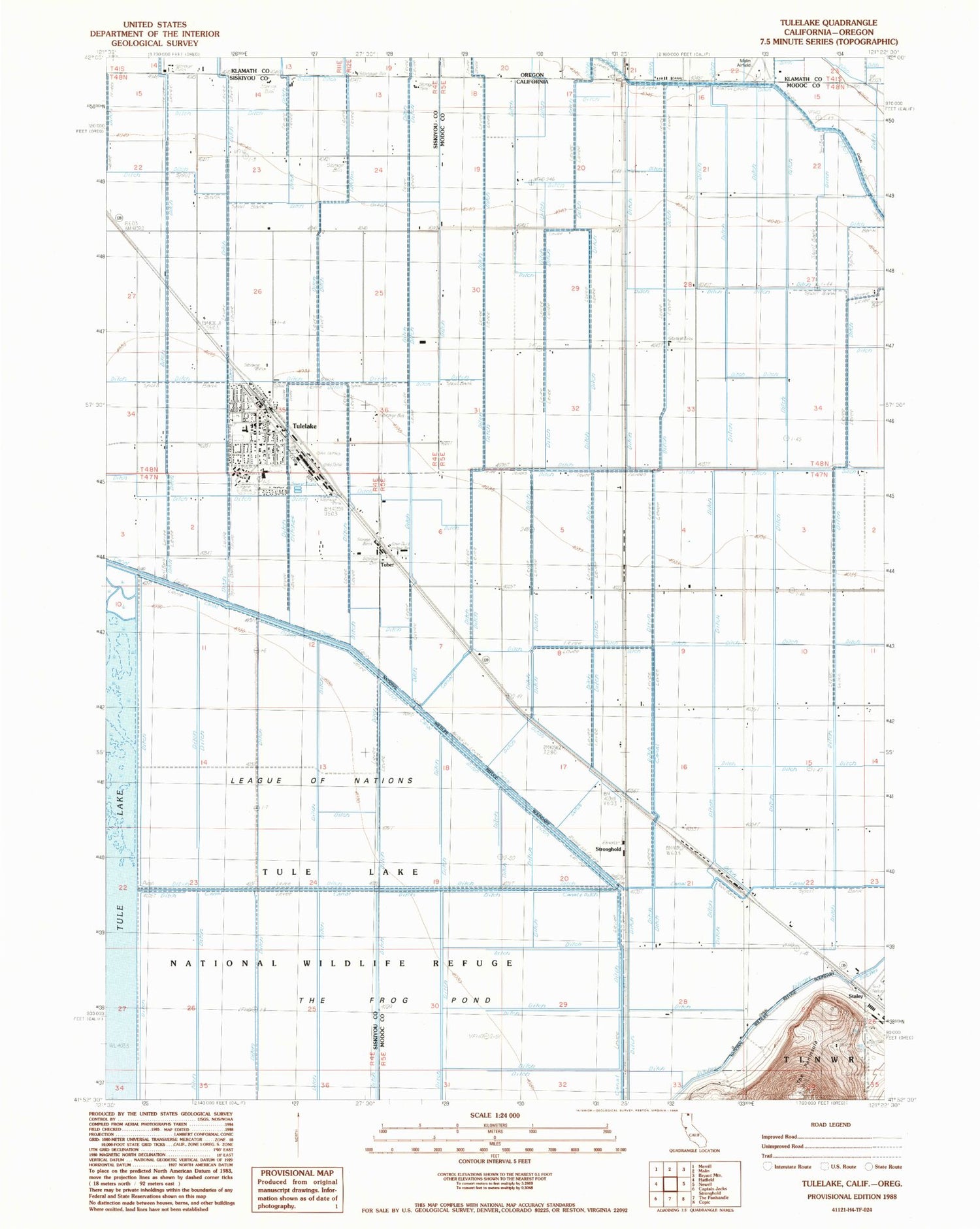
Classic USGS Tulelake California 7.5'x7.5' Topo Map
Couldn't load pickup availability
Historical USGS topographic quad map of Tulelake in the states of California, Oregon. Map scale may vary for some years, but is generally around 1:24,000. Print size is approximately 24" x 27"
This quadrangle is in the following counties: Klamath, Modoc, Siskiyou.
The map contains contour lines, roads, rivers, towns, and lakes. Printed on high-quality waterproof paper with UV fade-resistant inks, and shipped rolled.
Contains the following named places: Butte Valley Fairgrounds, Carr School, City of Tulelake, Community Presbyterian Church, Dalton, First Baptist Church of Tulelake, Holy Cross Church, Homestead, Kalina, Malin Airport, Otis Roper Park, Staley, Stronghold, The Frog Pond, The Peninsula, Trinity Lutheran Church, Tuber, Tule Lake National Wildlife Refuge, Tulelake, Tulelake Branch Siskiyou County Public Library, Tulelake Christian Fellowship Church, Tulelake City Hall, Tulelake High School, Tulelake Middle School, Tulelake Police Department, Tulelake Post Office, Tulelake Volunteer Fire Department, WWII Valor In The Pacific National Monument - Tule Lake Unit