MyTopo
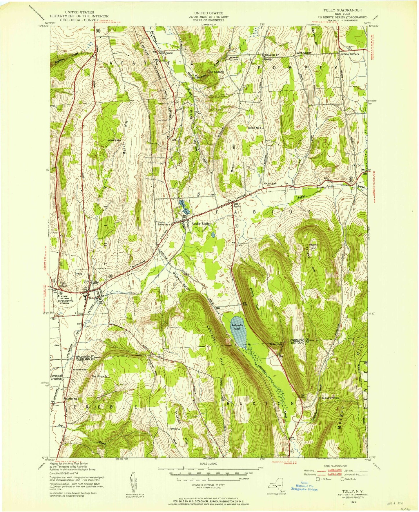
Classic USGS Tully New York 7.5'x7.5' Topo Map
Couldn't load pickup availability
Historical USGS topographic quad map of Tully in the state of New York. Typical map scale is 1:24,000, but may vary for certain years, if available. Print size: 24" x 27"
This quadrangle is in the following counties: Cortland, Onondaga.
The map contains contour lines, roads, rivers, towns, and lakes. Printed on high-quality waterproof paper with UV fade-resistant inks, and shipped rolled.
Contains the following named places: Apulia, Apulia Cemetery, Apulia Station, Maplewood Rural Cemetery, Chase Hill, Collingwood, Fellows Hill, Jerome Corners, Jones Hill, Labrador Hill, Labrador Pond, Matson Hill, Meeker Cemetery, Meeker Hill, Saint Leo's Cemetery, State Reforestation Area, The Cascades, The Pinnacle, Tinker Falls, Tully, Tully Center, State Reforestation Area, Truxton Hill, Tully Forest, Berwyn, Cummings Crossing, Swift Corner, Cascades Creek, Clark Hollow, Markham Hollow, Shackham Brook, Thermal Ridge Gliderport, School Number 12 (historical), Stump Pond (historical), School Number 2 (historical), School Number 4 (historical), School Number 17 (historical), Village of Tully, Woodford Airfield, Tully Mobile Home Park, Tully Cemetery, Old Tully Cemetery, Sherman Hollow Cemetery, Miles Cemetery, Palladino Pit, Hill - N - Dale Country Club, Apulia United Methodist Church, Tully United Community Church, Saint Leo's Catholic Church, Tully Free Library, Tully Elementary School, Tully Junior - Senior High School, Tully Fire Department, Apulia Fire Department, Apulia Station Post Office, Tully Post Office