MyTopo
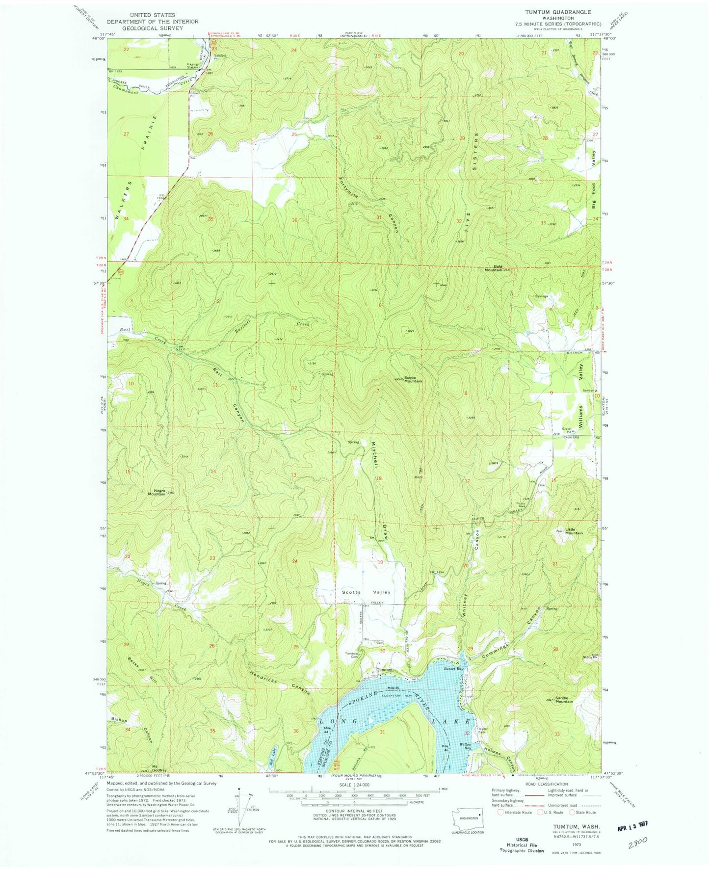
Classic USGS Tumtum Washington 7.5'x7.5' Topo Map
Couldn't load pickup availability
Historical USGS topographic quad map of Tumtum in the state of Washington. Typical map scale is 1:24,000, but may vary for certain years, if available. Print size: 24" x 27"
This quadrangle is in the following counties: Spokane, Stevens.
The map contains contour lines, roads, rivers, towns, and lakes. Printed on high-quality waterproof paper with UV fade-resistant inks, and shipped rolled.
Contains the following named places: Bald Mountain, Becks Hill, Cummings Canyon, Five Sisters, Fortymile Canyon, Hendricks Canyon, Holmes Canyon, Little Mountain, Mitchell Draw, McMillan Mountain, Rail Canyon, Red Lake, Saddle Mountain, Scoop Mountain, Scotts Valley, Stony Peak, Sunset Bay, Scotts Valley Cemetery, Whitney Canyon, Bartlett Creek, Willow Bay, Tumtum, Loon Lake Division, Old Scotts Valley Cemetery