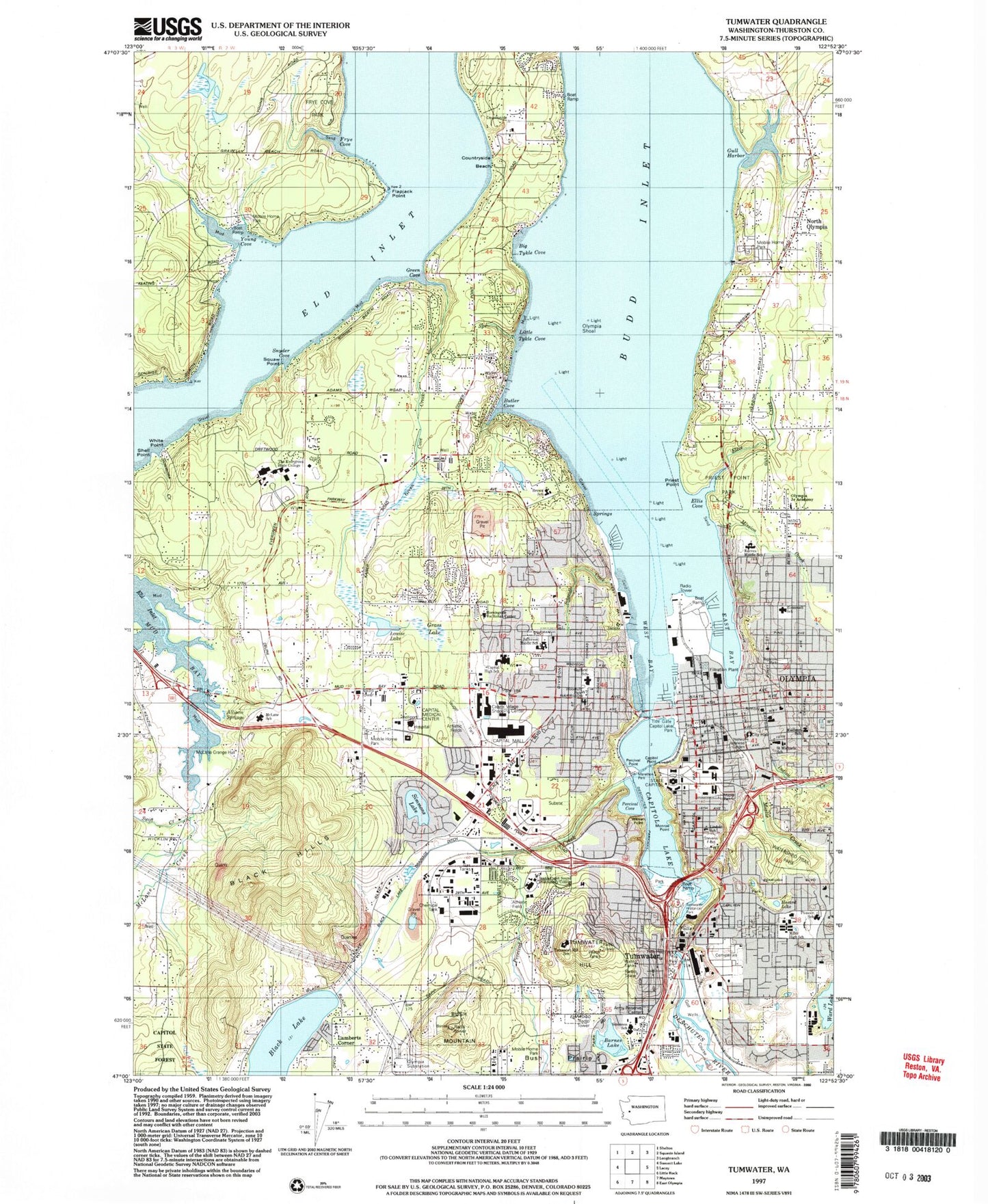
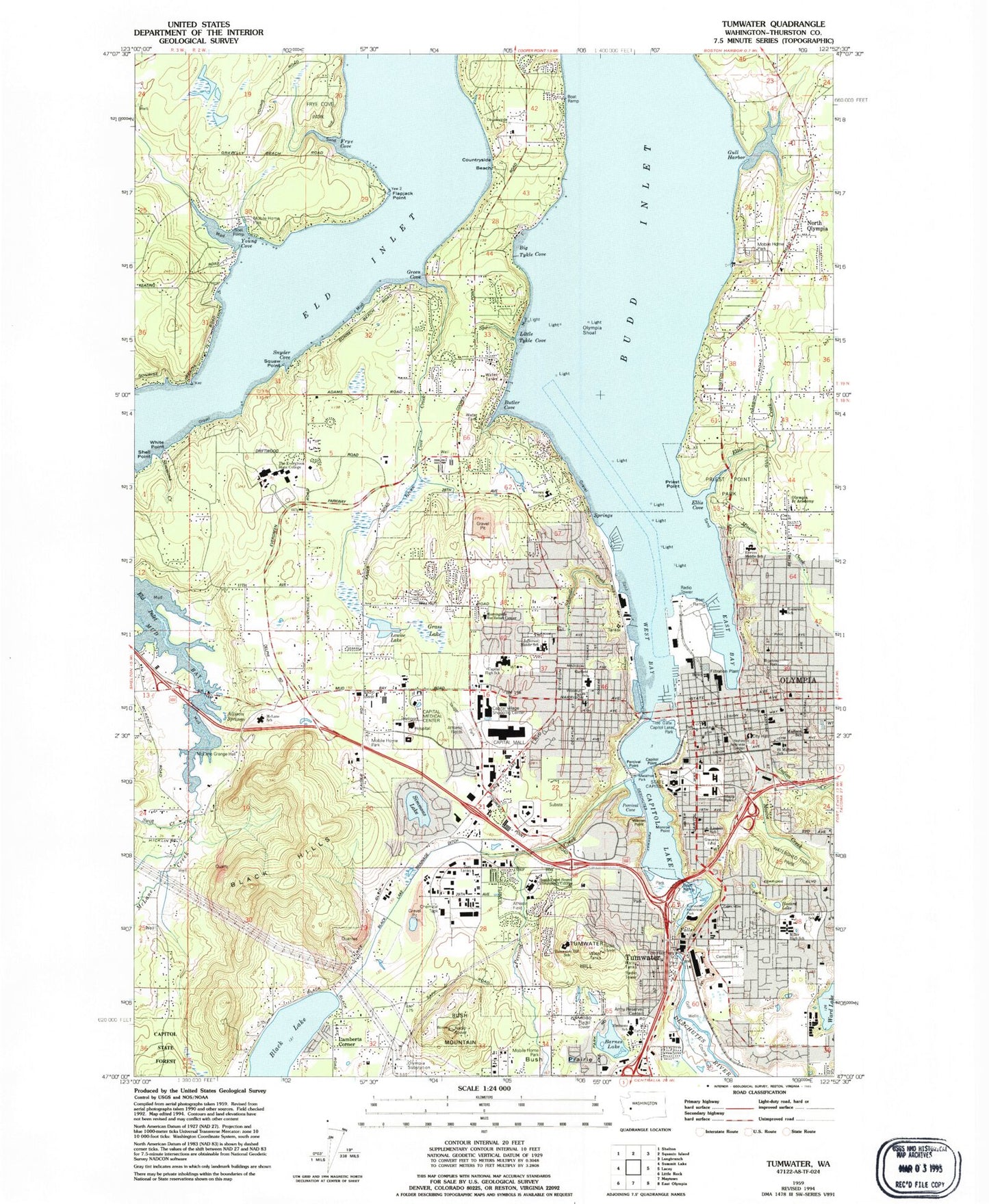
MyTopo
Classic USGS Tumwater Washington 7.5'x7.5' Topo Map
Couldn't load pickup availability
Historical USGS topographic quad map of Tumwater in the state of Washington. Typical map scale is 1:24,000, but may vary for certain years, if available. Print size: 24" x 27"
This quadrangle is in the following counties: Thurston.
The map contains contour lines, roads, rivers, towns, and lakes. Printed on high-quality waterproof paper with UV fade-resistant inks, and shipped rolled.
Contains the following named places: Barnes Lake, Budd Inlet, Butler Cove, Countryside Beach, Ellis Cove, Ellis Creek, Flapjack Point, Frye Cove, Green Cove, Gull Harbor, Indian Creek, Little Tykel Cove, Moxlie Creek, Olympia Christian School, Olympia Shoal, Percival Creek, Priest Point, Priest Point Park, Saint Michael School, Shell Point, Simmons Creek, Snyder Cove, Bushoowah-ahlee Point, Ward Lake, Avanti High School, White Point, Young Cove, Big Tykel Cove, East Bay, Capitol Point, Warren Point, Percival Point, Capitol, Schneider Creek, Lamberts Corner, McLane Creek, Hazard Lake, North Olympia, Tumwater, Percival Cove, Silver Spit, Sunrise Beach, Sunset Beach, Washington State Capitol, Gravelly Beach, Capitol Village Shopping Center, Capitol Mall, Simmons Lake, Eld Inlet, Westside Shopping Center, Yardbird Shopping Center, Capitol Lake, Marshville (historical), Evergreen Christian School, Olympia High School, Reeves Middle School, L P Brown Elementary School, Thurston County Off Campus School, Capital High School, Pioneer Elementary School, Deschutes River, Garfield Elementary School, Jefferson Middle School, Lincoln Elementary School, Madison Elementary School, McLane Elementary School, Roosevelt Elementary School, The Evergreen State College, Washington State Capitol Museum, Old Capitol, Hotel Olympian, Percivals Landing, Capitol Lake Park, Grass Lake Dam, Grass Lake, Kaufman Dam, Kaufman Pond, Deschutes Dam, Tumwater Falls Dam, Olympia Substation, Olympia, West Bay, Westwater Inn Heliport, Black Hills Community Hospital Heliport, Entrance Channel, Outer Channel, KGY-AM (Olympia), KVSN-AM (Tumwater), KAOS-FM (Olympia), City of Olympia, Kingdom Hall of Jehovahs Witnesses, McLane / Black Lake Fire Department Station 96, Olympia Fire Department Station 1 Headquarters, Olympia Fire Department Station 2, Capital Medical Center, South Bay Fire Department Station 7 - 1, McLane / Black Lake Fire Department Station 92, McLane / Black Lake Fire Department Station 91 Headquarters, McLane / Black Lake Fire Department Station 94, Tumwater Fire Department North End, American Medical Response, Thurston County Fire District 13 Griffin Fire Department Station 13 - 3, Thurston County Sheriff's Office, Olympia Main Police Station, Olympia Post Office, Westside Olympia Post Office, Howard Point