
MyTopo
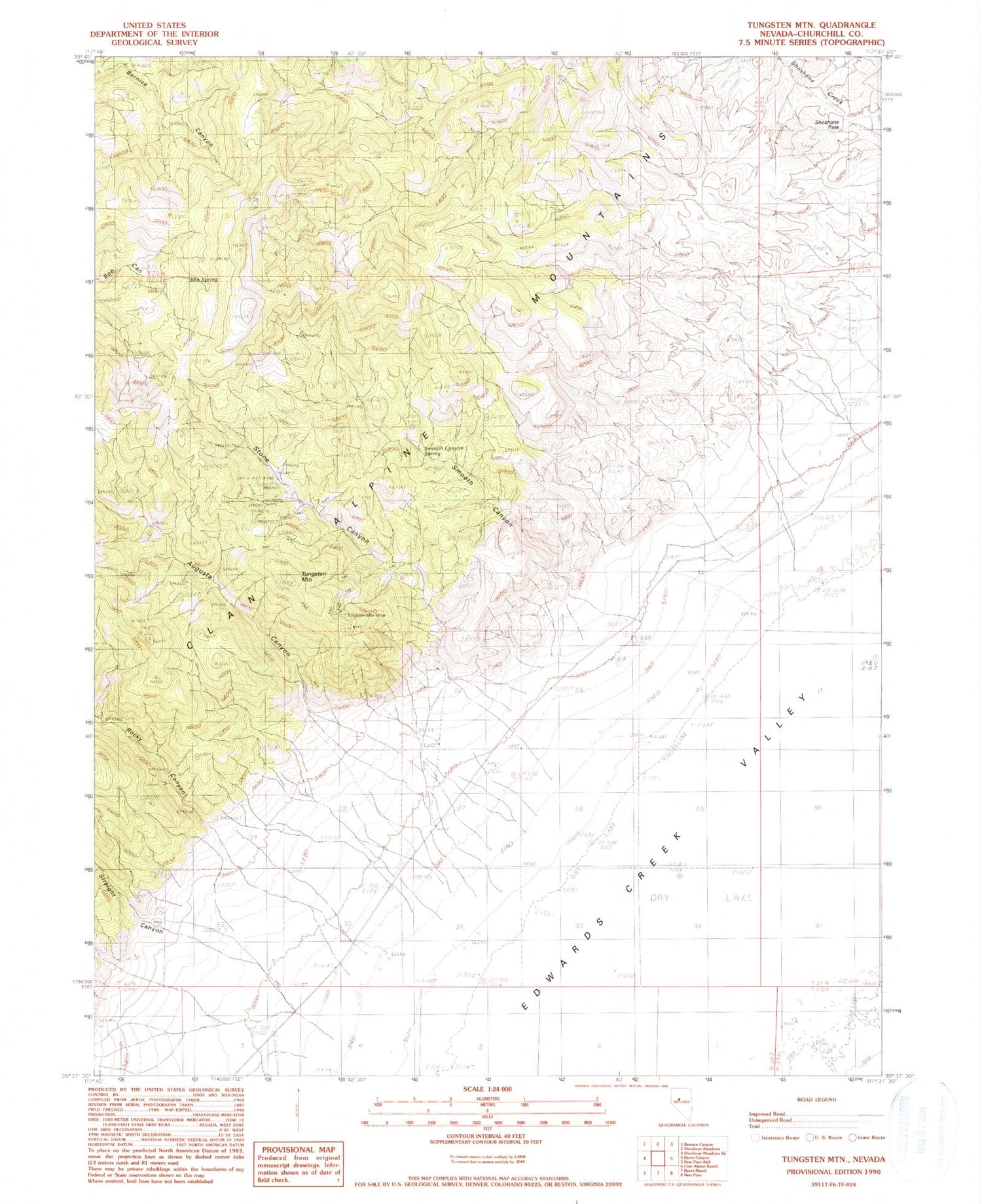
Classic USGS Tungsten Mountain Nevada 7.5'x7.5' Topo Map
Couldn't load pickup availability
Historical USGS topographic quad map of Tungsten Mountain in the state of Nevada. Map scale may vary for some years, but is generally around 1:24,000. Print size is approximately 24" x 27"
This quadrangle is in the following counties: Churchill.
The map contains contour lines, roads, rivers, towns, and lakes. Printed on high-quality waterproof paper with UV fade-resistant inks, and shipped rolled.
Contains the following named places: Augusta Canyon, Augusta Mining District, Bob Spring, Eagle Springs, Nevada Gold Group Mine, Rocky Canyon, Rocky Creek, Scotts Camp, Shoshone Pass, Smooth Canyon, Smooth Canyon Spring, Stone Canyon, Straight Canyon, Tungsten Mountain, Tungsten Mountain Mine, Tungsten Mountain Mining District, Willow Canon Creek


