MyTopo
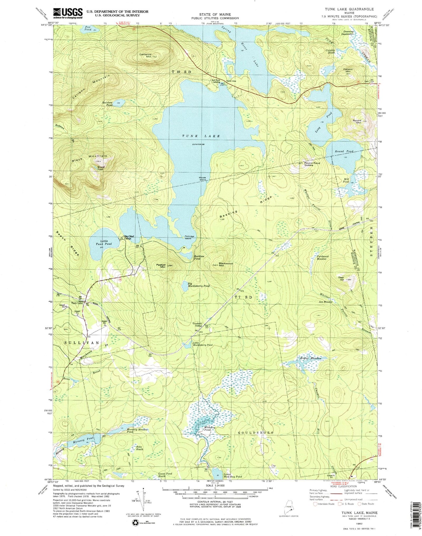
Classic USGS Tunk Lake Maine 7.5'x7.5' Topo Map
Couldn't load pickup availability
Historical USGS topographic quad map of Tunk Lake in the state of Maine. Typical map scale is 1:24,000, but may vary for certain years, if available. Print size: 24" x 27"
This quadrangle is in the following counties: Hancock, Washington.
The map contains contour lines, roads, rivers, towns, and lakes. Printed on high-quality waterproof paper with UV fade-resistant inks, and shipped rolled.
Contains the following named places: Barbless Pond, Basking Ridge, Big Chief Camps, Black Mountain, Blackwood Mountain, Bogus Meadow, Caribou Mountain, Catherine Mountain, Deer Hill, Fox Pond, Goose Pond Heath, Big Muckleberry Pond, Little Tunk Pond, Long Pond, Morancy Pond, Mouse Island, Partridge Island, Peaked Mountain, Rainbow Pond, Round Mountain, Round Pond, Round Pond Nubble, Spring River Lake, Tunk Lake, Tunk Lake, Upper Pond, West Bay Pond, Wizard Pond, Goodwin Siding, Beech Ridge, Downing Deadwater, Muckleberry Pond, Morancy Meadow Pond, Asa Meadow, Pardwood Meadow, Catskin Heath, Mill Pond, West Bay Pond Dam, Barbless Pond Dam, Bobs Heath, Catskin Mountain, Merchants Brook, T7 SD BPP